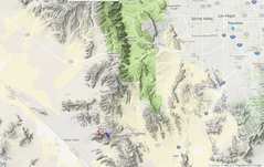
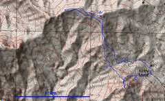
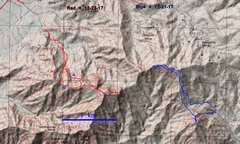
 Overview map. Tracks are near bottom, blue for 1st day, red for 2nd. |
 I drove up a decent HC road to the Kirby Mine, main goals were 1581m and 1671m |
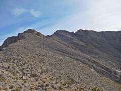
 I started up 1581m a bit soon. I'm actually looking down a 70 degree slope. Way up was class 3, way down was mostly class 2. |
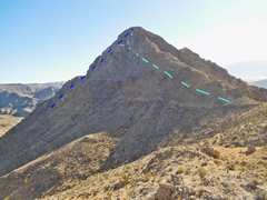
 view ~W to 1642m. At this point I thought it might be possible simply to prance along the ridge between 1671m and 1642m. |
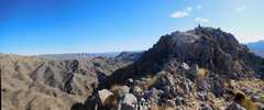 Top of 1581m. Cairn, which may have been a claim marker, but no register. |
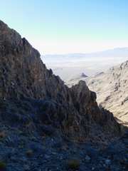
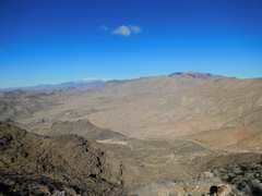
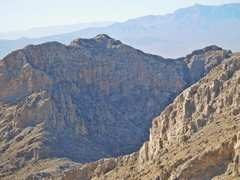
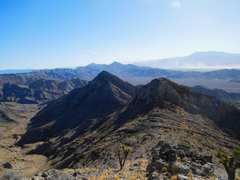
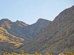
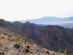
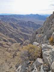
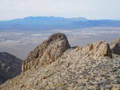
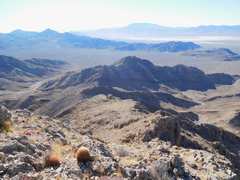 View ~S. Clark Mt in distance, Devil and Little Devil at L. This route looks class 2, though a cliff is hidden in this view. |
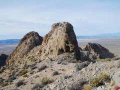
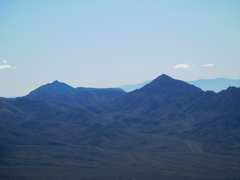 Devil (L) and Little Devil (R). |
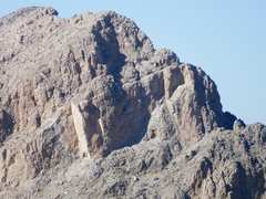 Telephoto of 1642m. Doesn't look pranceable. Later I'll show a view down from 1642m. |
 View ~WSW as I descend 1581m. |
 I'm now heading up ridge to 1671m, and find a few surprise class 3 downclimbs. |
 View back. 1581m (L) and downclimbs (R) |
 1581m with the devils in back. |
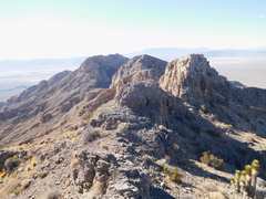
 Now I'm on the 1671m marked on USGS map. In back at L is a slightly snowy Charleston. |
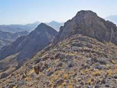
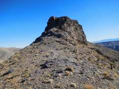
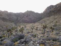
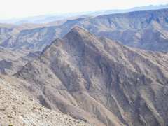
 I next went to a more rugged peaklet, which has the same last closed contour (1670m) as the map-marked peak. The E side was a slightly brisk climb. View of Devil. |
 Now i'm on the rougher 1670+ peaklet, view ~NW |
 View back at 1670+ peaklet; way off this side was mainly class 2. |
 Telephoto view of 1642m to W. At this point I was near my turn-around time |
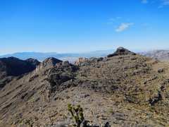
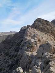
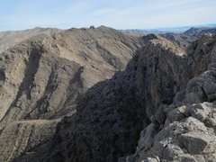
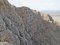
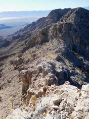 I went farther W, and found rough territory; either very steep loose talus on the sides of the ridge, or a rocky crest. |
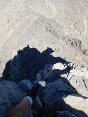
 The high ridge consistes of a broken thin walkway with drops from 10 to 100', sometimes just 1-2' wide |
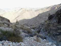
 Now I'm heading back E; view W. I just downclimbed that, class 3 on totally untrustworthy rock. |
 More view of the ridge W, 1642m at L. Not the easy walk I envsioned. |
 Heading back toward 1581m after a short day. |
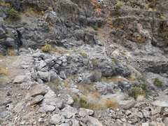
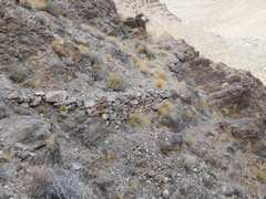
 I'm sidehilling along the ridge, going for a poly mine marker (aka bird trap). |
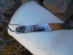 Midas claim, stamped on stainless steel. |
 View S to 1581m. I took the L path on ascent, R path on descent. |
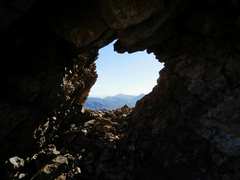
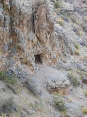
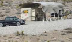
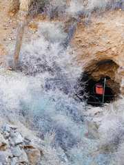 Kirby mine adit. |
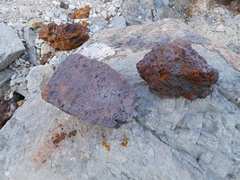 Most of the mine tailings consist of FeOOH "iron hat." This was possibly a lead/silver mine, with much FeS2 that decayed to form the iron hat gossan. |
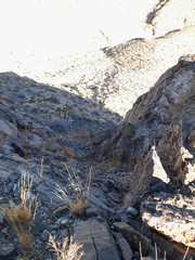
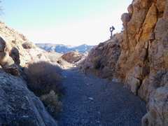 The last part is a pleasant gravelly gully. |
 I drove around to the N side of the range to scout the approach to 1642m. |
 Two days later, I took the red track for a run to 1642. |
 I drove my Jeep in ~3/4 mile, then headed up the class 2 wash to the rock in the saddle (R of center). |
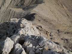
 View back down ~N, rubbly gully. There is more solid- rock scrambling near top. |
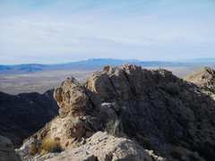
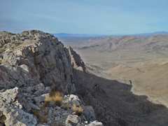
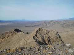
 I've popped over the ridge, and am looking ~S to Clark Mt. |
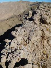
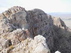
 The ridge has some class 3 that can be avoided by slight downclimbs to S or N |
 Much is a "dull" knife edge with little exposure |
 View W. I've cut N around a pinnacle to avoid elevation loss or a nasty downclimb |
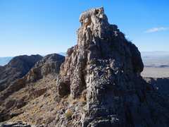
 The summit is up there. I was hoping it would be the rocky fin at R. Alas, no. |
 View back W at the pinnacles I just bypassed |
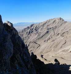
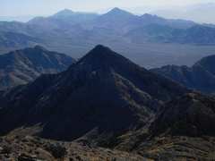
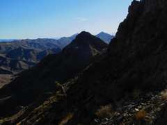
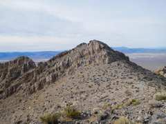
 View ~E. Slightly L of center are the two summits of 1671m, on far ridge. |
 same view, but HDR mode |
 View back ~W |
 I've downclimbed a bit, looking back at N side of 1642. I saw a possible route. |
 View ~SSE; this is the route I expected to prance on previous trip. Big drop. |
 View down to ridge connecting to 1671m. Not pranceable. |
 Another view back W. |
 True summit 1642m to W. The rocky fin at L is only 20' lower. |
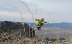 Jump spoiled by camera focusing on grass. |
 Now I'm heading back W. I'll climb that peaklet; class 3 this side, class 2 backside. |
 Telephoto of 1581m |
 I'll drop to R around that peaklet, then will drop down N side of ridge |
 There were cliffs on N side, but I could always find a way. Abandoned adit for prospect. |
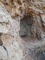 another abandoned prospect. The box once contained blasting gel. |
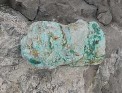 Not sure what the ore was, but there are abundant pieces of cuprite covered with a thin malachite alteration. |
 I followed a narrow mule road much of the way down |
 More road. |
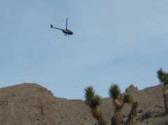 Helicopters buzzed me. |
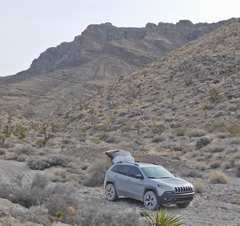 My car and 1642m in back. I could have driven at least 0.5 miles more, but was grateful for the warm-up. |
 Ah, that explains the copters. |
||