Hackberry Dome, 6049' in Mormon Mts., NV

Pics by Harlan W S
April 17, 2021

This is not a first known ascent; we found two bolts just above the sheer north face, and there was a rough cairn but no register at the summit. I never found a bolted rappel anchor, but there is a sturdy 6"-diameter conifer at the top of east-facing gully (you will see it south of the arete route; we didn't rap, so I don't know how much rope one would need for the gully).

I'd call this class 3+, with the "plus" mainly for a few spots of very significant exposure and untested rock. As one starts the gully, there are one or two spots where one has to creep around a corner of questionable rock, with a need to keep a good part of one's weight hanging out-- some would call that class 4. The fact that a slip above the top-out bolts would cause certain death, would also bias one to a higher rating (by one definition of cl 4). The rock is extremely grippy siliceous dolostone. We pruned a lot of loose rocks off the route, but I'm sure more will appear every spring.

To get to 6049, take the Hackberry Springs Rd to the parking (2wd), go about 2 miles up the gully, then cut left out of the wash to the plateau on the E side of the peak. Head west, then to the R (N) side at the base of the brownish cliff band. Start at the R side of the shallow gully, climb ~8' and traverse L ~10', then cut back R to the arete. Climb the arete until a slab opens up on the R. Either take the steep slab, or climb the exposed steep cliff at L (we took the slab).

I've had brain damage and no true balance since 2002, and I have no depth perception; Tracy has had clinical Parkinson's since 2013. With gusts of 30+ mph plus on the arete, we decided caution was in order.

00_6049
6049 as seen from
peak 7083, which
is N of Hackberry
Springs
00map1
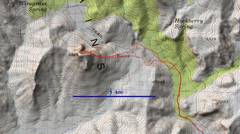
The extremely
undetailed usgs
topo map.
1map0
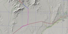
Context. Las Vegas
is off the map at lower
L. Take I-15 exit 100
(Carp-Elgin). Then take
the good (but mostly
gravel) Rainbow Pass
Rd. for 13.4 miles to a
L (W) turn on the 2wd
Hackberry Springs Rd.
Take the latter Rd 3.5
miles to parking
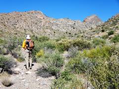
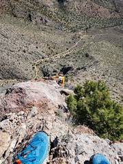
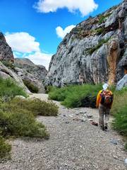
20210417_084800
Tracy heads WNW
20210417_085203
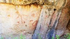
Lots of pictographs.
Also bolts and hangers,
still clipped with
quickdraws
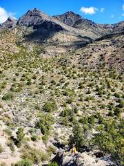
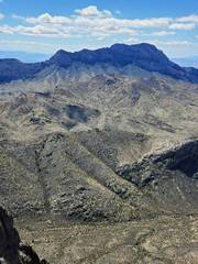
20210417_090200
6049 appears at R
20210417_094232
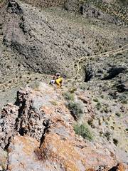
Climbing out of
gully, 7083 in back
20210417_094725
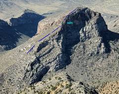
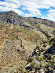
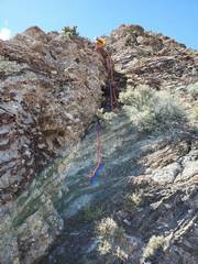
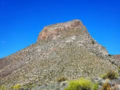
View 6049
to W. 'o' shows
start of climb.
20210417_104916
Tracy at start
of arete
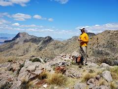
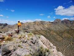
20210417_110211 20210417_112012
On top!
20210417_112015
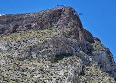
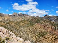
Sharp peak on R
skyline is usgs 6966
(on 1969 topo map
only); it has
~150' prominence
20210417_112033
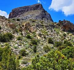
"The Dome," USGS
6365 is in back at L.
Gerry Roach called
that peak "Warwagon."
It proves to be cl 2.
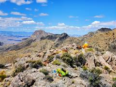
20210417_112040
Moapa Pk to S
20210417_112536
I am above ~300'
of air, but can't look
over it because of
the rounded edge.
20210417_112749
View W
20210417_120118
The wind was fierce.
I connected my 31'
and 75' 15mm web
straps together, and
left a dyneema sling
on slightly iffy anchor.
This photo looks UP
a steep, grippy slope...
20210417_120118b
...at the bottom are
two bolts and a
200+ drop at R.
20210417_131444crop
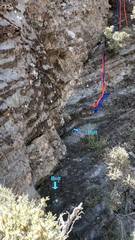
My best guess
as to route.
20210417_132416
View back UP
as we descend to
gully
20210417_140136
Tracy on trip out.