pics by Harlan W. S., CP & ST I joined CP, DB, Sarah and Andy for the first two days. I
left early, with a warm glow from all the good companionship and adventures;
those folks are probably still out there, trying to bag as many peaks as the
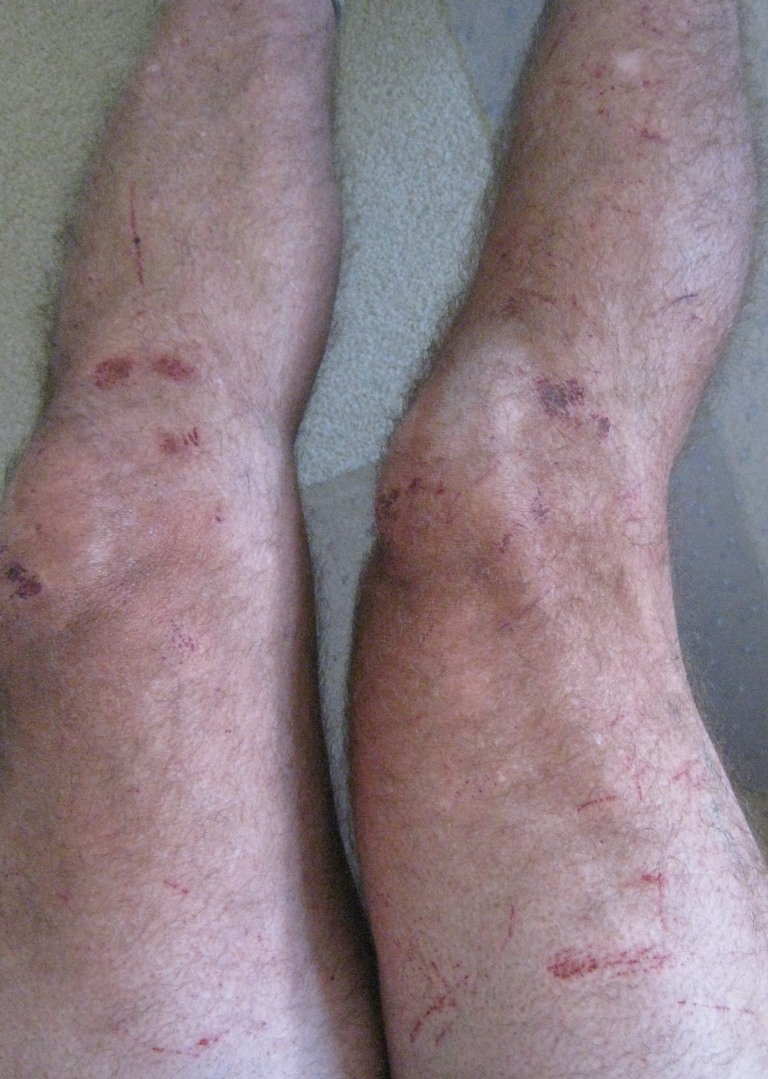
weather allows. (I had been up 4 rough-rock peaks in the 8 days before the
trip, and was so scratched up by March 28th,
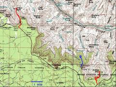
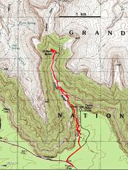
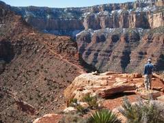
I was about due for a real bed and some new skin.) This has been a snowy season, and the South Rim N-facing slopes have heavy snow and ice cover. We originally planned a long day to Pattie Butte and back, but after seeing 40° slopes of hard snow, with no trail and a run-out on cliffs, we opted for O’Neill Butte and Sinking Ship on the first day (borders of light orange and pink below). On the second day, CP, DB and I went to an unnamed butte that proved to be an interesting challenge, while the animals (Sarah and Andy) went first to Horseshoe Mesa, then to “our” unnamed peak, after we passed on some beta. |
|
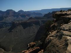
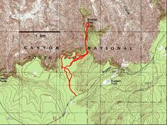
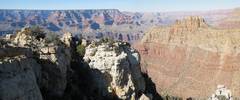
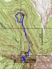
An overview map of the three “hikes.” The first day we did the peaks marked with red GPS traces; the 2nd day, CP, DB and I went on the hike marked in blue. |
1st
trip: O’Neill |
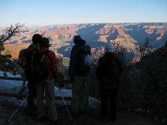
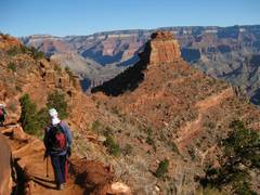
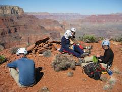
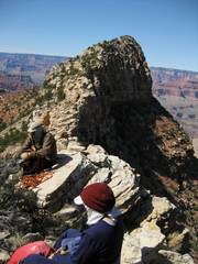
Gathering at the
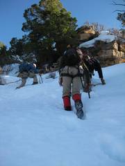
Top of the There was a lot of snow on the trail, but the NPS had done an incredible job shoveling. |
|
|
|
|
|
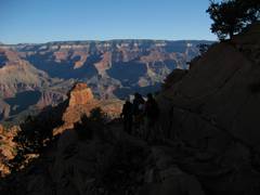
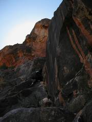
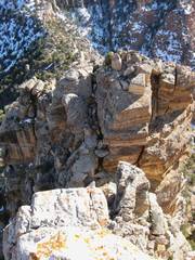
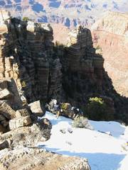
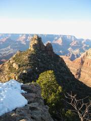
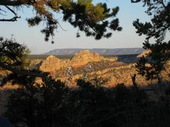
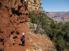
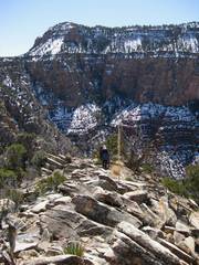
O’Neill Butte is visible at L. |
O’Neill is on the back (N) side. |
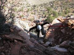
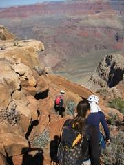
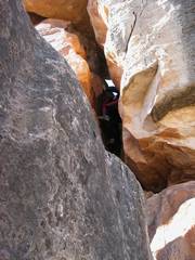
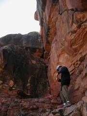
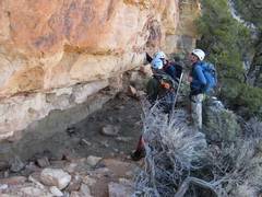
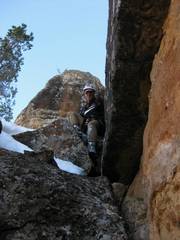
This class 4 ramp was the 1st significant obstacle. Since we had originally planned a class 3 hike, we didn’t have much “gear” except 50’ of Supertape with a locking biner; Sarah had a harness, and CP fashioned a diaper harness for DB. |
|
|
|
|
|
|
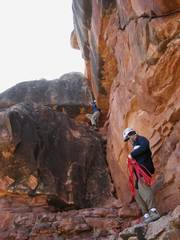
Next are 3 portions of climbing in rapid succession. I was too busy helping or struggling to take photos on the way up, so I’ll mainly show this stuff on the way down. |
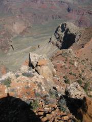
Now we are on top,
looking ~S at the trail near Cedar Meadows. |
|
|
|
|
|
|
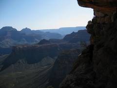
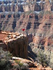
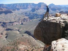
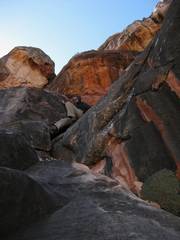
Lunching on top. As with most steep-sided buttes, when you reach the top, it’s hard to convey the drop on the sides. |
…but I’ll try. I’m looking down to the Tonto Plateau. The Kaibab Trail is to R. |
|
|
|
|
|
|
We head back down the N side. |
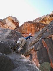
Andy on an overhang. |
|
|
|
|
|
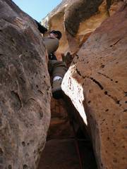
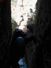
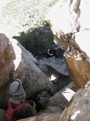
Sarah finishes the top “problem,” a funky squeeze traverse, and prepares to… |
…drop to here, where DB positions herself… |
…to drop to this ledge, above the squeeze chimney (this is CP above). The tightest part of the chimney is at the very bottom. |
|
|
|
|
|
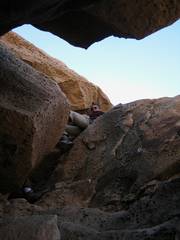
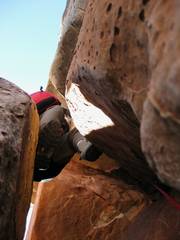
I stuck my camera in the squeeze chimney and pointed straight up. |
View NW; Sarah relaxes. |
This and the next photo show the 5th class crack and bottom of squeeze chimney. |
|
|
|
|
|
Here Andy drops out of the squeeze chimney. |
Sarah comes down the last class 4 ramp. There is a good finger-hand crack on the R, but you need to find subtle footholds on the L. |
Andy comes down unbelayed, in what is perhaps the oddest butt shot. |
|
|
|
|
|
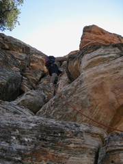
Now CP downclimbs that last ramp. |
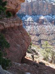
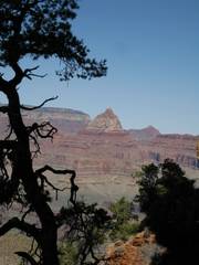
View back on O’Neill. |
Next that day, we went to Sinking Ship (I’m always hot) and pee, and started a comedy of errors. Since we started at 2PM, we were rushing; when I was finally ready to hit the trail, I followed the tracks Of the other folks in the snow, till the tracks disappeared at a mud patch. I was sure that I was way behind, so I made a beeline to the end of the rim mesa. I looked down on the correct land bridge, and shouted my lungs out, sure everyone was ahead of me. Then I backtracked, thinking they might have gone to a separate tongue of the rim. In reality, they were desperately looking for me. Andy and I ended up doing 4 traverses of the mesa that day. |
|
|
|
|
|
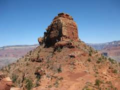
Here’s a picture of Sinking Ship, N end, at the time when I was shouting and still believed the other folks were ahead of me. |
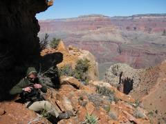
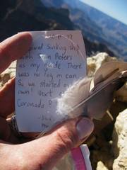
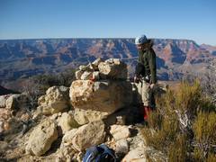
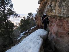
Finally we are together. CP showed us some ruins; here one sees an old metate (Harvey Butchart describes this site in one book). |
Next we entered a gully on the N side, and went through deep snow up to… |
|
|
|
|
|
…the crux, a gnarly 20’ too-wide chimney. I got near the top of the chimney just in time for my R leg to go spastic, and proceeded to drop crap on Sarah and Andy while CP went ahead to secure a belay. |
Thanks to CP’s belay, I got up into the snow above the crack. CP was graciously belaying the other folks, and I went up the steep snow. This view is N. |
Now I’m looking off the S side of Sinking Ship. |
|
|
|
|
|
View to NE, with |
|
View NW to unnamed peak we will hit tomorrow. |
|
|
|
|
|
After the big belay, the other folks climb the Steep snow. |
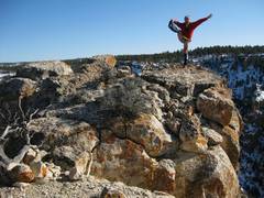
CP and Andy spent about 2 minutes on top, then headed down to prepare the rap station. I snapped this pic of Sarah… |
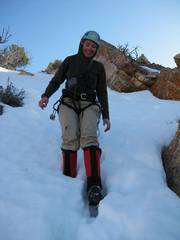
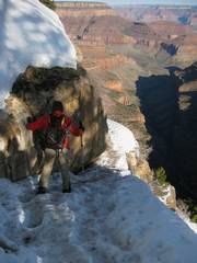
…and she took this pic of me. The leg loops on my harness kept pulling up the legs of my shorts, so I looked like I was wearing a diaper, or maybe hot pants. |
|
|
|
|
|
Sarah plunges down the snow above the rap station. |
A much-abused CP downclimbs the last class 4 below the crux. This might actually be class 3, but with klunky wet mountaineering boots, it felt tough. |
Now we climb back up to the S Rim! |
|
|
|
|
|
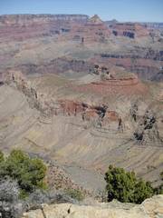
View back on Sinking Ship. |
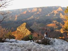
That same eve we
went to for a peek at the next day’s peak… |
…and to look back on Sink Ship, from the NW. |
|
|
|
|
|
OK, the next day, while Sarah and Andy started on a grueling trip, CP, DB and I headed to this unnamed peak. In low-snow conditions, this might be just a class 2 peak; but with the possible descent gully choked with snow, we took a bizarre route, actually circling the peak to avoid big cliff bands to the W. |
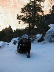
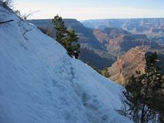
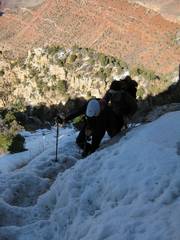
At the start of the day, we don crampons and use ice axes to head down the slippery trail from Grandview. |
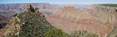
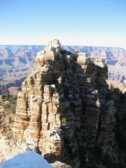
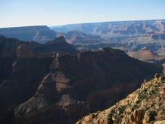
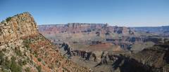
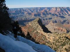
Finally down, this pano shows our peak with the cliffs that encircle it most of the way. |
|
|
|
|
|
We went through a lot of route-finding, then finally got to the talus so we could circle the mountain counter-clockwise.
|
There was steep snow on the N side, but fortunately we found moats near the wall. |
Now we are heading S on the W side of the peak! |
|
|
|
|
|
We split for a bit, CP choosing a less chossy route for DB. At top, I snapped this view NE to main water bottle, so I replenished my hydration supplies with snow at top… |
…Then CP and DB headed S lickity split, knowing we had a convoluted trip back. |
|
|
|
|
|
|
|
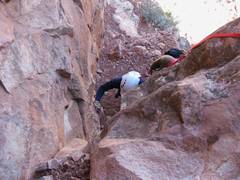
CP belays DB up the 1st class 3+ gully. We weren’t sure of the rock, so we climbed everything a bit harder than needed, choosing far-apart holds over those that might break off. |
CP pulls a line up the 2nd chimney, really the crux; though near vertical, the rock proved to be good with many footholds. |
|
|
|
|
|
We rest in the sun, CP smashes his shin and demonstrates some colorful language, then… |
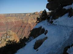
We don crampons again to head over Some steep slopes with creepy runout. |
A view back at “our” peak, showing the gnarly connecting bridge. |
|
|
|
|
|
|
We were happy when this was over! |
|
|
|
|
|
