Manly
and
|
|
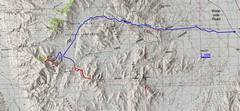
Overview map; blue= roads, red=hikes. On Saturday, March 31, I drove up the There was no place to camp (spots all taken) down low, and it was really windy. |
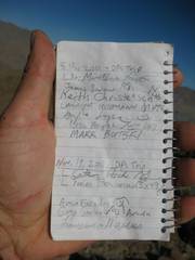
On April 1, we went to Manly, as described in the green-framed photos below. |
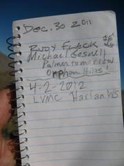
On April 2, Ken and
I went up as described in the orange-framed photos below. |
|
|
|
|
|
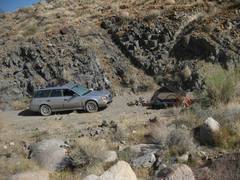
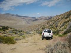
So this was my campsite on March 31. It was the 1st gravelly nook (somewhat sheltered from the wind) that I saw, not occupied by many vehicles. It was also high enough to be comparatively cool. |
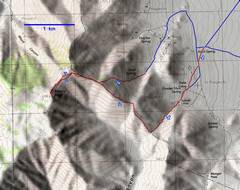
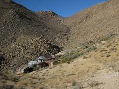
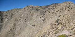
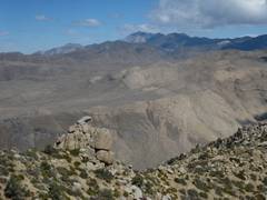
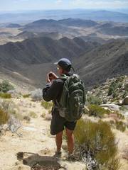
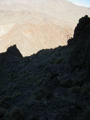
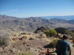
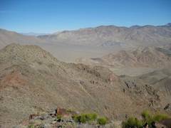
My hike on April 1 took me by Russell Camp, up to the saddle. I turned R (NW) at the saddle. |
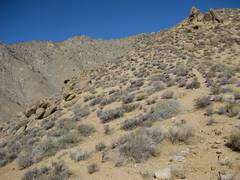
Now I’m heading NW up a pleasant, open ridge. |
|
|
|
|
|
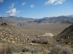
View from the saddle, back down ~NE to the intersection. At this point I saw Eric’s XTerra and Ken’s 4Runner pulling up to my car, which I had parked at ~4050’. However, they hiked up the peak by a different route (Quail Spring), so I didn’t see them for quite some time. |
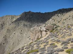
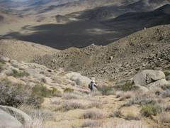
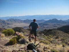
Random view up the ridge. Occasionally there is boulder-hopping, but generally it is a pleasant walk. |
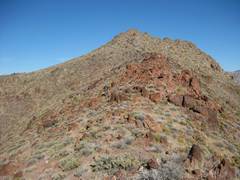
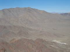
Manly is on the next ridge west. I’ll head WNW then turn SW (L) to the summit block. |
|
|
|
|
|
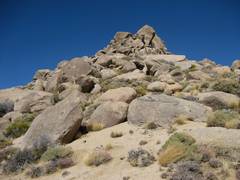
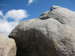
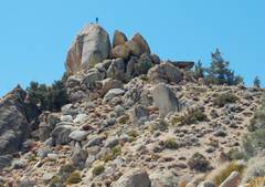
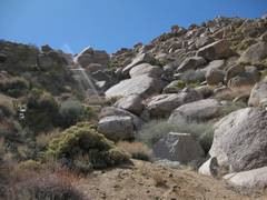
The summit is just L of center. |
Now I’m approaching the summit block to the SW. |
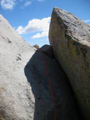
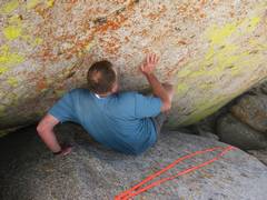
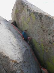
This is the ~class 4 chimney, as viewed looking N. I had dropped a handline, after ascending by… |
|
|
|
|
|
…this friction slab to the L (W of chimney). There is a creepy step-across on the L, where there is a 2’ gap over a 20’ crack. If you slip, you will likely be badly injured. This is the friction slab (“awkward class 3”) mentioned in Zdon’s guide and other sources. I highly DISrecommend this route. The holds are now exfoliating and fragile. |
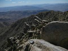
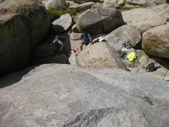
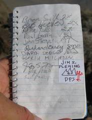
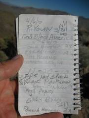
View back down at DPS box. The DPS does not require people to climb the summit block for a credited ascent of the peak. |
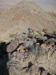
View S across summit benchmark. |
|
|
|
|
|
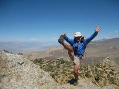
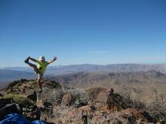
Self-portrait on summit block |
View ~N to Telescope. |
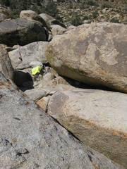
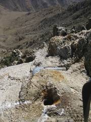
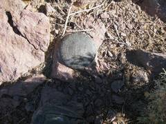
Piping from water cooler that was once on summit. |
|
|
|
|
|
|
|
|
|
|
|
|
|
I waited on top for about an hour, then saw the other folks below. Earlier, Anji had communicated to me with the secret “hoot” code. Eric took this photo of me on the summit block. The awkward friction slab requires stepping across the gap to my R (not as bad as it looks). |
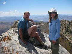
I see Anji and Ken to the N. |
In the end, I went up the summit block at least 4 times. |
|
|
|
|
|
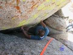
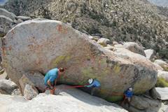
Ken demonstrates good form to ascend the chimney by the classic squeeze-and-grunt method. If you have really sticky shoes, you can climb the chimney facing into the rock, by grabbing the finger crack with your left hand. |
|
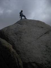
On top! |
|
|
|
|
|
Eric’s photo—Anji heads down the handline. |
Eric on top. |
|
|
|
|
|
|
Ken, view S. |
I returned with the other folks. They had previously spotted this sandy slide, which we took for a rapid descent to the XTerra at Quail Springs. |
View up, from near the car. Eric had rolled his ankle, but still managed to descend, limping! |
|
|
|
|
|
The XTerra, Striped Butte in back. Eric then drove Ken and me back to our cars, and he and Anji headed back to Vegas. |
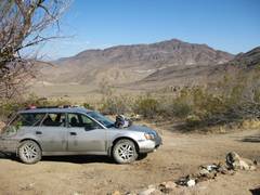
Ken and I drove to Stella Camp. This is a view of Needle (over my Subaru Outback!), our goal for the next morning. I got my 7.3” clearance Soob up here, but I would recommend burlier vehicles. I have skid plates (and a good sense of wheel placement!). |
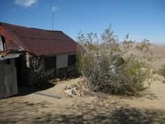
View of the dining room at Stella Camp. |
|
|
|
|
|
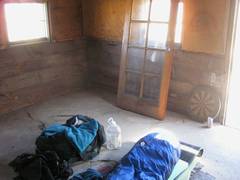
Where I spent the night at Stella. |
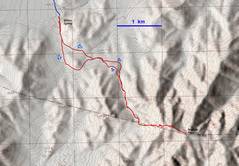
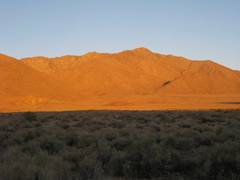
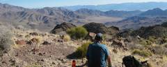
Next morn (Apr 2), we drove the relatively good road to Willow Springs, and started the hike up Needle. This is a view of Manly to WNW. |
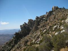
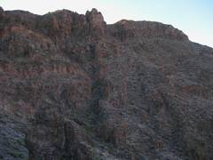
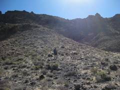
The first part of the trip to Needle is a pleasant desert slog. At the 1420m saddle, one heads E, up a class 2 route that winds among crags of volcanic rock. The loose rock danger is significant. |
|
|
|
|
|
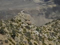
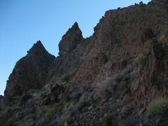
There are lots of pinnacles of volcanics along the way. |
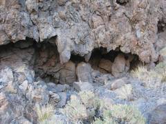
This is a cave beneath a cap of frozen basaltic “lava.” |
Ken is down there somewhere! |
|
|
|
|
|
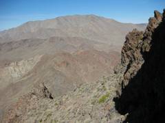
The false summit is to the ENE. |
|
|
|
|
|
|
|
|
|
|
|
|
|
|
|
View ~ENE. |
|
|
|
|
|
|
|
View S. |
|
View N – a different perspective on Striped |
|
|
|
|
|
View ENE to Manly, with Russell Camp barely visible in greenery at base. |
|
A mile from the car! |
|
|
|
|