Mexican DPS Summits -- Garmin-Compatible GPS MapsHarlan W SAug 19, 2013
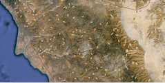
There are four Desert Peak Section (DPS) summits in Mexico: Picacho del Diablo, Pico Risco, Cerro Pescadores, and Cerro Pinacate. Before our recent trip to Picacho del Diablo,
we attempted to get garmin-compatible topographic maps. There are
two commercial vendors, who will sell maps for the entire country;
those maps are great for many of the most popular destinations.
However, in the areas around the
four DPS summits, the
commercial maps are either misregistered (the contour lines are shifted
50-200 feet), or the secondary roads tend to be inaccurate. Hence I set
out to make topo maps from freely-available
(USGS) sources, and to correct the misregistration and add roads from aerial photos.
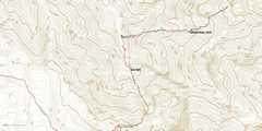
These
maps were made solely for climbs of the four Mexican DPS summits; they
do not contain details of the big cities. All have embedded
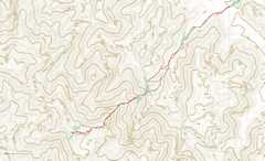
hiking routes; for Picacho del Diablo and Cerro Pescadores, the hiking
routes are based on actual gps tracks. For Pico Risco, the hiking track
is based on the DPS map. For Cerro Pinacate, the "route" consists
mainly of the waypoints available at climber.org, with a hypothetical
path around the lava flows. The dirt roads were picked off aerial
photographs. Registration corrections were vexing; I have not been able
to find reliable locations for the Mexican benchmarks (monuments, often
on peaks), so I resorted to reported GPS data and other information.
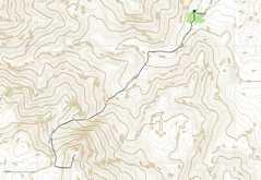
For Picacho del Diablo, we had our own tracks and other waypoint
measurements for the peak; steep cliffs on the ocean, and Y-junctions
in deep gorges, acted as well-defined features to match with contours produced from the digital elevation models (DEMs).
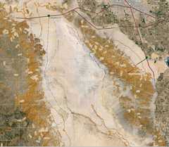
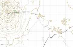
For Risco, the contours were shifted so the correspondence between landmarks on
aerial photos, and the valleys, was decent. For Pinacate, gps points for
the peak top, and the edges of deep craters, gave some confidence that
the contour lines were properly re-registered with the features on the aerial
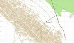
views. Pescadores is problematical; the summit is fairly broad,
and the summit sign-in is apparently not at the highest point. I tried
to reach a correspondence between the obvious ridges visible in
aerials, with the contour maps, and a gps track that followed a ridge.
(All DEM data are from the USGS NED server; 1 arc-second
data for Diablo, and (supposedly) 1/3 arc-second for the other three
summits. Most of the 1/3 arc-second data appears to be derived from over-sampled 1 arc-second data.)
It
wasn't until I was finishing the last map (Pinacate) that I realized
all the USGS DEM data for Mexico had a curious chracateristric that caused bizarre
contours in nearly flat areas. The maps for Diablo and Risco
Pescadores still have these bizarre comtours (but not in areas one must
hike), and I may update those maps in the future. I have solved the
problem with a data analysis post-processor; while that post-processor
is easy enough to apply to the other DEM data, it would require me to
remake the maps completely.
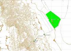
I
was forced to make the Risco map
"trasparent," else it would never show on the GPS itself; I suspect
there is some odd
flaw in the Garmin basemap in this area. Unfortunately this means that
in BaseCamp (NOT on the unit), you may see some contours from Garmin's
incredicly coarse basemap showing through. I repeat, these rogue
contours will not show up on the actual GPS display.
These maps are made
available without any gurantees whatsoever; use them at your own risk.
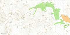
There are three maps: Diablo, Risco-Pescadores, and Pinacate. If
you have a PC, and an "older" Garmin mapping unit (e.g. 60csx),
you can use the self-installing maps here, here and here.
You MUST have completed the installation of BaseCamp or MapSource
(latest version) before running these executables. You can use
these self-installing executables with a PC (Windows machine) and a
newer
Garmin as well. But the main advantage of self-installing maps is
for older units; the older units will accept only one image file. After
running the self-installing files you will be able
to use MapSource/Basecamp to bundle the Mexican maps with other maps
you have installed on the PC, and send one large image (img file) to
the GPS
If you have a Mac or PC with a newer Garmin GPS (e.g. 62sc, Oregon, Colorado), you can download the zipped img files here. Unzip the file, then drop the desired img files directly on your SD card (in the Garmin unit);
make sure you place them in the "correct" directory for that model GPS.
|