El Bastardo (Peak 7986
|
This peak is in the
I wore shorts all the way to the summit, but it was hellishly cold and very windy. This canyon gets little light; snow and general cold can make "sticky rubber" boots very unsticky. The ascent took 2 hrs 10 min, the descent 1 hr 45 min, but I was trucking to keep from freezing.
This hike is somewhat
sentimental. I last went in May 1999 after a snowstorm, with my pal
Matt. He came off a rough week, got 2 hrs sleep the night before, and had a
hangover. I wanted to compare the difficulty pre- and post-stroke.
|
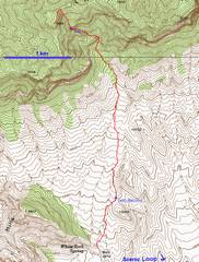
GPS trace (red). The 8093 peak on the R is informally named "El Padre". |
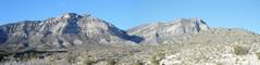
View (looking up) from parking lot for White Rock Springs and Keystone Thrust trail. Peak 7986 is to L; the ascent canyon is in the middle; and El Padre is to R. La Madre, not visible, is behind El Padre. |
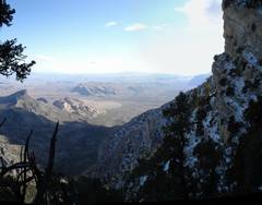
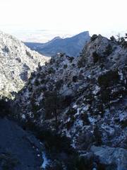
View back SE at Turtlehead, after entering the narrow part of the canyon at 6600'. |
|
|
|
|
|
Turtlehead again... |
...and again; now at ~7200' |
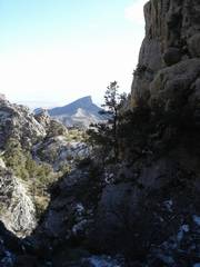
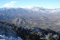
After topping the ridge at 7820',
we get this view NW of the Spring Mts., from |
|
|
|
|
|
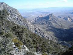
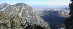
Near top of Peak 7986, this view SE includes (L to R) La Madre (highest and leftmost), then El Padre (right of La Madre, looks like a teta), then Turtlehead, then tan & red Calico peaks. |
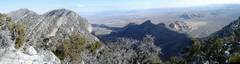
Slightly expanded panorama at summit Peak 7986. The winds were cold and very strong on top-- they would flatten me at times. The gusts were up to 62 mph in the valley, must have been worse up here. |
Heading back down, ~7300'. |
|
|
|
|
|
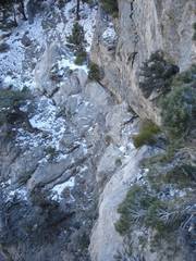
View at ~7150', roughly S across crux (waypoint trav-L on map). There is an unobvious, very large drop to L. The key is to use the crack for a traverse (not hard, but exposed; tough with snow). |
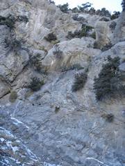
Now we're below crux, looking back N; the camera is really pointed up, so it's steeper than it looks. You really don't need to climb this wall; go left, pass by a small pinnacle 40' up, then turn back R though a gap, to crack in previous picture. (The crack is hidden in this photo). |
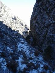
This shot is mainly to show the contrast in lighting. It was a nearly cloudless day, but the deep canyon was cold and dark. |
|
|
|
|
|
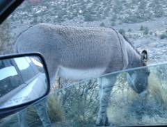
Hand-held, one (paralyzed) hand shot as I drive by a burro. |
|
|
|
|
|
|