Bridge from Lovell Canyon (Pahrump Side)
Harlan W. S.
Sun. Nov. 26, 2006
Some comments on the route, and road directions, are given at the end
of the page.
|
|
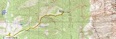
GPS trace of the drive and hike.
|
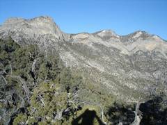
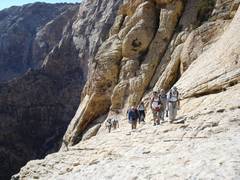
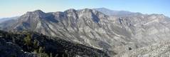
On trail, view west. Pepper Peak is at left*.
|
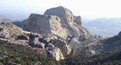
After cresting the limestone ridge at 7200', I get an early view of Bridge
to the east.
|
|
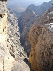
After hitting the sandstone, we get an adrenaline-charged view into Fern Canyon.
|
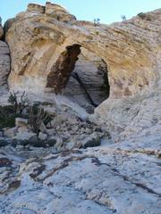
The bridge. The tinaja was totally dry, the first time I'd seen it that
way.
|
View E from the top.
|
|
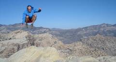
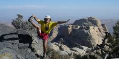
Jumping over North Peak. (Self-portrait; I waited on top for a long time, got
bored and cold, so...)
|
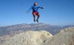
Jumping over La Madre (Self-portrait.)
|
As I head back west, I meet my compadres, coming up from Fern Canyon.
|
|
A view back, shortly before the trail heads into the limestone again.
|
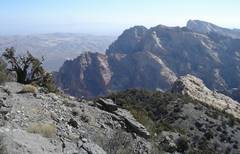
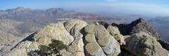
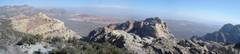
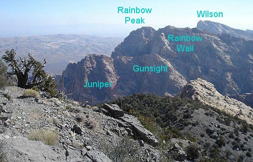
View SE to Rainbow and Wilson; here is a key.
|
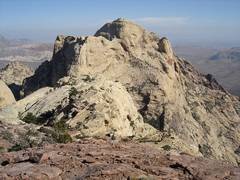
This view NE, from the limestone ridgeline, shows the summit labeled "North
Peak" by the BLM. This ~7250' lump has nice views, but is not the sandstone
"North Peak" described in many guides for the area.
|
|
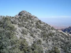
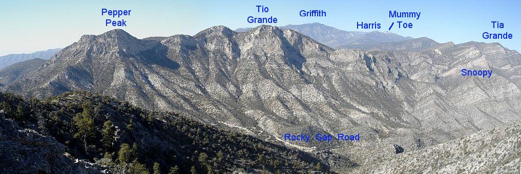
View east from the 7250' lump. A key is here.
|
View NW from the 7250' lump; here is a key.
|
Customary cerebellum check.
|
|
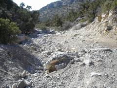
Here are some rough spots in the road; view downhill. This section is uphill
from the 2 mile "safe for ordinary 4x4s" section
|
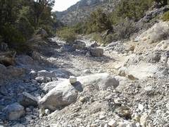
Another picture intended to make you think twice about trying to drive up here.
|
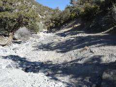
View back uphill. Tough 4x4s with short wheelbase, skid plates and very
high clearance drive this route, but there are plenty of scraped boulders and
crushed car parts along the way.
|
*Some say
the real name is Peppe Peak, and it is named after Peppe S, Red Rocks' leading señor citizen.
WE should check its summit register to get the true name.
======Road & Route Directions=========
This approach is an alternative to
the traditional route through the Red Rock Scenic Loop, Willow Creek, and the NE
part of Rocky Gap Road. This is the route described in the DPS guides, and is
most appropriate for travelers from California. However,
the route is actually rather fast for those coming from Vegas -- at least, with
current road conditions. Early on a Sunday morn, the trip west over Mountain
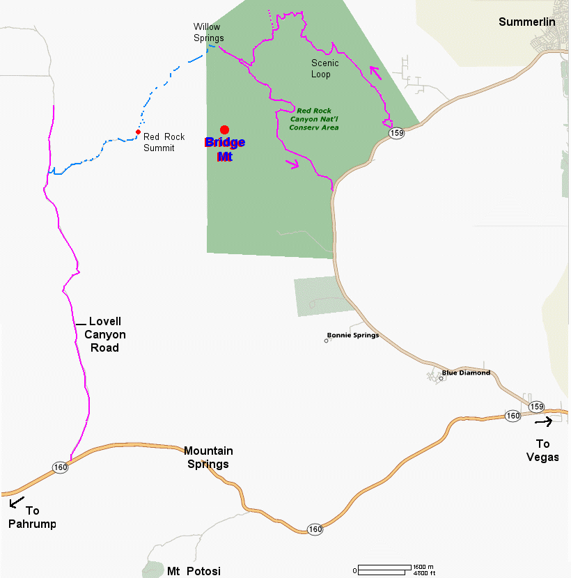
Springs Pass goes rather quickly. A ROAD MAP IS HERE; compare with the topo map above.
Directions from the west:From the intersection of routes 382 and 160 (west side of
Pahrump), drive 29 miles east on rte 160, to the Lovell Canyon Road. Turn north
on the paved Lovell Canyon Road and drive 7.7 miles. Turn right on a dirt BLM
road, and drive up as far as you can, which may be only 1 mile for a
modest-clearance vehicle, and as much as 2 miles for a 4x4. (This road
first goes straight for a short distance, then crosses a wash, curves radically
NNE, then radically S, then heads east again, all within the first 0.25 miles!)
Park and walk up the road to Red Rock Summit, where a marked trail leads east to
Bridge. The first part of the trail is easy and easy to follow. However, once
you hit the sandstone, watch for cairns.
From Vegas: Take route 160
west to Moutain Springs. After cresting the hill, look for the Mountain
Springs Fire Station on the right (north). From the Fire Station,
travel west ~3.1 miles, and turn north (right) on Lovell Canyon Road. From this
point, follow the instructions above (i.e. drive 7.7. miles N on Lovell Canyon
Road, then turn east...).
The SW end of the Red Rock Summit road has deteriorated
much since the DPS guide was issued, and I wouldn't drive my Subaru more than
1.5 miles up. A true high-clearance vehicle might be able to go 0.5 or so miles
farther, but after that, there are extremely rough washouts in a few places. I
saw some 4WD tracks, but probably from a short-wheelbase, HC jeep; I also saw
lots of broken car parts and boulders with nasty scrapes.
On Sunday I
drove the dirt road to just 1 mile east of the Lovell Canyon Road, parked, and
went to Bridge. From this modest starting point, the route is about 10 miles
round trip -- about the same as if you were to go in on the Red Rock Canyon side
and drove 2-3 miles up the old dirt road. However, the advantages are 1) less
mileage if you are coming from the west, and 2) since the first part of the
route isn't in the conservation area, but on "normal" BLM land, you can camp
without any reservations.
It took me 2hrs 15 min to get to Bridge on
Sunday. Admittedly, I'm in decent condition, but I was quite sore from
over-exertion Friday, so I didn't rush (too much). Also, I'd been to Bridge 7
times before, so route-finding was not an issue.
PS: I saw no bighorns
on Bridge Sunday, but saw 3 bighorns and 5 deer on Friday, when I was on the
east side of Red Rocks in a little-traveled area. There was more water and more
greenery on the east side. This is a very dry fall; for the first time in my
memory, the main tinaja on Bridge was completely dry.