Borah Peak (Idaho)

The 2nd part of our LVMC trip; see Part 1 and Part 3.

pics by Harlan W.S. & M Ali H
Aug 6, 2010


We woke up at Thomas Canyon Campground in NV on Aug 5, had a leisurely morning, then left to drive 340 miles to the west side of Borah Peak, the highest point in Idaho.  I could never have done this on my own; thank God, Insha'Allah, Ali drove. Now we had an extra constraint: we were supposed to pick up Mike S at the Salt Lake City airport at ~3:40 PM Aug 6 (the same day as the Borah climb). We had also noted that hailstorms were hitting the area by about 1PM, so we had strong motivations to start early for the climb on Aug 6. Borah was purported to have substantial exposed class 3, an exposed snow bridge, and nearly 6000’ of accumulated elevation gain. Ali was suffering from severe blisters, and this added schedule pressure meant that he would sit out this hike, so he wouldn’t be lame the next day.


We got up very early Aug 6 and reached the summit in very good time, thanks to the careful pacing of Joel and Justine. (If I had been alone, I might have reached the summit ½ hour earlier, and would have enjoyed the climb NOT AT ALL, and been lame the next day.)  I think I took 4 h 15m, and the others followed soon after. The early hike was windy and cold, and I didn’t see real sun till I summitted around 8:30AM.


One of the great events of the hike wasn’t known till days after we were back in Las Vegas.  On the way down I passed several groups, including a set of Boy Scouts.  On descent, one of the scouts got ahead of the others.  His pack tumbled off a ledge, he reached for it, and fell 700 vertical feet down a cliff/talus slope averaging 70-75 degrees. Miraculously, he survived a night unconscious on the mountain, and sustained one chipped vertebra, a concussion, and numerous cuts and bruises.


bmap

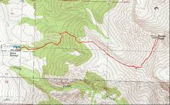
The gps track is in red. The route up is short, ~3.5 to 4 miles.

P1010034

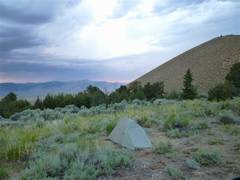
The night before (Aug 5), Ali took this photo WNW over Justine’s tent.  I had warned Justine not to pitch camp too close to me, as I snored. The next day she gave me a non-angry account of my snoring, and suggested I might have sleep apnea.

IMG_9631

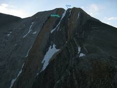
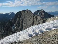
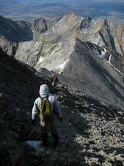
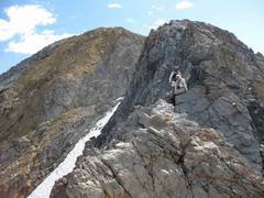
We were on the trail the next morn (Aug 6) by 4:15AM.

As we headed up the mountain, I took this photo to illustrate the crux of the climb – a short down-climb above a perilous snow-filled couloir. The ridge to the R of the crux is called “Chicken-out Ridge” (COR) and earned its name for several parties the next day.


IMG_9640

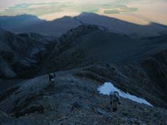
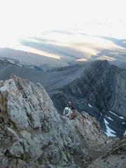
The shadow of Borah is visible to the W as we climb above 10,000’.  The camera flashed for this photo.

IMG_9644

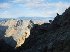
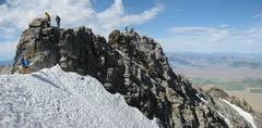
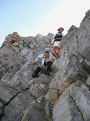
We start up COR, view W.  Justine learned to deal with exposure and class 3 rock very quickly.

IMG_9646

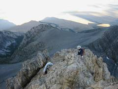
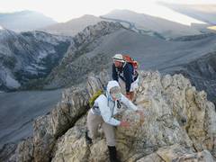
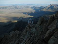
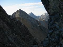
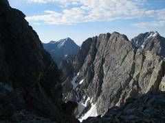
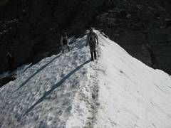
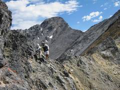
More COR—the next 4 photos.


IMG_9647

IMG_9649

IMG_9651


IMG_9653

IMG_9654

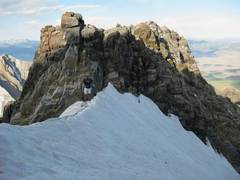
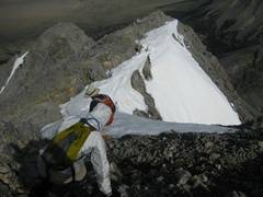
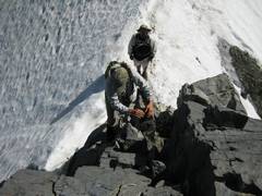
Joel crosses the upper snow bridge below the crux. The snow rapidly steepens to more than 50 degrees; a slip would be fatal.

IMG_9661

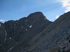
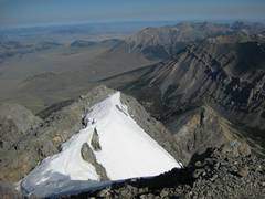
Past the crux, we still must climb nearly 2000’ to the top of Borah.
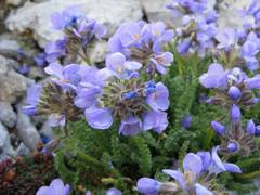
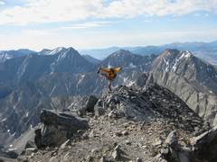


IMG_9662

IMG_9665

Sky Pilot.

IMG_9667

View S.


IMG_9670

IMG_9671

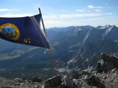
The top was VERY windy.

IMG_9679

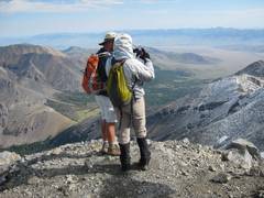
Joel and Justine, viewing the E ridge, still covered by hail from the previous day’s storm.


IMG_9680

Try this in a strong wind.

IMG_9681

We start heading down to the W.

IMG_9682


pan01rbk_9687-8

By now, the crux is a bottleneck.

IMG_9689

Snow bridge on the way back.

IMG_9690

Justine up-climbs.


IMG_9691

Now she down-climbs.

IMG_9692

IMG_9695

Borah in back.


IMG_9698

COR is done, and she smiles.

IMG_9700

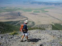
Joel is trucking down, with the campsite to his R.

IMG_9701

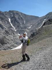
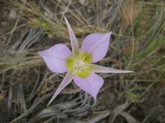
Lily. Now on to PART 3.