|
These sharp volcanic
peaks are quite visible from i-15 near
(Here they are from Crescent Peak and from Hart Peak ; the “Highpoint” is the same as “North Castle Butte”.)
Useful beta found here: summitpost, “Desert Summits”, and in the DPS (Desert Peak Section) archives.
The
Here’s a GPX format GPS file (relative to WGS84) that you can use at your own risk. (Here’s HOW). This route would be deathly hot in summer.
Click on any small
image below to see the larger version.
|
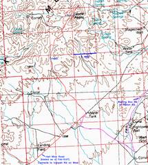
100k map with GPS traces, showing alternate drives
from and |
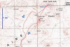
24k map with GPS trace of part of hike. The small pink numbers are keyed to a few photos |
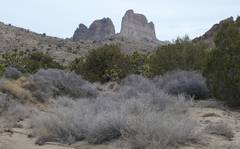
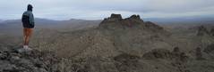
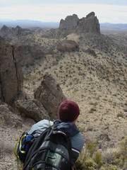
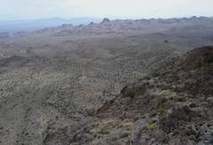
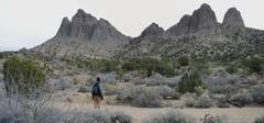
View NNE from near parking spot. Dove is the leftmost peak. |
|
|
|
|
|
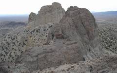
View SSW from near point 1. |
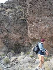
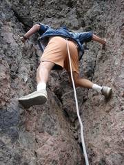
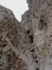
At point 2, looking ~W near N end of summit block. This is the one Class 5 stretch. Comments on rating below. |
CP starts up the crack. Lots of friction, but crappy rock. Test holds thoroughly! |
|
|
|
|
|
Top of NE to |
View down and NW. We’ve descended the summit block, Walked a few feet north to the 2nd slot (the 1st is VERY serious), and begin down. |
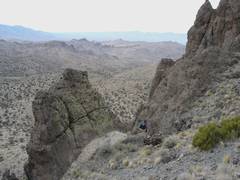
View back UP and SE. This slot is class 3, but not for large parties. Rockfall is serious. |
|
|
|
|
|
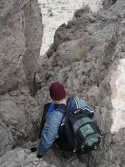
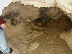
We’re looking in the cave visible on the approach to North Castle Butte (NCB). The cave is full of nest detritus, cow poops, and so forth. Animals probably came here to escape the heat |
Partway up NCB, looking back SW. Dove is the peak to the R. |
Top of NCB, view ~S. There was a sparsely-filled DPS register on This peak. |
|
|
|
|
|
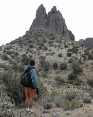
On NCB, view E to Hart. |
Scary. |
Descending NCB. Most of the trip is Class 2. You’d never know that from distant views. |
|
|
|
|
|
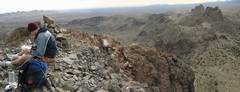
At point 3 on 24k map, view SE. Dove is the peak at R. We Descended the valley between the peaks. |
At point 4, view ~E. Dove is the higher peak at L. |
|
|
|
|
|
On reading the two DPS reports, you will see quite a contrast; the older report assigns class 4 to the Dove cliff, and “easy class 3” to the NCB crux. Yet the newer report calls these class 5 and class 4, respectively.
For Dove, the difference may be between the old “Sierra” definition of class 4, and the newer interpretation. Indeed, CP and I both free-climbed the Dove crux, and the exposure is not that great; on good granite, I would call this class 4. However, the rock is not trustworthy, and there is an extra measure of difficulty in arranging simultaneous holds, or using a non-intuitive hand-jam just because you don’t trust a nubbin of rock.
There is a rappel sling at the top of the crux on Dove; with 50’ rope or webbing doubled over through the sling, you can get some measure of added protection for the descent.
For NCB, we think the older DPS report may actually have described an easier route. From our short perusal, it seems there might be a true class 3 route a bit farther west. The one “class 4” section is indeed short, but is blind, and the rock is again dubious. And for what it’s worth, there are still bees or yellow jackets on the summit.