|
|
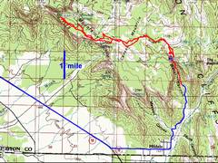
100k topo map with
GPS tracks. The blue track shows the drive in, starting with route
59, from Hurricane, |
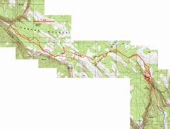
24k topo. I had to draw in some of the route on the W side, as the GPS would not track in the deep canyon. The pink dots show the “correct” route as described by Bo and Tamya. |
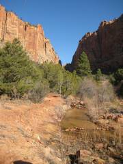
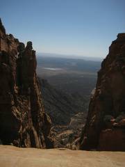
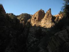
The trail starts out heading N into the narrows, |
|
|
||
|
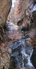
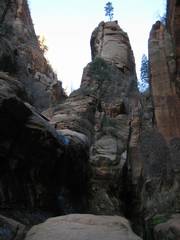
The first significant waterfall, around 5800’. |
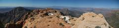
View N. The spur trail cuts up left. |
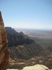
View S, from high up on W side of canyon. Soon the trail started down. |
|
|
||
|
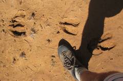
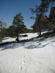
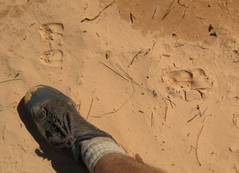
Elk tracks? The inner tracks are about 4.5” long, and they seem wider at the rear. At first I thought these were cattle tracks, but there are no fresh cow poops nearby. |
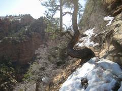
The top of the mesa was often covered with icy stretches. |
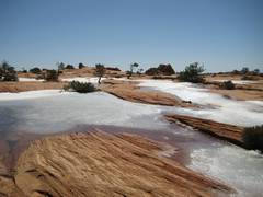
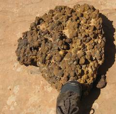
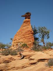
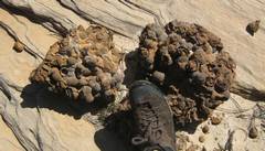
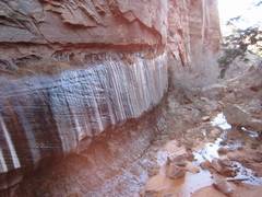
“Grapeshot” iron-rich layer that used to cover much of the mesa. |
|
|
||
|
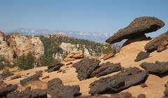
View of Pine Mts to WNW; “mushroom” made of grapeshot layer on softer sandstone. |
|
|
|
|
|
|
|
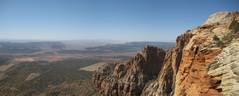
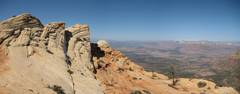
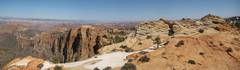
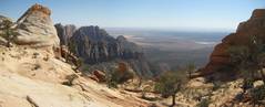
View SE from a notch. |
View SW from notch. |
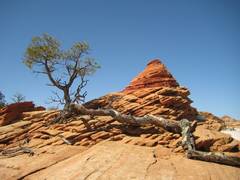
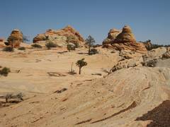
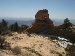
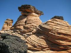
Some hoodoos. |
|
|
||
|
|
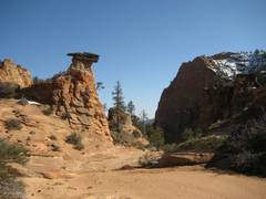
Hoodoo you think you’re foolin? |
Finally, the last
stretch. View N into |
|
|
||
|
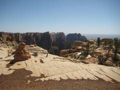
Window, just SE of summit. |
The highest point is at left. |
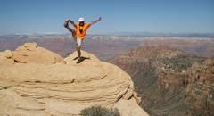
View from the
highpoint. |
|
|
||
|
|
|
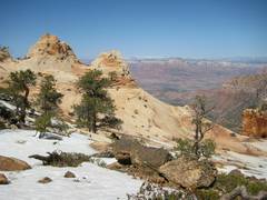
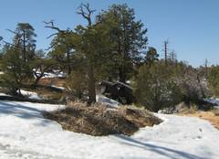
There was a lot of snow on the route across the mesa. |
|
|
|
|
|
More grapeshot stone. |
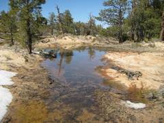
There were lots of temporary snowmelt ponds in the wooded areas. |
|
|
|
||
|
Another view SE. I saw more views on the way back. |
A notch along the way; unknown road to S. |
Small deer tracks. |
|
|
||
|
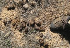
Elk scat. If you think this is crappy… |
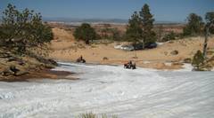
Wait till you see the 4x4s tearing up the vegetation. The motorized vehicles come up an old road to the E, on the only non-cliffy part of the mesa. |
Of course, there are also ATVs. They aren’t legal here, but I wasn’t upset till… |
|
|
||
|
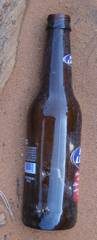
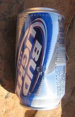
I found their garbage. |
The two ATVers had downed at least 3 beers, and simply thrown the cans on the slickrock. |
|
|
|
||
|
As I am about to cross from E to W, I look NW at the cliffs I had just explored, looking for a safer way down. |
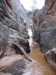
I finally drop into the canyon, and must run S through this water to get to the climb-out point. |
Finally, after 1st climbing 600’ to the canyon rim, I drop down again to the canyon. |
|
|
|
|
My
One reason: I had forgotten
to re-read and print out the directions that I had first seen on www.summitpost.org months before, for the
route up Water Canyon . Secondly,
they’ve had a lot of snow in
But with decent sleep Friday
night, and a sniff of Afrin, Saturday seemed better. OK, maybe I would drive to Hilldale and scout
out the first part of the route. I
didn’t get a very early start, and eventually arrived at the trailhead a
bit after 9 AM Vegas time (I’ll stick to Vegas times; Utah time is an
hour ahead). There seemed to be a decent
trail, so I figured I’d just follow the trail as long as I could, then
maybe head up the canyon toward the ridge.
The elevation at the trailhead was already 5240’, so certainly
this couldn’t be that intense a hike.
Ah, snow. I saw the first
patches below 5800’, at the first waterfall. Since the bottom of the
canyon was obviously very wet, I decided to follow a spur trail up to the left
(west). There were some bootprints in
the hardened snow, and I would follow these prints for the next hour.
Here was the 1st
interesting twist of fate. If I had brought the directions, I would have known
that one should just continue up the canyon, rather than take the trail. But with the cold meltwater, that route
really would not have been an option, at least not a warm one, since I was
wearing leather Pingora boots.
So I continued on the trail,
following the bootprints, and I gained elevation. The trail was a bit hard to follow at times,
and covered with conifer needles, but I could always find the snowy footprints
at the end of dry stretches. Up, up I
went to 6500’; the GPS wouldn’t track satellites in this deep
canyon, but at least the altimeter was working.
And then the trail began descending, became a bit more ambiguous, but
still had prints in snow and mud. Then at near 5900’, the trail just
dumped over a wall into the stream bottom.
I could see some footprints below, so after a rather hairy downclimb, I
was standing in the silt, looking south to more bootprints in the snow, leading
up a steep gully to the east side of the stream. I looked N up the canyon to sheer cliff walls
and a water-covered bed, and karma made the decision for me. I would follow the path up the cliffy east
side, gain the gentler slope, and head to the top of the mesa.
Well, there wasn’t
really a path on the east side. I could
see where previous human feet had made a faint herd path, and started making a
few small
Then near the mesa edge, of
all things, I saw an ATV track. I knew
there was a long, old, rough jeep road on the east side of the mesa. Ironically, the east side route is about the
only place one could find a class 1 break in the cliffs; but this route is also
far too long for foot travel.
Officially, this road had been closed to motor vehicles since the 1970s.
As I neared the 6900’
elevation, I met a large group of friendly backpackers. They seemed to have a lot of local trail
knowledge, and at least one had a mild accent typical of
I continued on WNW, with more
ATV tracks, some old, some probably just days old. I had mapped out a route in the middle of the
mesa, near some old jeep roads; but the soft sand (especially where churned up
by ATVs), and the alternative softening snow, made the going slow and
tiresome. I began to posthole in the
snow. (There are many lunate structures
of sand, about 3-10’ high; I think that in some dryer time, these were
dunes, now partly covered with manzanita.) Still, at my current pace, I should
make the summit at 1 PM, a decent turn-around time. The middle of the mesa didn’t have many
views, but was a wonderland of shallow half-frozen ponds.
About this point, I saw what
appeared to be a slick-rock route a bit more north, with some neat hoodoos, so
I wandered that way, congratulating myself on finding a faster route. It was scenic, but became increasingly
rougher, till I had to look forward to a significant downclimb. I grudgingly checked my GPS, and realized
this bit of spontaneity would require me to cut back through soft sloped snow
to get to my original course. So I lost
and regained elevation and also lost some time.
So I picked up the pace.
At last I espied the
highpoint; after 2 hours of trudging across the treed mesa top, with occasional
views, the top looked pretty neat. The
area was rougher, the mesa had narrowed quite a bit, and there were no recent
ATV tracks for the last mile. I jogged
across the hoodoos to make sure I was on the highest, and took a few
pictures. It was 1:15PM, but I
wasn’t too worried, as I would surely not make the same navigation errors
on the way back.
The initial part of the way
back was actually fun, as I stayed closer to the south rim, and was on
slickrock a good part of the time. The
route was more up-and-down, but the footing and views were better.
Then I saw and heard the ATVs
– and one modified serious 4x4. Man they were tearing up the
landscape. I try hard not to dislike
anyone, so I convinced myself these were probably OK guys; life in Hilldale is
probably a bit tame, so everyone has an ATV.
Then I saw the garbage; I know it was fresh, since my GPS track had me
walking across this very slickrock in the morning. The ATVers had downed a few
beers (Bud Light is a favorite of health-conscious ATVers everywhere) and
simply thrown the cans down. As I looked
around, I realized they had jettisoned orange juice bottles, water bottles,
etc. My benefit-of-the-doubt feelings
vanished. A bit further on, I saw 5 gallons of cached gas. I thought about making a fuel modification,
but decided I should really concentrate on getting down before dark.
“Stick to the
plan” I told myself, “follow the GPS tracks when available, otherwise
find your old footprints and the few small
OK, now I was REALLY sticking
to the plan. I traversed to the east
side of
The next surprise came when I
looked south and saw the footprints in the snow, the place I had been in the
morn… and in between was about 100’ of 6”-deep water. I sure as heck didn’t want to climb
back up the cliffs, so I gritted my teeth and ran through the cold water, then
pulled myself up the sandy, very steep class 3+ to the faint trail above, using
too many vegetable holds. OK, I would
rest, put on some neoprene socks, and just ignore my water-soaked boots. The rest was a trail, and should be
easy.
It wasn’t that easy. It
was now about 4:15 PM or so, and the deep canyon was pretty dark and a bit
cold. My GPS hadn’t been tracking in this part, and some of the snow had
melted, so some footprints were gone.
Still I made the 600’ of gain slowly, taking a few short wrong
turns, always back-tracking when the footprints petered out. I knew there was an enormous cliff below on
my left (east), and didn’t want to be too creative. Then at ~6500’,
I realized I was on a hitherto unseen spur trail to the top of the ridge;
perhaps this was where I should have gone this morning, and this was why the
backpackers looked so dry. Yep, Bo and
Tanya’s site shows that this trail would indeed have made life
easier. In any case, I backtracked down
to a very faint junction, lost the trail a few more times, backtracked, and
eventually dropped onto a clearer trail near in the gully bottom.
I jogged out to the car by
about 5:20PM. Ironically, the water in
the back of the car was warm – after all, it had been in the sun all day
– and the warmth “tasted” good. Just before I reached the
car, I saw two tough-looking hikers; one said, “Wow, I see you made it
down OK!” I’m guessing these
were the folks who were shouting from across the valley earlier, when I was
perched on top of a very large cliff, looking for a way down. If they only knew.