Donkey Poop Point and Feen-a-mint Butte
(Canyon Point and Panamint Butte)

Harlan W S
Dec 6-7, 2014

The road into Cottonwoad Canyon is accessed by a 2wd road from StovePipe Wells, This 2wd road is 8.4 miles long, and goes by the campground on the W side of the store, N of the airstrip, and NW up the bajada, till it drops over a wash into Cottonwood Canyon. This road was actually the biggest challenge; there were 1.25" of rain a few days before, and the low ground near the airstrip was turned to soupy mud. Two folks who were supposed to join us got stuck in the mud and weren't pulled out till the next day.

 The DPS guide says it is an extra 8.7 miles from the mouth of Cottonwood Canyon, up to the trailhead for Canyon Point; in truth, your car odometer may read more like 10.5 miles, as the route up the wash is very sinuous. We were lucky enough to follow the recent track (in the sand!) of someone who knew the way; there are lots of places one could get into trouble, as the old 4x4 road is still visible, and leads to washed-out, 3' drop-offs. Get out and look for alternatives whenever you have the least doubt.

We took the west route to Panamint Butte, with a slight modfication to avoid an unpleasant stretch.  This must be the only time that I have seen the DPS guide overstate the difficulties of the road; 
 "Follow this road 5.7 miles to where it begins to curve right (NE) toward the mountains. All vehicles park here. The road is basically impassible to all vehicular traffic beyond this point." Jodie drove 1.1 miles beyond "this point."

0cppb
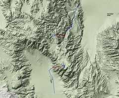
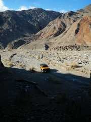
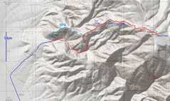
Overview map.  John R and
Craig J were going to meet us at
 the mouth of Cottonwood Canyon,
 but they got stuck in mud just
outside Stovepipe Wells.

1cp
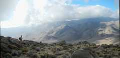
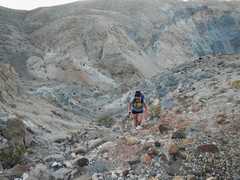
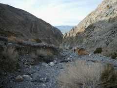
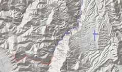
Part of the road and the hike to
Canyon Point. The weather made
 this a neat trip, but the humidity
 made Jodie's LSU clothes seem
especially appropriate.
DSCN7954
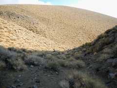
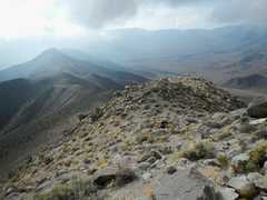
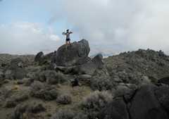
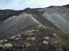
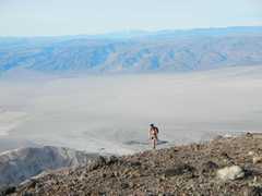
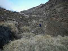
The crux of CP is a pile of loose
 rock right off the end of the road.
DSCN7955
DSCN7957
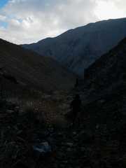
After this point, the
route goes over mild
class 2. Most of the
walk is benign.

DSCN7960
DSCN7968
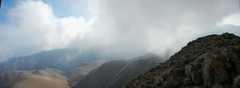
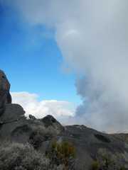
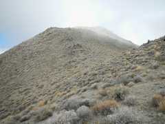
Oops, the summit is about to enter a cloud.
DSCN7969
DSCN7971
DSCN7972
DSCN7973_stitch
DSCN7977_stitch
DSCN7979
DSCN7983_stitch
DSCN7984
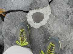
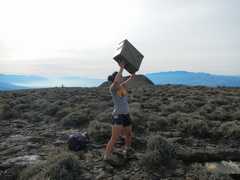
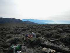
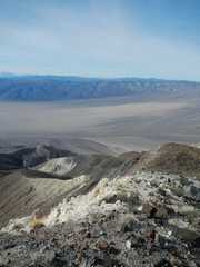
"Conditions" (and the Canyon
Below) make this hike.
DSCN7985
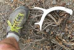
The springs are that-a-way
DSCN7986
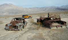
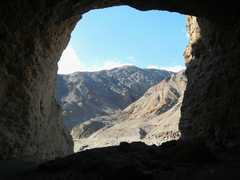
Hole in cliffs on drive out.
DSCN7988
DSCN7990
Next we drove around to the
west side for Panamint Butte.

DSCN7991
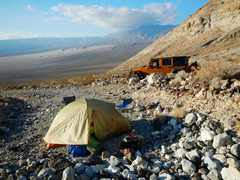
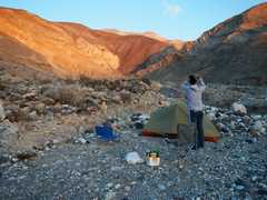
Campsite, dunes to NW
DSCN7993
View east up approach
canyon at sunset.
DSCN7993map
Next day we started up a
variation of the DPS route.
DSCN7994
DSCN7997
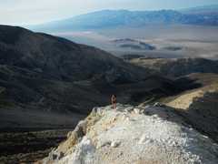
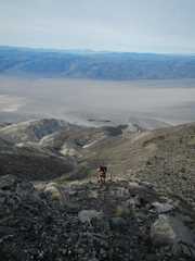
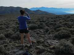
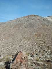
The top is up there somewhere.
We'll gain about 4300-4400' over
some steep stuff, only to reach
an almost flat top!
DSCN7999
DSCN8000
I call this TiO2 ridge in honor of
Jodie's life saver gummy candies.
Actually, the black-brown
basalt rock has more TiO2.
 
DSCN8002
DSCN8003
DSCN8004
DSCN8006
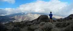
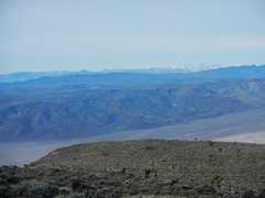
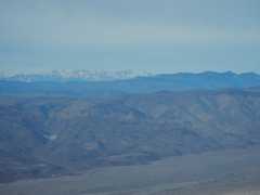
Sierra to NW, Langley to Russell
(lower end of Inyo range at right)
DSCN8008
Olancha Peak in back
DSCN8010
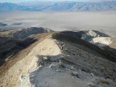
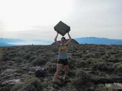
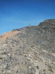
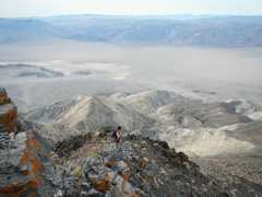
We came right up this ridge, which
was falling apart and rather sketch
 in places, so the flat top was a bit
of an anticlimax!
 
DSCN8011
DSCN8012
DSCN8013
DSCN8016
DSCN8017
DSCN8020
DSCN8022
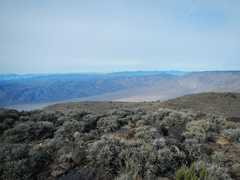
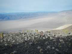
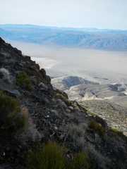
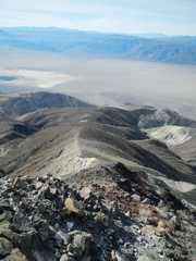
Telescope Peak to SE. Note the
 fog in Panamint Valley.
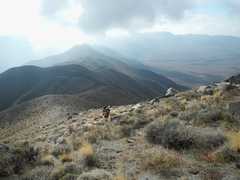
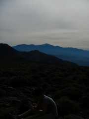
DSCN8024
DSCN8025
DSCN8033
DSCN8035
Heading back down.
DSCN8036
DSCN8037
DSCN8038
DSCN8041
 Jodie is up there somewhere,
coming down "The Thing," a
 basalt-talus-covered lump.
DSCN8042
DSCN8043
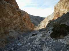
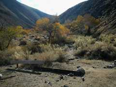
We had gained about 800'
in this pleasant canyon in
the morning, and now it
provided some shade.
DSCN8045
DSCN8048