Charleston
Peak via
pics by Harlan W. S. This is a tough hike, starting below 6900’, with no
real trail, and a lot of very difficult terrain. The route-finding occurs at a small scale; at
low elevations, you will be constantly looking for the most brush-free route
by the stream – which is choked with willows and thorns – and at
high elevations, you will be searching for the least-slippery path by
polished-rock and algae-covered falls.
You can avoid a lot of pain by simply taking the ramp to the right of
the “5th-class dryfall” (the fall is mentioned by
Branch Whitney). (However, there
is one significant caveat about
this ramp; near the elevation as the waterfall, there is a 10-20’ cliff
band. You can climb through the cliff
band in at least two places; the ramp may fade out farther to the SE, but I
was just impatient and climbed a class 4 crack.) My main conclusion is that if you want to do this route,
you should become a member of Branch
Whitney’s site, and follow him.
He knows the many paths around the brush; else you will waste a huge
amount of time trying to navigate the obstacle course. I went solo, driving out from Vegas. Two hours of
driving got me to the USFS sign about
8AM. I hit the “trail”
~8:20AM, and topped |
|
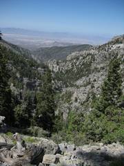
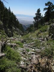
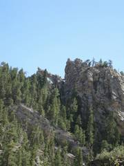
The upper part of the route. |
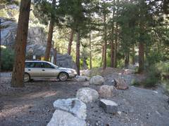
The road-end parking area. There are many great campsites, and this area is extremely popular with the Pahrumpians. |
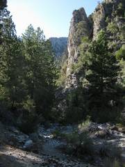
Starting up the stream. There is a confusing network of trails on both sides. I was looking for a divide in the trail, so I might take the lower branch; I counted 5 divides. |
|
|
|
|
|
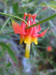
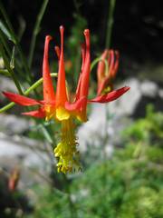
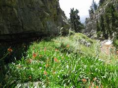
Scarlet columbine. |
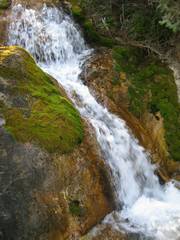
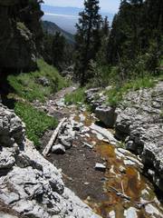
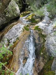
A much-photographed waterfall; this area has abundant flowing water all summer; that means abundant choking brush. |
Hummingbirds kept buzzing me, apparently thinking that my yellow-and-orange shirt was the mother lode. |
|
|
|
|
|
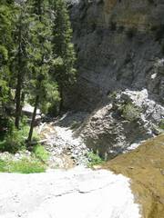
Near the “class 5 dryfall” I headed R (NE) onto this simple ramp up to 11200’. |
Finally on the
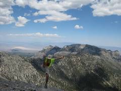
South Loop Trail, I look back S over |
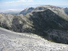
Lots of people were on the peak; here hikers descend the NLT. Mummy Mt. is to N. |
|
|
|
|
|
Some people saw me doing my standard cerebellum check, and began clapping. Then a young fellow tried to replicate the move, and complained of a severe burning. He wanted to try again, but I convinced him that it was not a good idea to injure himself before a long hike back. |
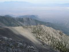
Looking back SE; Carpenter is over this ridge. I was going to use this ridge for descent, but it looked a bit rough. |
The upper parts of the canyon (above 10000’) are smooth ramps. I decided I would descend the canyon to say I had properly done the route. |
|
|
|
|
|
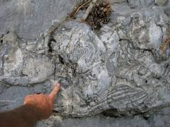
Rose coral fossils. |
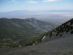
View down toward |
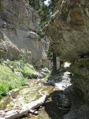
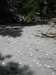
Extremely slippery, slimy stream beds. Near here I lost my GPS; I slipped on the slime like Bambi on ice, and while I was upside-down, the GPS probably slid into the bushes. Ironically, I normally keep that velcro-flap closed, but was consulting the GPS at the time. I didn’t notice the loss till 30 minutes later. |
|
|
|
|
|
You will find yourself avoiding the slick polished-rock falls and algae slime at all costs, occasionally walking over beautiful columbines, by thistles and stinging nettles. |
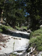
More neat canyon and slimy streambed. |
This is the top of the “class 5” waterfall. Go L and up for an easy climb around. |
|
|
|
|
|
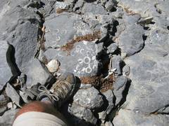
These white blotches are calcite crystals in the partly-metamorphosed limestone. |
This is a convoluted chert and limestone boudinage. |
You really don’t want to see the stream too often on the way down; if you do, it means you have some nasty navigation. |
|
|
|
|
|
This is the arch in Branch Whitney’s figure 1, description of the hike. Actually, you don’t see this unless you turn around on ascent. I didn’t see it till I was coming down. |
Some thoughts: The road. Branch Whitney says to allow 90 minutes to get here from |
Some thoughts: The hike. The majority of the people who discuss this hike think it is great; but the majority have followed Branch. I would suggest that you do the same, because the initial brush route-finding is maddening. The faint initial “trail” divides many times, and the cairns are sporadic, often ending when an animal trail branches from the “true” route. The upper parts of the route are very slimy and slippery at some times of year; even without algae, the highly-polished limestone makes the footing treacherous. It is simply impossible to describe the early
route-finding in a printed document.
The path is far too convoluted, and the landmarks are ambiguous. |
|
|
|
|