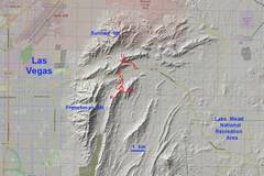
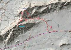
 Context map. |
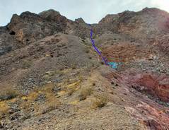
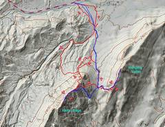 First hike, Jan 28. I started up the N side of Knife-Edge (K-E), then went up W side Hanging Valley (HV). I circled back to look for better route on the N side of K-E. Red is my track, blue is normal slog (off PeakBragger). All told it was 3h 20m., about 4 miles. |
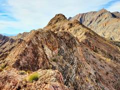
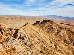
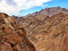
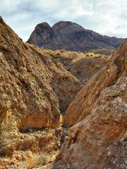
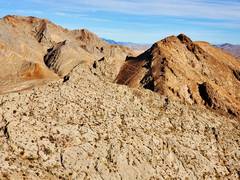
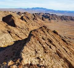
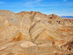
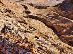
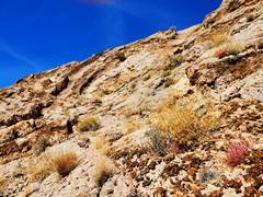
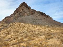 View S to Knife-Edge. The normal route is on the east side; I came in from north, and mistakenly went to a deep red gully, which is class 4 dirt (10' near vertical crumbling start) |
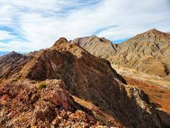 View SW on ridge; Brown summit of K-E at L, grayish Frenchman Mt at R |
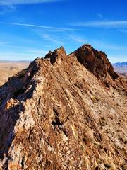
 I walked on very top edge as much as possible; in fact... |
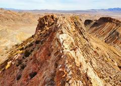 ...I stepped on that whitish point (view back NE) |
 |
 |
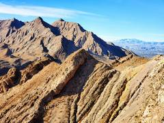
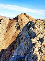
 View NE to HV peak. I saw a trail (sheep?) all the way to the ridge. |
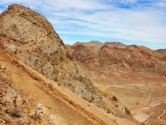 View NE. I dropped off K-E here; the talus became incredibly steep, and I don't recommend this way. |
 Now looking NE along W side of HV peak |
 From just beyond summit of HV, view SW over K-E to Frenchman |
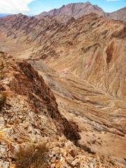
 Slightly zoomed, showing where one crosses valley between peaks. |
 View of Muddies. |
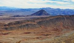 View over Lava Butte. |
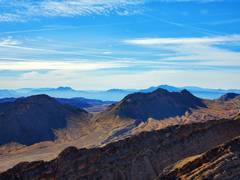
 NNW over Division and Unity to Sunrise Mt |
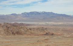
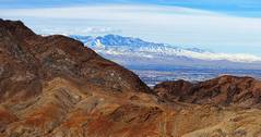 Spring Mts over N edge of Frenchman, from HV peak. |
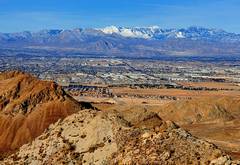
 View to Henderson from HV. |
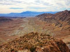
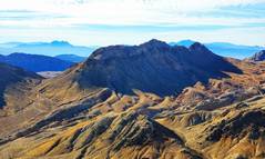
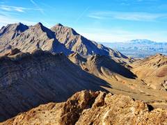
 View SW to Frenchman, showing valley between K-E and HV. |
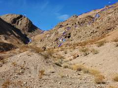
 Springs. |
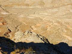
 I crossed back N of K-E to look for a better route. This is the route I first used. Avoid the red stuff. View is UP. |
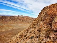
 K-E from NW |
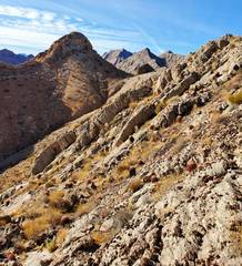
 Division and Unity to N |
 Neat gully I took back to car |
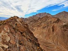
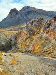 Should have turned W here, went E. Route up K-E shown. |
 |
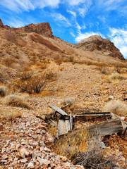
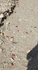 Lots of spent shells as I neared the car. |
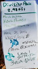
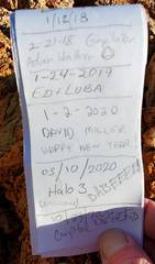
 Jan 31, I went to Division Peak by a fairly standard route from the ESE, then over Unity Peak and back down the SE side of Unity. All told it was about 2 h, 3 miles. |
 I'm NE of Division, looking SW. The summit is at L; there is an occasionally knife-edgy ridge NW of the summit, but I climbed the peak by entirely class 2 or lower route, walking on the sharpest edges only for balance training. |
 Closer to the summit, Frenchman Mt in back on R (to SW). |
 Stll closer... |
 |
 |
 View N from Division, Sunrise Mt on L, Unity at R. |
 Frenchman again, Potosi at R in distance |
 Spring Mts, with Charleston, W across Vegas Valley. |
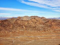
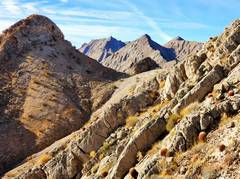
 Knife-Edge to S; Rainroad Pk (Black Hills) at L on skyline. |
 Muddy Mts on skyline to ENE. I came up valley at L in shadows. |
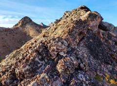
 Unity to NNE. Note zig-zag sheep trails in talus to L of peak. |
 Now I'm near top of Unity. While the route need be class 2 at most, all the way up I walked on the sharpest, highest edge for balance practice. In this shot, I'm standing on a sub-fin and will eventually walk on every highpoint of the fin to the top. I put my hands down about 3 times, and used my arms as counter- balance. |
 View of Frenchman (L) and Potosi (R, distance) from Unity. |
 View down at valley W of Unity; I would have gone across this to Sunrise that day... but I had a plan for a surprise visit... |
 Sunrise to NW from top of Unity. |
 Hanging Valley (L) and Kinfe-Edge (R) from Unity |
 |
 |
 |
 |
 Now I'm descending SE slopes of Unity, and suddenly the terrain drops off steeply. Rather than risk a cliff, I cut L... |
 ...and came down these steep but manageable rock slabs |
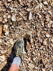 lots of degraded children's footwear around there. ??? |
 View back at my route, Division on L and Unity at R, but neither summit is visible. |
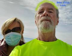 When I got down I called Gina to see if we could walk. She is a fellow survivor, but is shy about photos. She looked great and seemed fit. We both have sars-cov-2 antibodies, but I should have kept my mask on to hide my wrinkles. |
![20210131_132652[1]](thumbnails/20210131_132652%5B1%5D.jpg) ...just before I finished my hike, I slipped on a near level spot, and got ~20 barrel cactus spines in my arm. One broke off and is still in my arm. The others were quite hard to extract, and my skin tented up as I pulled. I washed down the area with isopropyl when I got back to the car. |