Garmin 60c and Magellan SporTrak Pro Screen Comparisons
Please click on each small image to see a larger version of the same photo.
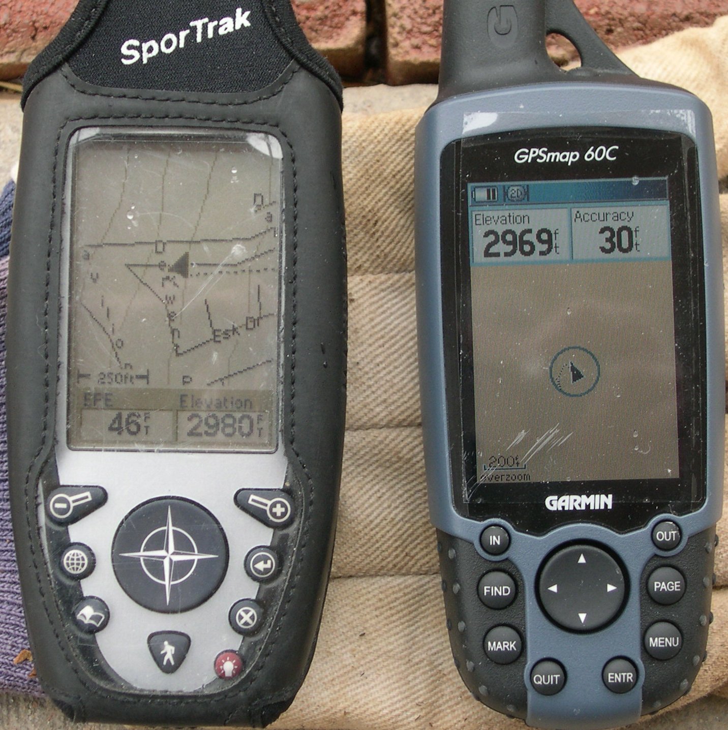
Magellan STP in its protective case (thick vinyl window) at left; Garmin 60c at right, with a Fellowes PDA protector over the screen. Both have topo software loaded. Actual elevation is ~3030'. GPS were held vertical till they obtained 3D fixes, then were laid horizontal for the photos.
The Garmin screen shows no contour lines, because its topo software uses true USGS 100k contours as vector objects, and there are no contour lines in this area. My neighborhood didn't exist at the time of the latest USGS survey, and there are no streets marked in the Garmin topo for this area.
The STP software uses a DEM model that allows interpolation, so contours are dynamically redrawn to be visible in any screen (they are the light sub-vertical lines). The streets are apparently pulled from the Tiger database, and are fairly accurate in this area.
Overall, the Garmin USGS contour lines are more accurate (in very rugged, mountainous terrain) than the Magellan topo lines.

The STP is now out of its protective case. Both GPSs are horizontal, and the 60c just lost sync.
I took the pictures under the eave of my porch, and used the viewfinder, not the LCD screen, to focus (presbyopia). Unfortunately, this close, the viewfinder path is not nearly coaxial with the lens, so I didn't control reflections very well.
Both GPSs show some track vestiges. In the case of the STP, the track (dotted line) is connected from the last position, 40 miles to the east; for the 60c, the track reflects the random position changes.