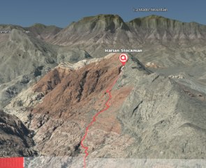
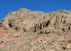
 Recent route on Gray Cap (use mouse to rotate image, lower left to change speed) |
||
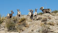
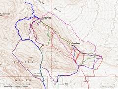 Various routes, certainly not all I've taken. I didn't see a register on GoatBed till about 2011, but then I wasn't looking. |
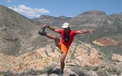
 My 1st trip along the ridge and over Turtlehead, 3/2004. I picked an iffy way up the limestone. |
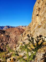
 2004 again, note the lack of development to left. |
 2004; this was the last hike when I still had vertigo from 2002 brain damage. |
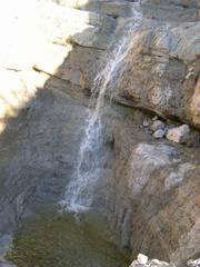 2005 was a very wet year, and when we went up the "easy" way, there were lots of waterfalls. |
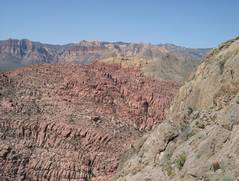
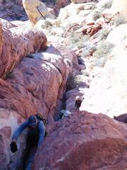
 At that time, there was no published way south down the sandstone, so we wound around cliffs till we were down. I haven't been on that exact route since. |
 Jeff C. And Michelle N, 2012, the search for Ron Kirk. Ron's body was later found below the cliffs on south side of Turtlehead. |
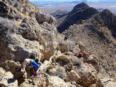
 In early 2017, Tom, Barb Judy and I decided to try a random route on the south.. |
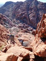 That S route was "interesting" and led to a very convoluted gps track, as we constantly cliffed out. |
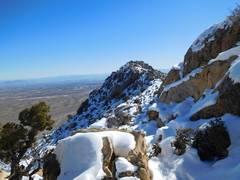 After Gray Cap, we headed SE on the ridge. We hit very snowy sections |
 Judy, Tom and Barb helped each other. |
 In 2018, Judy, Barb, Susan M and I did a traverse. You can see the new houses of Summerlin encroaching in the distance. This was less than a month after my 2nd brain surgery of 2018. |
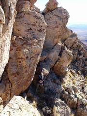 Judy (bottom) and Barb (hidden behind rock) spot Susan (top). I think this trip convinced Susan not to follow us on this route ever again. |
 Next obstacle on way NW. |
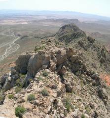
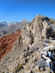
 Looking back SE. When by myself, I sometimes walk the very height of the ridge as a test of balance. |
 Sept 2020, on a cool day we again went SE to NW. |
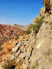
 View back SE over Goatbed, one can see more development in Summerlin |
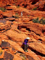
 Judy and Barb handle same downclimb with aplomb. |
 We came down "Ghost Canyon" a route that HLV cairned in later 2005 or 2006. Barb looked up over the slabs as we walked east in Gateway Canyon, and wondered if we could find another way up the ridge that followed sandstone all the way. |
 ...so solo explorations began. First I found this great canyon across from the east end of Kraft Mt. It got me up to the ridge with 1-2 class 3 moves, but had just a small stretch of sandstone. |
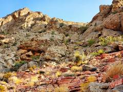
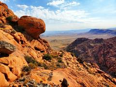
 ...standard view from Goatbed. I had seen a big cairn closer to Goatbed in 2004, and wondered if it would lead to a decent descent... |
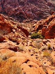
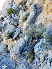
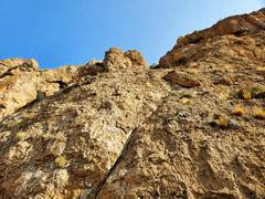 ...it didn't. I descended over very steep slabs, seeing no more cairns. This photo is aimed UP, and doesn't do justice to the sketchiness... |
 ...and just when I thought it would work, I hit a wall that varied from 50' to 15'. I finally down-climbed from the upper right to the bottom of the ledge, by using this catclaw-filled crack. |
 the next week, I thought I'd try this route to Goatbed! it's steeper than it looks... |
 ...and had me hugging walls over class 4 moves on sketchy rock. |
 ...but it was direct! |
 Another standard view from Goatbed... |
 ...and the cliff I passed. |
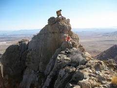
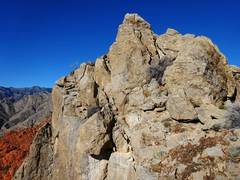
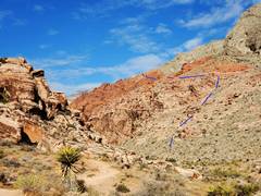
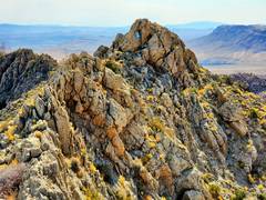 So on the 3rd try, I ascended the limestone ridge by the route I used 16.5 years back, to the top of Gray Cap. |
 Then I started SE down Gray Cap, hoping to find the mythical sandstone slab route down to the Canyon at the east end of Kraft Mt. |
 ...and here is where I made it way harder than it needed to be. I should have stayed 200' up to the left of the boulder. |
 When I passed the boulder, I was on top of a 50' cliff... |
 ...so I descended the gully, skirting around hidden dryfalls. I was actually just east of the route we took in 2017. |
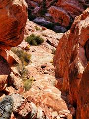 It got vey interesting near the canyon, and I skirted lots of dryfalls till I finally slid 10' down a steep ramp. |
 4th time lucky! Here I'm on the east end of Kraft Mt. |
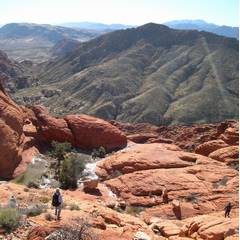
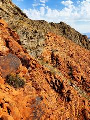
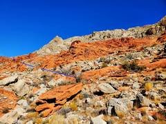
 ... and there is a mostly class 2 route that follows red slabs, with a few areas of big grippy limestone boulders... |
 |
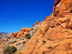 |
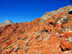 The only obnoxious part is the red sandstone loose slabs in the final loose ramp on right. You can see the boulder where I made the mistake on the previous trip. |
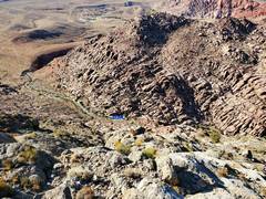
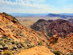
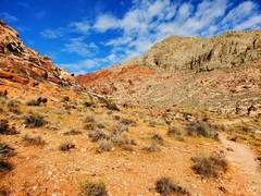
 View SE down valley |
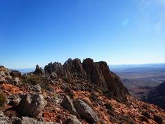
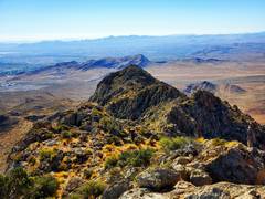
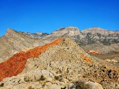
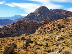
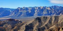 From top of Gray Cap |
 I hadn't seen Iris Ma's sig in a register for 10 months. She's a tough one. |
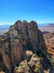
 My only class 3 was dropping down on the N side of Gray Cap |
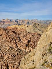
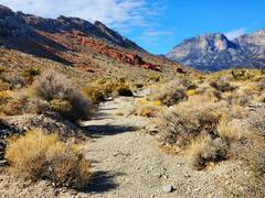 View NW up Brownstone Valley |
 Kraft Mt, as I return. |