Hayford LVMC Hike and Shakespeare Festival
H.W. Stockman
October 30, 2004 |
Hayford Peak (9912') is the highest summit in the Sheep Range, NW of Las Vegas. The hike involves an ~ 5.2 mile walk up an old gravel road (very washed out) to a cabin, then an ~ 2.4 mile trailless climb up a ridge to the peak itself. The trek up to the cabin is uneventful, though long, and gains about 2000'. The subsequent ridge route to the peak is partly marked by cairns, and is mostly a walk-up, with some minor class 2. A helicopter-serviced transmitter is atop the peak.
We had a great time, with15.2 miles round-trip, and 4600' accumulated elevation gain, most in snow. The trip was led by Joel Brewster, whose calm good nature helped pave the way for rational decisions. We didn't want to do anything foolhardy, so we watched the clock and the conditions.
As Handel said, "we like Sheep."
How to get there: see odometer log at end of page for road travel.
Click on any small image to see a larger picture. (Cliquez sur une petite image pour voir la grande image correspondante.) Order is essentially chronological. Even the large images are reduced in size to 20% the number of pixels in the originals. Contact me if you want the full-sized images. To save a large image under Windows, 1) click on the corresponding small image; 2) when the large image appears (fully), right-click on the image and choose "Save Picture As..." on the menu. Be sure to note where you saved the image!
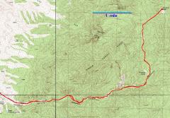
GPS trace of route. We stayed on the ridges for the actual climb; the snow was thinner and burned off by the southerly exposure. |
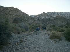
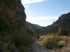
View East at start of trail; we were at the trailhead before the sun broke over the ridges. |
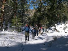
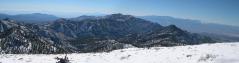
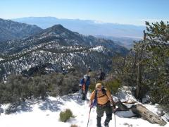
West, just before the cabin. The snow on the "trail" didn't get much deeper than this, but the snow was up to 2' deep off the center of the ridges. |
|
|
|
|
|
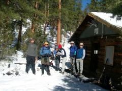
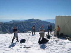
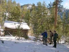
We reached the cabin. Should we enter? "Open the door, secure, foolhardy king."
Click here for bonus picture from Steve. |
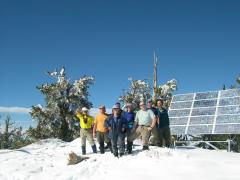
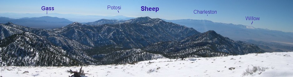
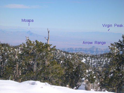
On top; view ~SW. Here is a key to the peaks. |
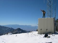
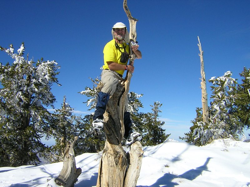
"Blow, winds, and crack your cheeks! rage! blow!"
Nick practices for his upcoming role. |
|
|
|
|
|
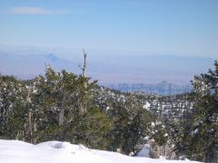
View east; here is the key to peaks. |
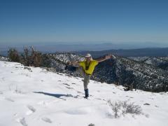
Cerebellum check; "I find my tongue is too foolhardy." |
The rest of the theater patrons arrive for the Shakespeare festival. |
|
|
|
|
|
Luba is in a hurry to celebrate her 40th birthday.
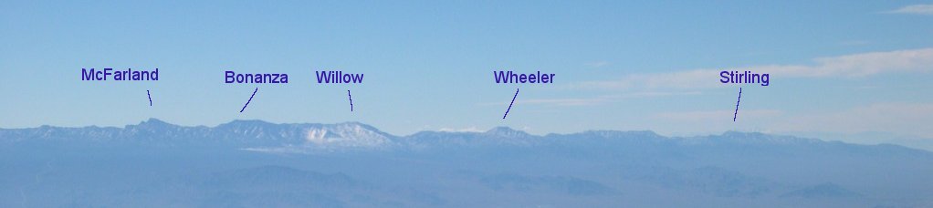
Here is another peak key. |
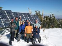
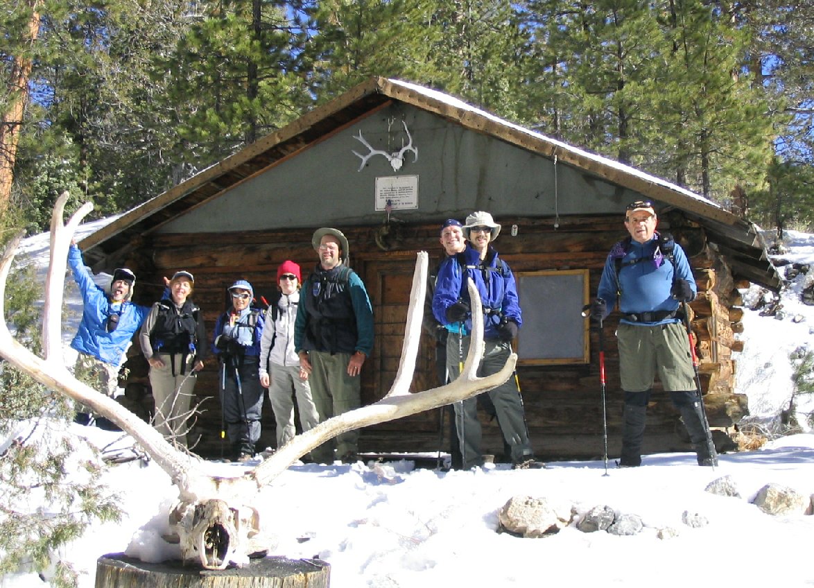
L to R: Bill, Joel, Nick, Ed. Paul, Ali, Howard, Luba (in front).
Click here for special bonus picture from Ali. |
|
|
|
|
|
|
|
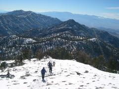
Time to descend; daylight hours are waning. |
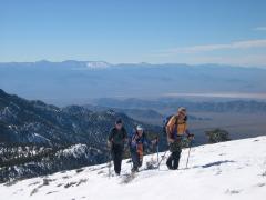
Snow and trekking poles help make this stretch more fun. |
|
|
|
|
|
|
Back at the cabin. |
Walking out as the sun drops low behind the ridge. Back on the gravel below 6500'. |
|
|
|
|
My car odometer log to trailhead, 10-29-04 (YMMV):
0.0 -- IHOP parking lot on NE corner of I-95 and Cheyenne; set odometer to zero. Turn right (west) onto Cheyenne, then take the immediate north (R) ramp onto I-95.
18.5 miles -- turn right at the green Corn Creek sign (there is also a brown Desert National Wildlife Range sign; both signs are on the N side of road). The roads are gravel from here to trailhead. (NB: as of 11-11-05, the signs at the turnoff are back up.)
22.45 miles -- pass the Desert National Wildlife buildings on left. Restrooms.
22.5 miles -- take left turn at T junction, onto Alamo Road. Big sign says it is 16 miles to Hidden Forest Road -- actually, it's about 15 miles. (NB: on 11-11-05, parts of the Alamo Road were washed over with thick gravel deposits.)
(30.0 - 30.1 miles -- road is a little rough)
37.7 miles -- turn right on (signed) Hidden Forest Road. (NB: As of 11-11-05, the Hidden Forest Road was recently bladed, and is in pretty good shape.)
(39.2 rough road, minor washout)
(40.2 minor washout)
(41.1 minor washout)
41.6 miles -- park.
I've made the entire trip in my Subaru Outback -- but the road is rough at spots.
If you want a GPS log or waypoints, contact me at: hwstock
at alum dot mit dot edu.