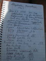
Stepladder
and Chemeheuvi (CA) solo; Signal and Castle Dome (AZ) with LVMC
pics by Harlan W.S. I headed down Thursday, so I could break the long (for
me) drive into 2 days. For Stepladder on
Thursday, I had bright skies and 77F by the car; but the stiff wind kept the
perception of heat to a pleasant level (gusting well over 25 mph on
top). I passed a kidney stone while
heading up Stepladder, which was “interesting.” Thursday night I
camped in the desert near Chemehuevi; more 25 mph winds, but it seemed
peaceful. I headed to Chemehuevi,
right from my tent site, at 6AM the next morn. Even with a big stupid screw-up, I was on
top by 8:15AM, and it was downright cold, with the wind still gusting. Later
on Friday afternoon, I drove down through Blythe to Quartzite AZ, and then to
a primitive campsite near Crystal Hill in the Kofa preserve, where I met
Ali. The night was pleasant, with a
coyote serenade ~4AM. The next morning (Saturday) Eric, Angela and Anji were also there, and
we all drove to meet Joel and Collin at the western roadhead for |
|
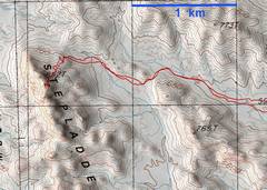
GPS track for Stepladder |
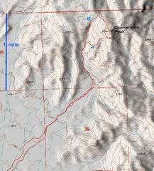
GPS track for Chemeheuvi |
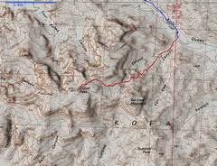
GPS track for |
|
|
|
|
|
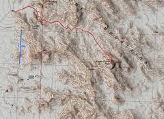
GPS track for Castle Dome |
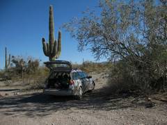
On Thursday, I got to a point east of Stepladder before 11AM. The driving was easy; I took the powerline road recommended by climber.org, rather than the horrible road given by DPS. |
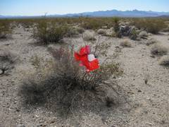
Love is cruel. Remnants of a Valentine’s Day balloon. |
|
|
|
|
|
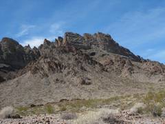
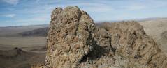
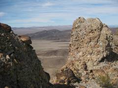
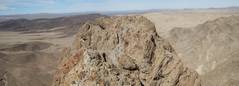
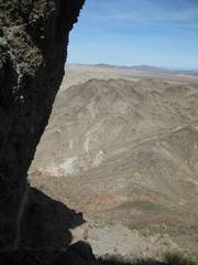
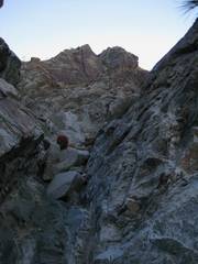
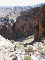
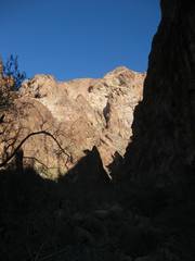
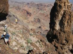
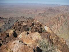
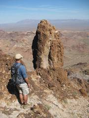
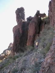
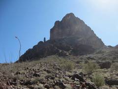
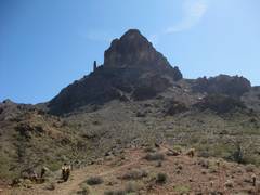
As you get near the peak, it looks gnarly. |
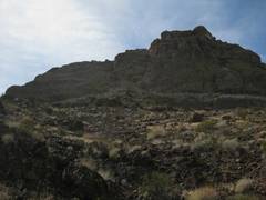
View up. There is an obvious use trail that never exceeds class 2 to the last ridge.. |
…which is an 8’ outcrop of class 3 volcaniclastic rock; a debris-filled tuff, with cobbles of mainly silicic volcanics, perhaps even a lithified lahar. |
|
|
|
|
|
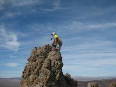
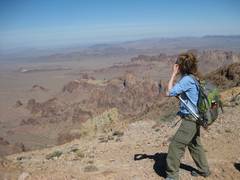
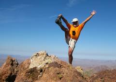
Self-portrait. It was very windy. |
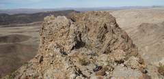
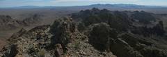
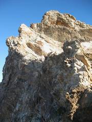
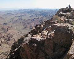
Another view from S of the S peak. The N peak (on R) has the same last closed contour line on the USGS map, but looks slightly lower; the small 8’ spires on the top of the S peak probably don’t show up in the map, which was done by photogrammetry. |
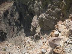
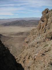
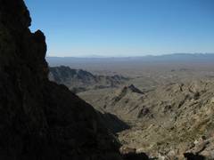
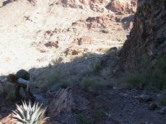
Steep canyon on E side. |
|
|
|
|
|
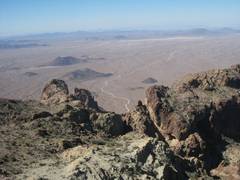
View ~NW. |
View ~SSW. |
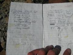
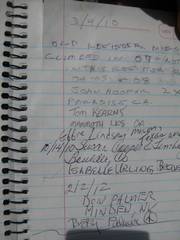
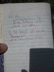
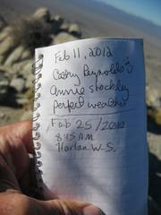
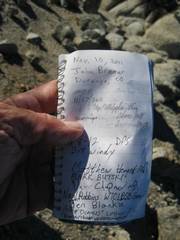
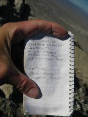
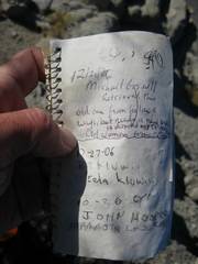
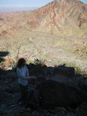
Inside register box.. |
|
|
|
|
|
|
|
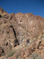
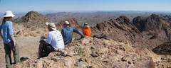
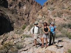
The peripatetic Palmers. |
|
|
|
|
|
|
Spirit Mt to N. |
Yet another view N. |
|
|
|
|
|
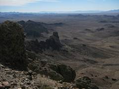
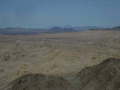
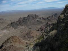
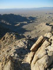
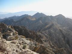
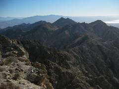
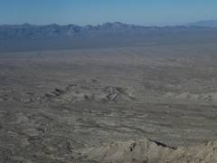
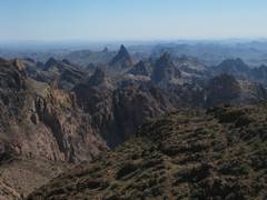
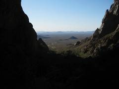
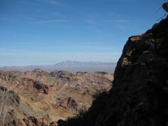
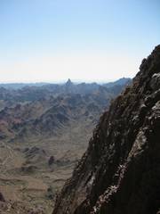
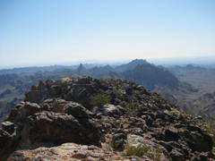
View S. This is a very stark, but impressive land. |
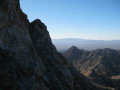
Thegap between the S and N peaks. |
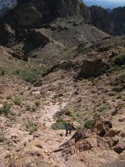
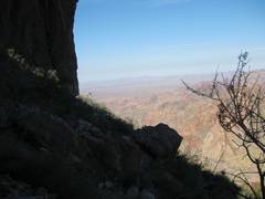
View ~E, upon descent. |
|
|
|
|
|
View ~NE on descent. |
View S. |
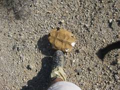
Desert tortoise shell. I had the very uncomfortable sense that I was crushing juvenile tortoise burrows on the walk in, no matter how carefully I trod. The DPS should try to cairn one route across the desert, just to keep folks walking in one area (the cairns are not needed for routefinding). |
|
|
|
|
|
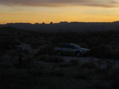
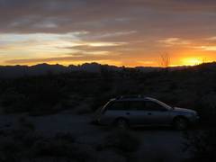
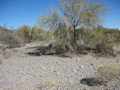
That eve I camped in a wash at the Chemehuevi trailhead… very peaceful, high winds. |
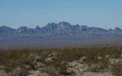
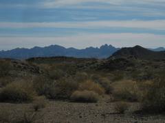
Mopah and Umpah Mts to WSW. |
|
|
|
|
|
|
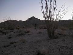
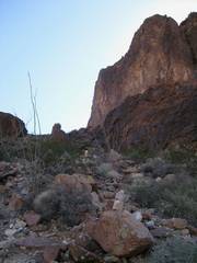
The next morn I headed to Chemehuevi ~6AM. I was warned about the cholla, but found open washes where it was very easy to keep away from spiky plants. |
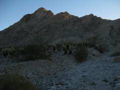
The light hits the ridge. About this time I decided to do a gps “goto” on a waypoint. I should have put on my reading glasses; I tagged the nearest waypoint, which was the summit! I was supposed to first head L to the NW ridge, a class 2 climb. |
So I ended up climbing straight toward the summit, in defiance of intuition. I saw one small cairn. |
|
|
|
|
|
|
Now I’m on the S spur, looking N at the last 400’ to the summit. I actually climbed past here, saw a steep low cl 5 ramp, checked the name of the waypoint (now that I had light)… Doh! Time to drop a few hundred feet and traverse. |
View SSW over traverse. |
|
|
|
|
|
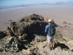
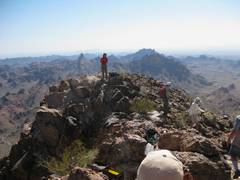
Finally on the summit ~8:15AM. |
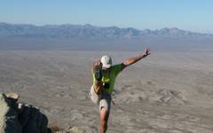
View W. I had to try 20 shots to capture “the pose.” The strong winds kept knocking me over. |
|
|
|
|
|
|
|
|
|
|
|
|
|
|
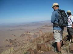
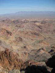
Hey, isn’t this the same damned view from above? SE toward the lake. |
|
I think my car is down there. |
|
|
|
|
|
View SSW as I head down the real DPS route. |
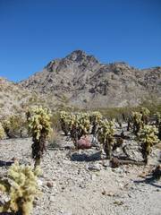
View back to peak, over lovely cholla. |
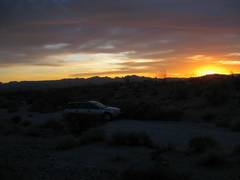
Then I drove into AZ, and stopped at Crystal Hill in the Kofa refuge; this is a random view from my camp spot. |
|
|
|
|
|
A saguaro gives me the finger. |
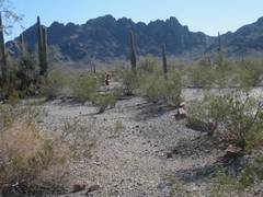
It’s a bleak area, but there are abundant places to pitch tents under palo verde and mesquite/acacias. |
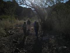
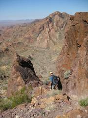
On Saturday morn, we drove out to it to within ½ mile, but since I had recently patched a tire, I thought the better part of valor would be to catch a ride for the last stretch. View S; Ten Ewe Mt is ceneter-left. |
|
|
|
|
|
|
Up to the half-way point. |
Ali over the ½-way point. |
|
|
|
|
|
|
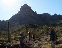
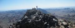
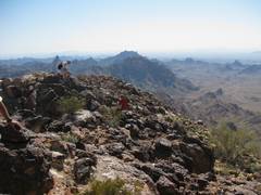
Ten Ewe*, view mainly E. |
Anji on summit, view ~N. |
|
|
|
|
|
View ~ENE. |
View ~W down to road for Palm Canyon. |
View ~ESE. |
|
|
|
|
|
View ~WNW. |
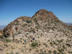
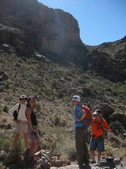
The folks rush off to tag the N summit. |
Eric on N summit. |
|
|
|
|
|
|
On the way down, we unexpectedly met Slawa and her friends at the ½-way point. |
|
|
|
|
|
|
I drove out before the others, and headed east on story there)… |
|
|
|
|
|
|
|
There are palms up there in that dark slot… yawn… |
|
After I had gained perhaps 500’, and the trail was long gone, I turned around and headed out. View W. |
|
|
|
|
|
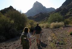
The next morn, we head ~E in the wash N of Castle Dome. |
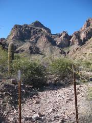
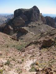
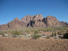
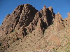
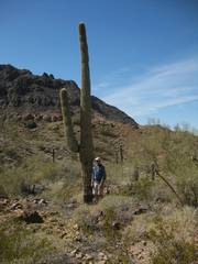
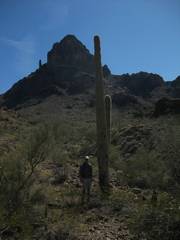
A first view of the peak. Our route will be on the L, between the thin spire and the main mass of the mountain. |
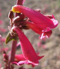
Penstemon. |
|
|
|
|
|
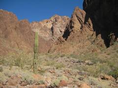
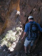
Now we are out of the wash. It was perhaps 70F, but felt quite hot because of the sun. But soon… |
…we were in the shadow of the mountain, and got cool. |
|
|
|
|
|
|
|
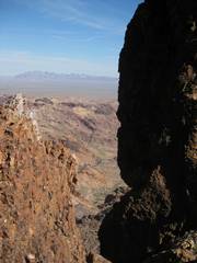
View ~W along base of cliffs (on the N side of peak). |
View ~E. |
|
|
|
|
|
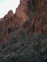
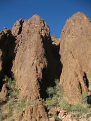
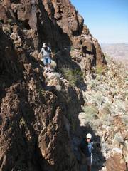
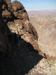
This the notch between the spire (top of photo) and main mass of mountain; Eric below. Collin, Eric and I mistakenly went up the R (S) side of this wall, up a chute that was more like class 4. The correct chute is class 2-3, on the L (N) side of the wall. |
Wiew between the spire and wall, ~N. |
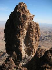
The spire. |
|
|
|
|
|
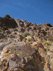
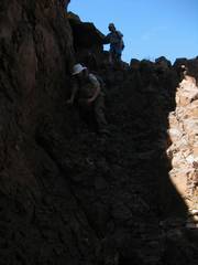
The rest of the route was class 2 and mild class 3 with exposure. |
|
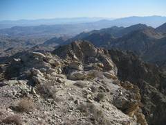
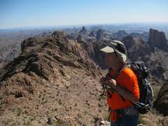
View on top, ~SE. |
|
|
|
|
|
|
View ~NW. |
|
|
|
|
|
|
View ~SE. |
Slawa shows up again! |
Slawa takes a picture of me taking a picture of her. |
|
|
|
|
|
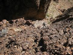
Descent… |
|
more desent… |
|
|
|
|
|
|
|
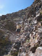
The correct class 2-3 chute, in gap between spire and wall. |
|
|
|
|
|
View of the last chute, from the other side of the gap. |
|
|
|
|
|
|
|
|
|
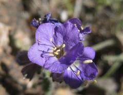
Phacelia. |
|
|
|
|
|
|
|
|
|
|
|
|
|
Collin by saguaro. |
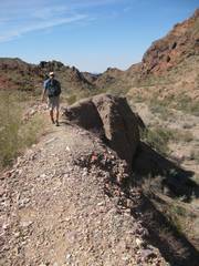
The dirt knife edge above the wash. |
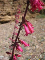
Penstemon. |
|
|
|
|
|
Almost back! |
On
Saturday for physically, and never breathed hard during the hike. But the tense drive in over rocks, and all the talking, used up my cerebellar capabilities, so I opted not to join Anji, Joel and Collin for Ten ask them ;^). I was largely recovered by the drive out. |
|
|
|
|
|