La Madre
by NW (LVMC)
pics by Harlan W. S. Provided you can get a car to the start, this is the
fastest and safest route to La Madre, with a minimum of loose rock. However, the route-finding requires you to
pay attention, particularly at lower elevations. I didn’t take many photos, partly because I was
focused on finding “the best route” (which might have been back
at the car). DB began to freeze at 7650’, and Ali graciously
volunteered to wait with her at a warmer spot till our return (she also got
to experience some Persian cuisine, including the famous date and peanut butter sandwich).
CP took off for a fast romp over La Madre, El Padre,
and peak 7900. The other 7
intrepids fought gusts which must have been over 70 mph at times (gusts were
60 mph at the Have Google Earth? Go to the bottom of
the photos for Google
Earth instructions. The included file is also a gps file. I realized that my pack contained, among other things,
this clothing: an extra GoreTex windbreaker, an extra pair of GoreTex pants,
an extra pair of gloves, two sweaters, gaiters, an extra pair of wool socks,
neoprene socks, an extra balaclava, a poncho, and two headlamps. I’m not sure what I was prepared for;
but I was prepared pretty well. I also
had three bottles of water; but I didn’t eat or drink on the trip. I’ll put more narrative at the bottom as time permits. |
|
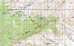
100k topo with GPS trace. The last 2.6 miles of dirt road are HC and 4WD. |
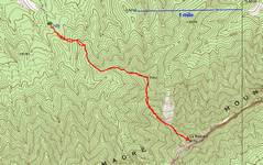
24K topo |
|
|
|
|
|
|
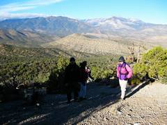
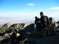
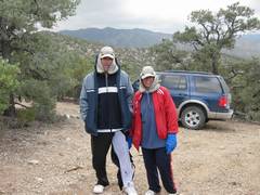
Ay 7650’, we huddle. |
|
|
|
|
|
|
|
|
Notice the Michelin Man effect. Jose is actually a slim guy! |
|
|
|
|
|
|
|
|
|
|
|
|
|
|
|
|
|
|
|
|
|
|
|
CP shows off his special harlequin pants. On the road out, CP found a Chupacabra bait. |
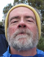
Harlan shows off the special Harlanquin blood on his face. I got a nosebleed, purely from the wind and cold. By the time Chris called the blood to my attention, my sunglasses were covered in red. |
|
|
|
|
1 Save this file on your computer desktop as lm8lvmc.gpx. Your browser may want to give a different extension (like xml), but don’t let it win.
2 Open Google Earth
3 Under Tools | Options... pick the 3D tab, and put Terrain Quality on Higher
4 Under File, pick Open, then for type of file, pick Gps.
5 Navigate to the saved lm8lvmc.gpx (on your desktop), and open it.
The little controls
in the upper right will give you spastic and annoying options for changing the
angle of attack, angle of rotation, zooming, etc.
You can use the arrows on the uppermost control to change the declination viewing angle, and you can move the “N” to change this azimuthal viewing angle.