McFarland Snow Climb (via North Canyon)
West of Las Vegas, NV.
Harlan W. Stockman
Saturday, May 28, 2005 |
Today's words: Badger Fat and Cyclooxygenase. A trip summary is at the bottom of the page. Trotsky, not Kerensky.
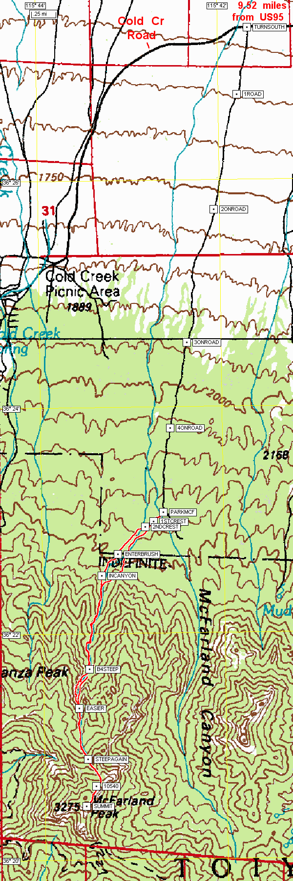
Here are waypoints in csv format (text, can be read in Excel) for WGS84 and NAD27; here is a map of most of the waypoints. USE THESE GPS FILES AT YOUR OWN RISK.
If you don't know which datum to use, chances are you shouldn't be using a GPS. Here's what the waypoint names mean.
|
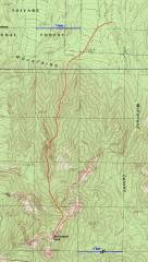
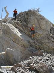
Route. |
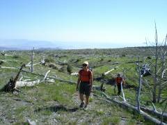
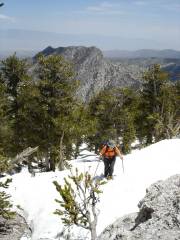
Starting off across the tree cemetery. |
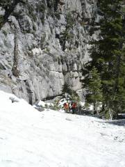
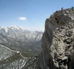
View N, just above the "class 3" section in Branch Whitney's description. |
|
|
|
|
|
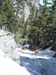
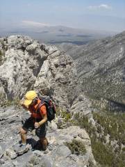
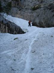
2100' vertical on crampons -- perfect snow. |
Alda nears the top of the snow. Mack's Peak is in the background. |
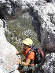
After chastising me for going out on the arch (which is perched above a 300' cliff), Luba climbs down through the arch. to stand at the top of the cliff. |
|
|
|
|
|
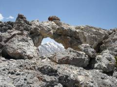
Charleston Peak through the arch. |
|
|
|
|
|
|
|
|
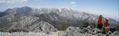
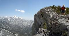
View east, semi-panorama at top. Mummy Mt at left, Charleston Peak at right. |
View SE. |
|
|
|
|
|
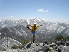
Look at me! |
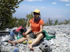
Om, om on the range. |
View S, the first part of descent. |
|
|
|
|
|
|
Alda nonchalantly skirts the precipice. |
Attempt to scare Alda's daughter. |
|
|
|
|
|
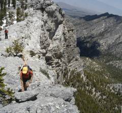
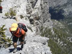
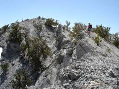
This is the "class 3" cliff in the Branch Whitney description. The snow bank extended over the cliff, allowing a walk-up. Note the glissade tracks. This is another picture intended to worry Alda's daughter. |
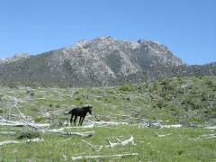
Wild horse in front of Mack's Peak. |
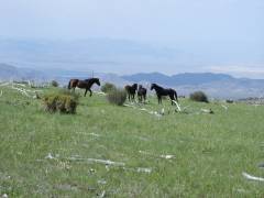
View N, more wild horses, om on the range. |
|
The descent was too fast to allow many photos. I turned around once to take a photo, just in time to see Luba flying toward me, her ice-ace sending up a rooster-tail of snow! |
|
|
We took the North Canyon route, which is pretty shielded from intense sun. We had near-continuous snow from 8400' to the knob north of McFarland, at ~10540'. From there, we took off the crampons and were able to walk along the rocky edge, above the huge eastern cliff, for spectacular views. The previous entry in the log was from September, 2004.
This was a great trip, much better than I expected. Snow conditions were ideal. We put on crampons at 8400'. Even though the snow was often over 5' deep (from tree wells), we didn't posthole. There were no signs of avalanche in that canyon (though broken bristlecone branch tips are collecting on the snow surface). The "Class 3" cliffs in Branch Whitney's description were under a smooth snow bank, so you could walk right over them. On the way down the snow, we didn't use crampons, just plunge-stepped and did standing glissades for 2100 vertical feet. One person had just trekking poles, and felt fine without an ice-axe. I used my axe for controlling glissades, and for one mini-self-arrest (mainly because I was stupid and insisted on glissading to a cliff edge).
I took my Subaru Outback to the "trailhead"* without incident; high clearance is more important than 4WD, though I made it with 7.5" clearance.
*There is no trail. The only difficult route-finding occurs when you leave the grassland and head into the scrub pinyon-juniper woods. It is very easy to lose direction in that part of the trip.
What the waypoint names mean:
TurnColdCr -where you leave us 95 and turn left (S) on Cold Creek Road
TurnSouth -- The gravel road where you turn left (S), about 9.5 miles after
leaving us95
1ROAD -- these next 4 waypoints are just along the gravel road, but there
isn't a way to get lost
2ONROAD
3ONROAD
4ONROAD
ParkMcF --where you park your car
1stCrest -- the 1st crest to aim for, after a stream channel
2ndCrest -- the second crest, after another channel. From here you mainly
walk on a featureless field with dead trees
EnterBrush -- about where you should enter the brush (small trees); there
are animal paths that may help walking, BUT...
INCanyon --aim for this point to make sure you don't wander into the wrong
canyon.
B4STEEP --this is a ways before the canyon gets steep; the GPS may lose
reception about here
EASIER -- the grade levels off, the GPS usually picks up again by here
SteepAgain -- grade gets steep
10540 -- the first false summit at ~10540' -- you can see the peak from
here.
SUMMIT -- the top!