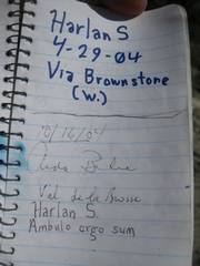
Pincushion
Pinnacle/Traverse (NE of Red Rock, NV)
pics by Harlan W.S. I first went to Pincushion from the NE (via Little Red
Rock) in January 2002. I had no idea how severely my life was about to change. On that trip, with Pierre M, we planned to hit both
summits; but after NW summit. The
wind on top was ferocious in 2002, but as we descended back to the car near Little
Red Rock, it was quite hot. So I had some unfinished business for my solo trip in May
2012. I had been up Pincushion/Damsel many times in the intervening
years, but always managed to miss the Pinnacle and the SE summit. This May it
was cooler than in January 2002, and the 30 mph gusts were welcomed this time. |
|
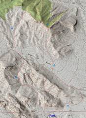
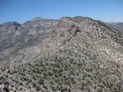
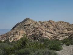
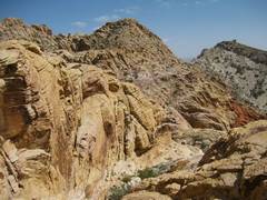
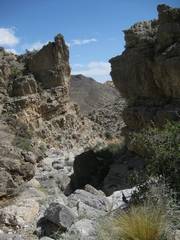
See the numbers on the photo for approximate picture locations. The Pinnacle is at 3, the SE peak is at 4, and the NW peak is at 5. |
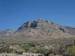
View to Pincushion/Damsel to N, from near point 1. |
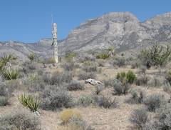
Camouflaged weather station between 1 and 2. At 1st I wondered what a saguaro was doing out here. |
|
|
|
|
|
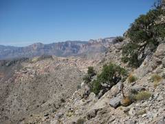
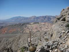
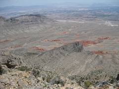
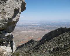
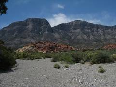
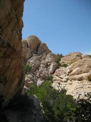
Near 2, looking SW. |
A bit higher than 2,
view SW; in distance, |
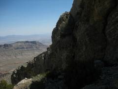
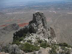
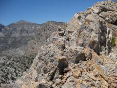
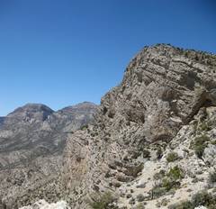
Near 3. looking at “break in cliffs.” There is a short (~15’) class 5 section at the break. |
|
|
|
|
|
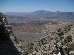
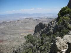
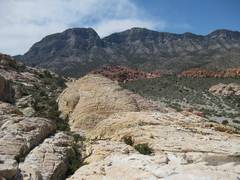
View SW near 3, over Graycap and Calico to |
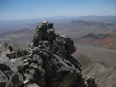
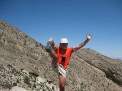
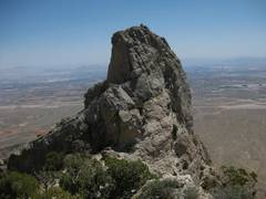
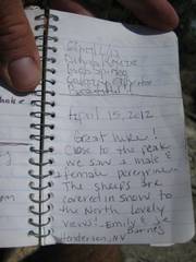
Suddenly, I’m on top of Pinnacle! I couldn’t find a register. |
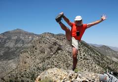
You should see the drop in back of me! But there wasn’t room to maneuver on the tiny summit, with the 30 mph gusts. Near 3. |
|
|
|
|
|
|
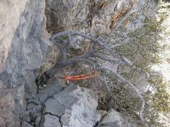
Now I’m looking straight down on the 15 mm orange line that I had previously rigged. Getting around the bush is a significant problem. Someone had kindly left a short black 15mm sling, through which I looped my webbing. Near 3. |
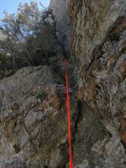
Now I’m down, looking back up. The “triangle” to right of webbing is tough; slightly overhanging. Here’s Richard for scale. There is a low class 5 crux about 15’ high. |
|
|
|
|
|
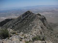
Now I’m climbing up to 4, looking back SE at Pinnacle (3). |
Still higher, looking back at Pinnacle. |
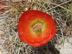
Claret Cup |
|
|
|
|
|
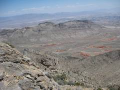
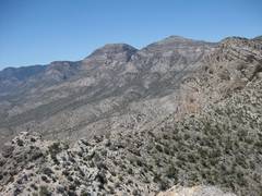
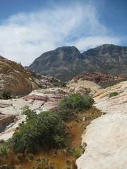
Still higher, View ENE across Little Red Rock to Gottlieb and Summerlin Peak. |
View ~NW to La Madre. |
Now at 4 (SE summit Pincushion) looking NW to 5 (NW and higher summit). |
|
|
|
|
|
|
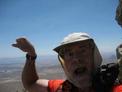
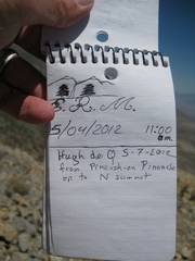
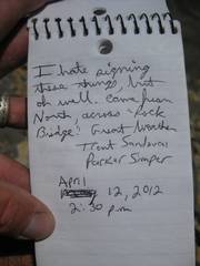
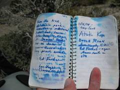
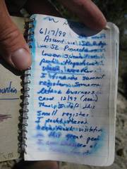
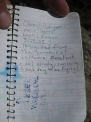
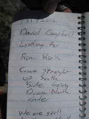
Such angst about signing registers! See my comments at point 5. |
|
|
|
|
|
|
|
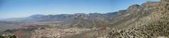
Pano ~W to NW from 4. |
|
|
|
|
|
|
|
Point 5 approaches! |
View E on way up 5. |
|
|
|
|
|
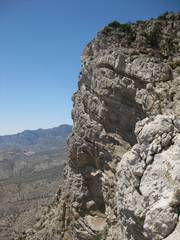
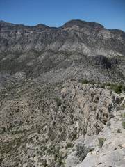
Cliffs on W side of 5. |
|
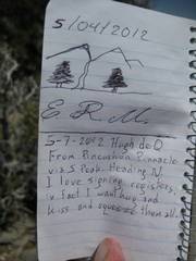
I left this business card on 5, 8 years ago. I first came from the SE in 2002. |
|
|
|
|
|
Susan Murphy and the crew! |
|
|
|
|
|
|
|
|
|
|
|
|
|
|
|
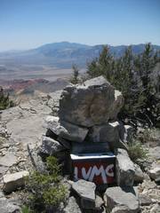
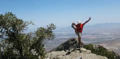
My answer to register angst! |
Compare with 8 years back… |
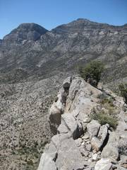
SE summit (point 4) from NW summit (point 5). |
|
|
|
|
|
Now I’m walking N from point 5. |
Madre (R) and Padre, near point 6. |
View of Graycap, to ESE, from near point 7. |
|
|
|
|
|
View back at Padre (L) and Madre, from N of point 7. |
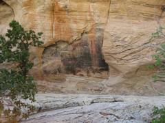
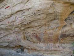
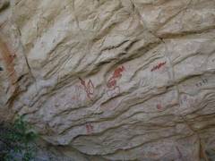
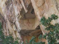
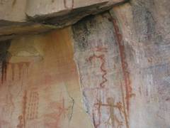
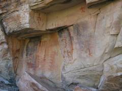
Pictographs. |
(in case you are wondering, the map was altered so this area is not on the map) |
|
|
|
|
|
|
|
|
|
|
|
|
|
|
|
|
|
|
|
|
|
|
|
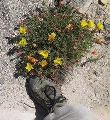
Primroses. |
|
|
|
|
|
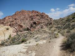
Near point 8; back on the sandstone slickrock, across a maze. |
|
|
|
|
|
|
|
Near point 9. |
Back on the trail near 10! |
|
|
|
|
|