River
Mountain Ridge near Boulder City, NV
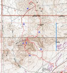
pics by Harlan W. S. There is a narrative at the end of the page. The hike was 10.7 miles, 3700’ accumulated gain as shown on the GPS trace below. This hike would be fatally hot in summer. |
|
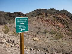
The trailhead is actually a paved parking lot over a fairly unobvious bridge. Actual maintained trail is just on the approach to Red, and to Black Mt Overlook (which is 0.4 miles SSW of the true Black Mt). |
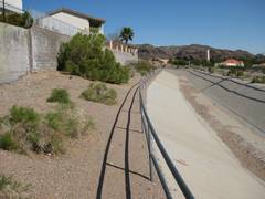
The first part of the trail is not very wild! |
Once you get away from the houses, it’s pretty hard to lose the maintained trail. |
|
|
|
|
|
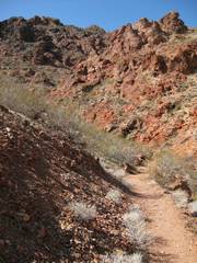
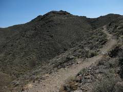
The maintained trail is well-graded, with switchbacks. |
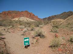
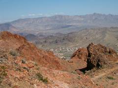
Now I’m at the junction, after climbing out of the canyon; Red Mt is just 0.3 miles to the SSW. |
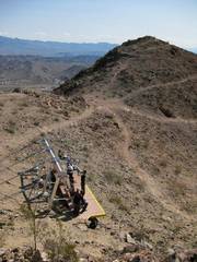
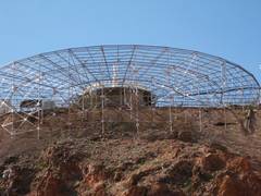
There are ziplines up there! |
|
|
|
|
|
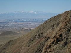
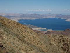
Mandatory view of
snowy |
|
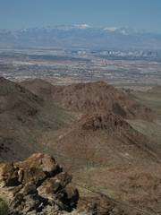
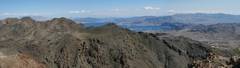
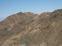
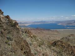
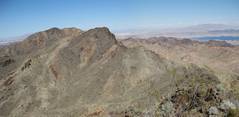
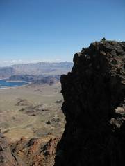
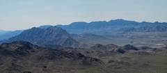
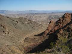
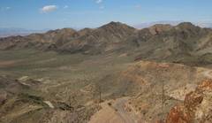
View ~NNE to of the River Mt Range. |
|
|
|
|
|
|
The trail to Black Mt overlook is well-graded. |
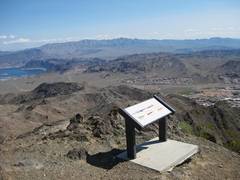
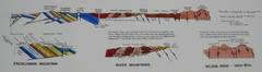
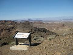
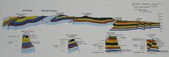
There are two signs on Black Mt Overlook; each has a geological cross-section. |
|
|
|
|
|
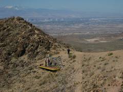
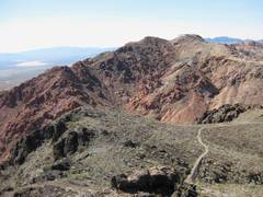
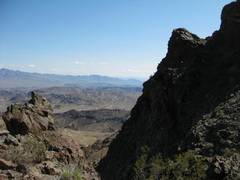
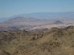
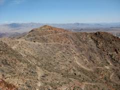
View N to where I am going next (trail ends here) |
|
|
|
|
|
|
|
|
View back S to |
|
|
|
|
|
|
Now off-trail, I look back at the overlook. |
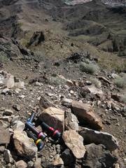
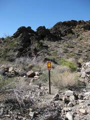
An odd cache; I can only guess that these were meant for adventure racing or some more primitive version. They still worked. |
rougher, but there are decent sheep trails. |
|
|
|
|
|
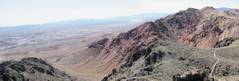
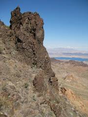
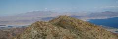
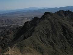
At far left is River Mt; to the right is the neat, sharper intermediate lump (just S of 3642). |
Muddy Mts to NE. |
Mt Wilson (AZ) to E, with overpass Visible. |
|
|
|
|
|
|
|
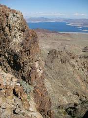
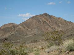
View W to Black Mt
near (a 5092’ peak) |
|
|
|
|
|
|
|
|
|
|
|
|
|
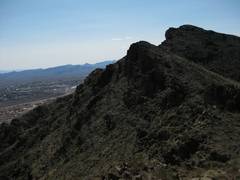
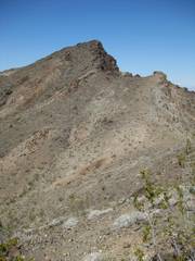
Now I’m atop an intermediate peak (my guess is ~3650’), view N to |
The E side of this intermediate peak is actually overhung (view SSE). |
|
|
|
|
|
|
|
|
Another view of |
|
|
|
|
|
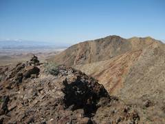
Now we can see (5092’) in back. People around here were not too original with names. |
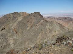
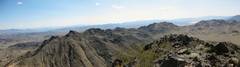
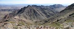
View back S over the ridge I traversed. |
|
|
|
|
|
|
|
|
|
|
|
|
|
|
|
|
|
|
|
|
|
|
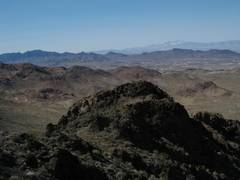
N to Frenchman and Lave Butt. |
|
View S to ridge again; I’ll cut R (SW) down the gully for my return. |
|
|
|
|
|
|
That’s the Sentinel in the middle of pic (red L side). |
Apparently this is a permitted 4x4 Road. |
|
|
|
|
|
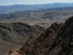
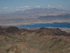
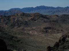
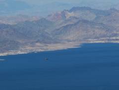
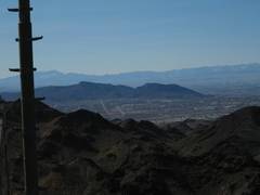
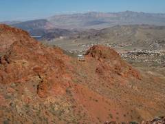
View back at River Mt as I cross the desert. |
Now I find myself climbing up Red Mt again. |
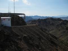
The junk on top. |
|
|
|
|
|
|
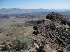
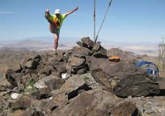
View from the highest rock you can reach. |
View back N to where I was a short time ago. |
|
|
|
|
|
This the structure on top. I’m guessing that may be a faraday cage. |
Now I’m descending the unofficial trail to the SE of |
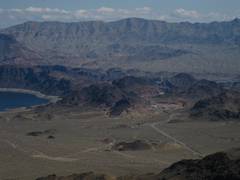
Another zipline station. Fortification Hill is the black flat mesa at L. |
|
|
|
|
|
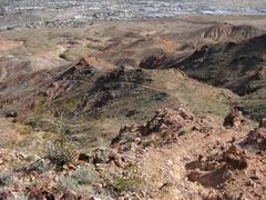
The trail. |
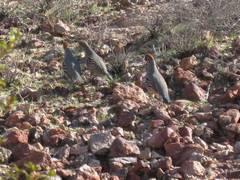
Quail on the trail. |
|
|
|
|
|
I've had a cold for about 2 weeks. A week ago Tuesday, I thought I was well enough to go for a short hike, and had a pretty significant relapse the next day. So just sat on my butt for a while, until I woke up feeling good (well, everything is relative!) for two days. I puttered around yesterday morn, then took off for Boulder City (BC) perhaps 8:30 or so -- late enough to miss the 215 traffic jams. I started off from the car, to hike, ~9:40.
I wanted a hike that was extensible, depending on how I felt. The River Mts had never called out to me, so I had plotted some routes for my GPS, and left them for a rainy or sick day. This was the day.
It's not a wildly impressive area-- Red Mt looks like a
Hillbilly spaceship has landed on top, and there are now zip lines from near
the top; it's fun to watch the tourists zipping along, but screams overhead
distract from the feeling of solitude. OK, that was peak #1. Next I
went to the trail end on "Black Mountain Overlook," then continued
off-trail to the true Black Mt (#2). But the neat part was the
ridge north of #2 and on the unnamed peaks to the north,
actually higher than Black; these peaks (#3) are actually overhung on a
precipitous east face. OK, maybe #2 and #3 are not real peaks -- there is
only about a 250' prominence above the ridge. Then I crossed a powerline
road with massive towers, and went up #4 --
Then I headed W and S across the desert, and realized this area near BC is extremely popular with a) quail and b) mountain bikers. I thought I might as well go up Red Mt (#1) again, just for kicks, and headed up cross country till I intersected the road; I kept finding pretty new beer cans in the wash, collected 3, and deposited them on the side of the road; I'm guessing people driving up the road just threw their cans out the window, and with the recent rain, the cans traveled far down the wash (an interesting thought; people drinking beer while 4x4 driving on a steep winding road).
Now at top of #1 again, I snuck as far as I could to the highpoint near the huge set of transmitters on top. Then I headed down an unofficial trail that had mountain bike tread marks over much of it -- unless these guys are real experts or totally insane, I'd say the walked the bikes in a few places.
Back in time to miss traffic on 215. 10.7 miles, 3700' accumulated gain. And the best part: no relapse (yet).