Railroad Peak (South of Henderson, NV)
H.W. Stockman
January 22, 2005 |
To reach this peak, travel SE from Vegas on Rtes 93/95, to a point just N of Railroad Pass, then follow the power line road SW.
WGS84 lat=35.9852566 lon=-114.9213224
Turn west off 93/95 onto gravel road.
WGS84 lat =35.970979 lon= -114.939452
Park 4WD car to start hike.
There is no trail; the ridge route is very rough. This mountain would probably be miserably (deadly) hot in summer.
|
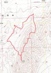
GPS trace. |
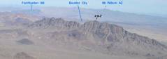
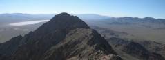
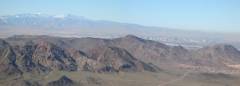
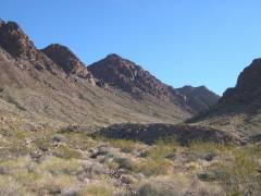
This is a view of the "Black Hills," looking east from Black Mt. The highest peak is indicated with the elevation 4142'. The magenta dotted lines indicate ascent (far, leftmost) and descent from ridge. The mountains have a granite-like core (whitish rocks that weather dark), with various silicic volcanics on the northern flank. |
The Black Mountain Range is to WSW. |
|
|
|
|
|
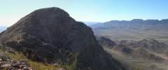
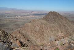
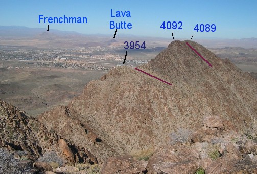
View SW to NE-most lump, 4089'. This mount has a large cairn on top, and is the most-visited, since access is simple. The ridge walk SW is more interesting than this easy peak, but is seldom done, so the route is full of large, loose boulders. |
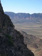
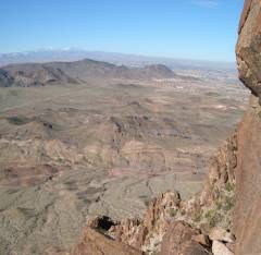
View SW to highest Peak 4142, over peak 3954'. The Eldorado Valley "Dry Lake" is to left, not too dry at present. |
Looking NW to snow-covered Spring Mountains. |
|
|
|
|
|
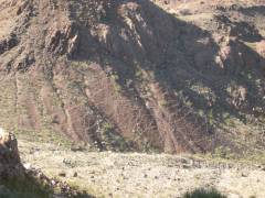
Sheep trails crisscross talus below |
From 4142', peak view NE over Henderson. Here is a key to the peaks. |
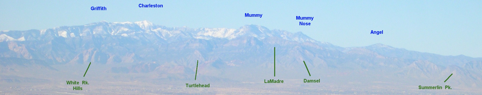
NW to snow-covered Charleston and Mummy; careful examination discloses White Rock Hills, La Madre, and Turtlehead. |
|
|
|
|
|
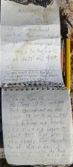
The 4142' Peak had this register. The much-more visited 4089' peak had 3 register cans, all ratty-looking. |
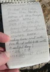
The last entries. The B's were the only names I recognized. |
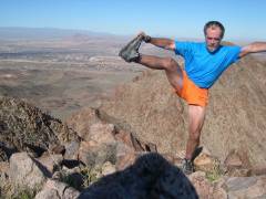
Do I look goofy? You should try running out to the edge of a cliff, composing yourself, then going into a balance… in ten seconds (camera timer). |
|
|
|
|
|

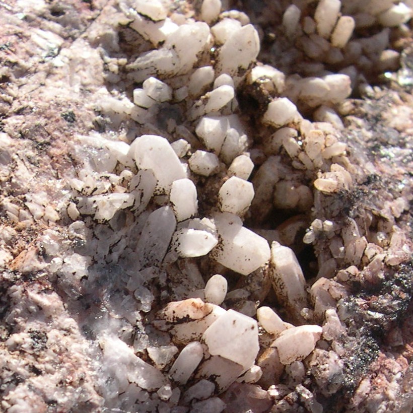
Quartz crystals in vug, summit. |
View back SE on descent valley and highest point (center). |
|
|
|
|
|
Extraneous observations:
The 4142' peak was an island of serenity for me, despite the various noises of humanity below, despite the sprawl of Henderson, the surprisingly big Railroad Pass Casino, and the Clark Co. gravel operation to the south. The land on the north side of the peak is owned by Clark Co. or the US Gov't, but I'm sure that will change some day, and I expect there will be houses or other buildings lapping up to these mountains.
There were sheep and coyote signs, new since the last heavy rains (no more than two weeks old). There are rumors of mountain lions up here, so I carried a pepper spray in my hand while cutting through a few narrow canyons (no joke).
The cairn on top of the 4142' peak has a faint silver spray paint on some of the rocks. There were euhedral quartz crystals on some of the cairn rocks.
Peak 4092' has a remnant survey station near the top.
There is another 4000' + peak just south of peak 4142'.
One could possibly make it to the parking place in a passenger car with decent clearance. SW of that point, the road is pretty even, but goes over large dips that would possibly cause a car to bottom-out.
The power line road has some garbage -- beer cans, broken glass, spent shotgun shells and rifle ammo. I heard dirt bikes and ATVs while I was on top, and also heard automatic weapons fire. This noise apparently came from the low desert just SW of Henderson.