Ruby Dome & LVMC
Backpack
Harlan W. S. Adventures of the Ruby Slippers. Directions to Ruby Dome trailhead are at the end of page. |
|
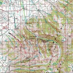
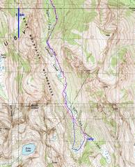
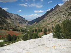
100k topo map with GPS trace to Ruby Dome (L, red) and the R Fork or Lamoille Creek (R, purple and blue). |
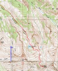
24K GPS trace for Ruby Dome hike, Sept. 1. We started at the Spring Creek Campsite. The route is initially over a crude trail, then is class 2 (with low class 3), scrambling from cairn to infrequent cairn. Accumulated elevation gain is ~5100’, 10.5 miles RT. |
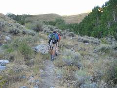
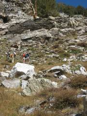
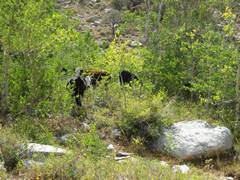
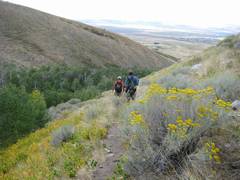
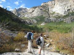
We head SE from the parking lot, go through 2 small gates, and swing L of the stream. Note the cows on the distant hill. Cow signs persist till ~8600’, and end at a rough rocky stretch. |
|
|
|
|
|
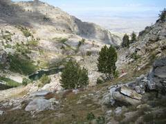
View NW down above the cow country. Spring Creek (town) is in the background. |
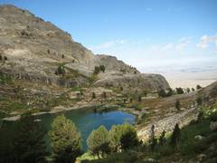
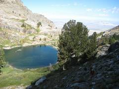
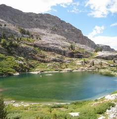
Since plants cover the bottom, this “lake” is really a pond. Supposedly there are fish at the SE end of the lake, in the deeper water. |
The rough trail – often invisible— travels on the E side near the lake, then ascends at the base of a cliff on the E side. |
|
|
|
|
|
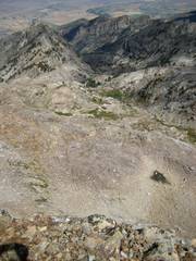
Beyond the cliff, one turns ~90° to the L and climbs out of the bowl on a faint trail
between |
|
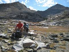
We’re nearly at 10000’; Griswold |
|
|
|
|
|
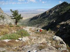
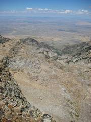
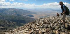
At 10100’, view ESE. To R is “Ruby Pyramid”, an 11200’ peak just E of Ruby Dome. The Dome itself is not visible. The saddle in the center is the stopping point for the star-crossed 2005 expedition, which ran out of bottled oxygen. |
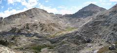
Now we head to the right up the “west ridge route”. From the plateau at 10100’ to this point, cairns are sparse. |
View N. We’re at ~10650’. |
|
|
|
|
|
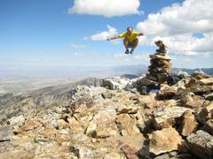
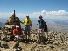
Self-portrait. Nyah Nyah. |
Panoramic view from summit. The town of at the L of photo. |
View NW from summit, showing (roughly) the W ridge route. |
|
|
|
|
|
|
View E from summit. There is a cruddy rock lip to this 70° slope; the slope sits atop an immense N-facing cliff. |
|
|
|
|
|
|
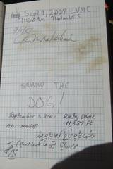
Who is Sammy the Dog? |
|
My foot STILL itches. You would think my foot would get better some day. |
|
|
|
|
|
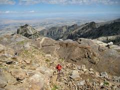
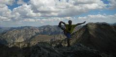
Leaving summit, view SW. |
View SE back to summit. N face to L. There is a cairn at this point, showing the way NE off the ridge. |
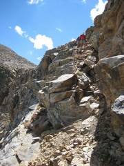
This is a class 2 section with exposure, right below the ridge crest. |
|
|
|
|
|
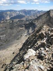
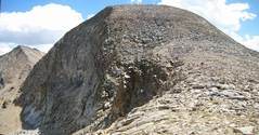
Ruby Dome is in back, L of center. The W ridge route climbs around the tor at R. |
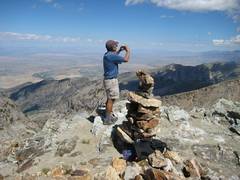
Alan gets some advice from an orthopedic surgeon. |
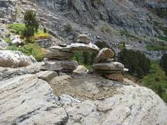
Somebody got carried away with this cairn. |
|
|
|
|
|
|
|
|
|
|
|
|
|
That afternoon, Alan headed for the road in |
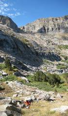
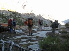
The next day, we backpacked up In search of the LVMC group. We expected to find them at the small lake by the blue GPS trace; luckily, we saw Beth fishing, and she pointed us to the camp. |
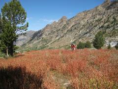
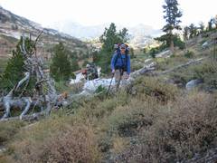
View N as Ali hits ~7500’. |
|
|
|
|
|
|
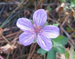
Wild geranium? |
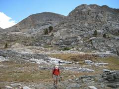
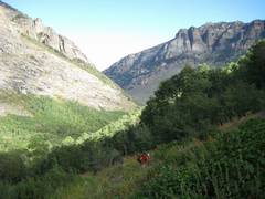
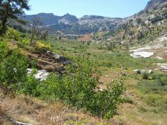
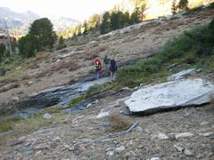
View S. Soon the trail will disappear, and we will cross to R (W side). The canyon has some rather dense willow thickets. |
|
|
|
|
|
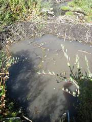
There are lots of dams from bank beavers (i.e., they don’t Build lodges). |
|
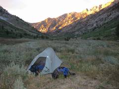
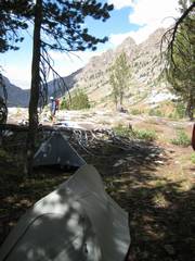
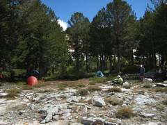
Our camp. |
|
|
|
|
|
|
View N from camp. |
|
|
|
|
|
|
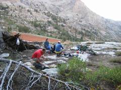
Early next morn. |
|
|
|
|
|
|
|
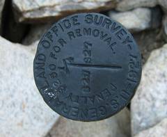
Beth told us that this is a rare type of benchmark – from the Precursor of BLM. |
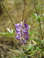
Lupine. |
|
|
|
|
|
The "trail", southeast from the
Spring Creek Assn campground, provides easy access to Ruby Dome. Info on the campground is here: Spring
Creek Assn .
To get to the Spring Creek Association office
from Wells NV, travel west on i80 ~49 miles, then take exit 303 off i80 near
Elko. Take the ramp south to state 535, then travel east (left) to
The trailhead is on private land, and you must pay a $25 deposit per group, and
$10/person/day for access. You have to pick up a gate key at the
association office; the office is open only Mon-Fri, 8AM to 5PM, so you will
have to plan your time a bit carefully. We left
The deposit will get mailed back to you, and you can drop off the key after
hours, in a supplied envelope, through the office mailslot. They don't
take VISA, but will take a check or cash.
The best campsite may be at the trailhead; if you sleep in the car, the level
parking lot will be a good place to stay, and there is a nearby space for 1 or
2 tents. Otherwise, most of the campsites are rather lousy. Cows
occasionally get into the campground and leave cow patties; and some people
leave trash. The new outhouse looks clean. There is little shade --
the lower shady spots tend to be popular with cows. There is a pretty stream in
places, but remember that cows graze uphill, outside the fence.
The second night, you can camp on the side of the road on FS land, or in the
USFS campground in Lamoille canyon.
![]()