Schell Traverse (East-Central NV)

Photos from H.W. Stockman & Steve N
Aug. 20, 2005

A road trip log is at the bottom of the page.

Click on any small image below to see a larger version.

schells082005

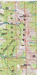
GPS trace (red) on 100k topo. We started at the Timber Creek Campsite on the W side of the range, wound N and then E to North Schell, then walked the ridge down to South Schell. The we descended to Berry Creek, where shuttle cars were parked.

schell_gain

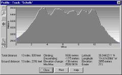
The total elevation gain was ~5300' with all the ups and downs, keeping us above 11000' for the ridge walk.

DSC02914

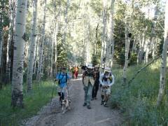
We're starting out ~8:30 from Timber Creek.


DSC02935

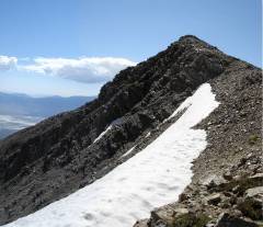
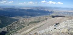
View S on the faint use trail to North Schell. The snow in the distance is on the divide between Timber and Berry Creek drainages.

pan16sch2944-5

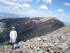
View S to the top of North Schell.

pan14sch2955-57

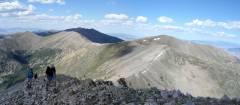
View SE, with Moriah on the left, and Wheeler on the right.


pan13sch2959-60

Looking NW past Nick.

pan12sch2961-2

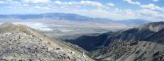
View S from N Schell. The lush drainage lies between quartzite mountains (left, E) and limestone peaks (right, W).

pan11sch2970-1

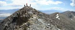
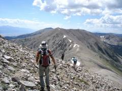
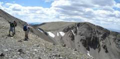
View NW as more intrepids approach the summit.


pan10sch2974-5

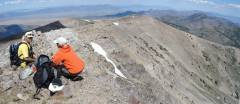
View SE from a nubbin just below the summit; Luba and Steve phone home.
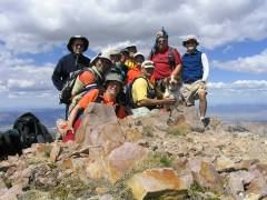
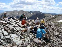
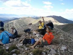
nschell_summit_IMG_0041

Everybody on top!

DSC02979

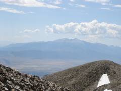
Wheeler Peak & Jeff Davis from Schell.


pan07sch2989-94

A pano centered roughly on E view.

pan06sch3000-1

View NNW, Ali and Luba confer.

DSC03006

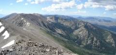
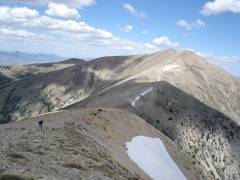
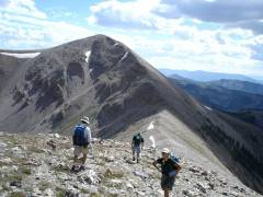
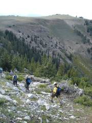
Now we start trekking south over the ridgeline. About half the ridgeline was fairly easy walking, but 1/2 was composed of watermelon-size rough quartzite boulders.


pan05sch3008-11

Wait for me! View S.

DSC03019

View back N.

DSC03026


DSC03029

View S, a break along the way.

pan04sch3040-1

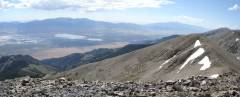
View SW at the divide between Berry and Timber Cr drainages.

DSC03048

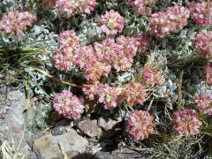
Cushion buckwheat (alpine var. depressum), past its prime.


pan03sch3053-5

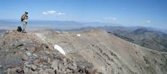
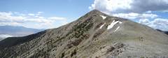
View E from the top of Taft.

DSC03068

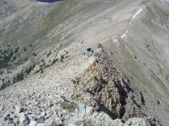
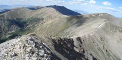
Now we head to South Schell -- a class 2 climb with a nice serrated quartzite edge.

DSC03075

Looking down and N at my compatriots.


pan02sch3079-80

Another view N.

pan01sch3082-3

Yet another.

DSC03088

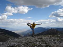
On top of S Schell, I capture Ali's enthusiasm and Luba's apple.


DSC03090

View S. Look at me! Look at me!

DSC03097

The far hill was covered with domestic sheep. Between us and the far hill was a crappy limestone talus area, full of loose rock.

DSC03099

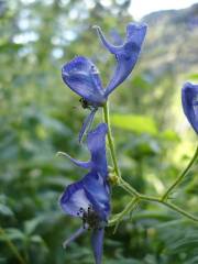
Monk's hood in Berry Creek.


Content warning: This photo contains graphic scenes of animal behavior, and may not be suitable for younger or more sensitive viewers.

Road Log

From i15 and i95 intersection in Las Vegas:
- take i15 for 22 miles NNE
--then turn west on us93
-take US 93 for 85.3 miles N
Near Crystal Springs is junction with 375/318
--take left toward Hiko
(375 and 318 are together for ~0.7 miles)
From that junction, travel N on 318
-take rte 318 for 111.5 miles N of the junction to intersection with rte 6
--turn right (NE) on rte 6

-take Rte 6 for 24.1 miles to junction with US 93 (just south of Ely)

--turn left (N) onto US 93

-take US 93 for 17.8 miles N to junction with Rte 486

--turn right (E) on 486 (sign for Duck Creek)

-take 486 E, then SE and SSE for 8.45 miles, to junction with Timber Cr Rd (FR425)

(watch for the Timber Creek sign -- it's small, easy to miss, on SE corner).

--turn left (E) on Timber Cr Rd

-take Timber Cr Rd SE for 3.7 to 4.0 miles to campground.

____________

sum 273 miles


-- or --

From i15 and us 95 intersection in Las Vegas:

- take i15 for 22 miles NNE

--then turn west on us 93

-take us 93 for 276.5 miles to Rte 486 (sign for Duck Creek).

--turn right (E) on 486

-take 486 E, then SE and SSE for 8.45 miles, to junction with Timber Cr Rd (FR425)

(watch for the Timber Creek sign -- it's small, easy to miss, on SE corner).

--turn left (E) on Timber Cr Rd

-take Timber Cr Rd SE for 3.7 to 4.0 miles to campground.

----------------------------

sum 311 miles