Telescope Peak (11049’) CA, the Long Way (from -253')

pics by Harlan W. S.
Nov. 03, 2007


We started at Shorty’s Well in Death Valley, at ~3:30AM.  Bruce picked the weekend so we would have a waning moon, which rose ~1:30AM (a full moon may set behind the mountain by the time you start the hike).  The accumulated elevation gain is more than 11500’, since there are several bumps on the ridge.


Our route up the first ridge, to the 5200’ saddle, seemed pretty stable and mostly free of loose rock – there was a pack trail much of the way to the 1st saddle. A GPS log is available upon request.


Special thanks to Lori for getting this trip going, and to Britta and Shad who drove to Mahogany Flats and hiked the summit, so we wouldn’t have to (shudder) hike back down to the well.


To get to the start of the hike, find the intersection of rte 190 and the Badwater Road (near Furnace Creek).  From that intersection, travel 6 miles S on the Badwater Road, then go SW (right) on the Westside Road.  Take the Westside road for ~11 miles to an intersection; on the left is parking near Shorty’s Well, and on the right is the Hanaupah Road on which you begin the hike.  (About 1.15 miles BEFORE you reach that intersection, you will see a sign for Tule Spring,; this is a decent marker to let you know your stop is coming soon!)


This is a very hard hike.  There is no trail, and the trip would be fatally hot most of the year.  Navigation is not easy.

A gpx file, to use at you own risk, is here.  Do NOT open the file in your browser; save it to the desktop (right-click on PC, ctrl-click on Mac).


Click on any small picture below to see the corresponding larger image. I didn’t take a lot of photos; light conditions weren’t that great, we still had some haze from the San Diego fires, and I was fixated on reaching the top.  I took better pictures of Telescope in 2005.


Telescope-shorty_100k

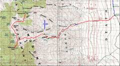
This 100k topo gives a summary of the

route; the red is a GPS trace.

TelescopShorty

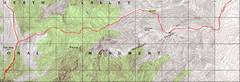
This map (24k topo) ahows the 

latter part of the trip.  In this dry 

2007 year, the “spring” was a 

running stream for at least hundreds

of feet.  The water is a bit milky from 

rock flour; use iodine tablets or a filter.

IMG_2404

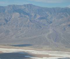
This view W was taken from 

Dante’s Peak the next day, and 

shows the route.


persp-map

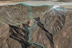
This perspective image from 

GarbledEarth also shows the route.

IMG_2341

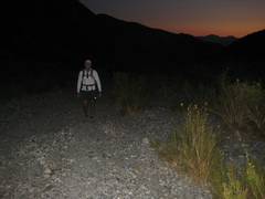
OK, back to the hike.  This image 

was taken looking roughly E, about 5AM. 

The first 6-7 miles are on gravel road.

IMG_2343

View W in very faint light, 

perhaps 1.5 miles from spring.


IMG_2344

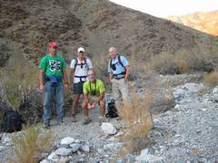
What the heck is the guy in the

lime-green shirt doing?


L to R: Jeff, Brad, Harlan and Bruce.

IMG_2345

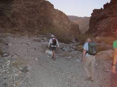
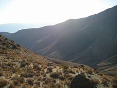
The first serious altitude gain;

the spring is down below.

IMG_2346

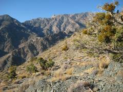
View W at the 5200’ saddle. 

Telescope’s main peak is at right.


IMG_2349

View SE as Brad rests at the saddle.

IMG_2351

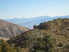
View ENE on the endless ridge. 

Can you see Jeff?  Corkscrew is 

at left; Pyramid is at right.

IMG_2352

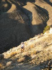
Now I’m at ~8200’.  The ridge we

ascended is behind the bush at left.


IMG_2354

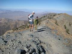
The summit!  I arrived perhaps 15 

minutes after Brad (sometime before 

1:30PM). Brad and Shad now prepare

to descend and get the heck out of 

the wind.

IMG_2357

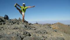
I spent a few minutes on top 

and took my usual pose.
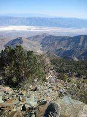
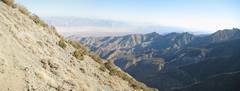
IMG_2366

View S from Summit.  The sky is

still hazy, partly from the SoCal fires.


pan01telshort2368-70

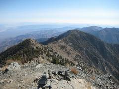
Now I’m looking S at the peak.

IMG_2372

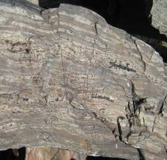
Metamorphic rock on the trail.

pan04telshort2384-5

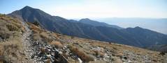
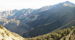
Now I’m looking ~SE; the dashed

line shows the endless ridge route.


pan03telshort2387-9

IMG_2394

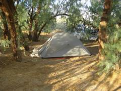
The next morn; my camp spot

at Furnace Creek.