Troy Ridge, NV
An
Odyssey to Ilium
H.W. Stockman & Nick N.
Aug 30-31, 2003
|
To get to the Troy Peak
"trailhead", start at the junction of i95 and i15 in Las Vegas, then
take i15 N from Las Vegas for 22 miles. Then turn west onto i93. Take
i93 for 85.3 miles, past Pahranagat
Lakes and Alamo, to Crystal Springs
and the junction with 375/318. Take the left (toward Hiko)
on state road 318/375; the two roads are together for 0.7 miles, then 318
diverges north (right). The easiest approach is to take 318 N to a gravel road
just S of the town of Sunnyside
(there is an airstrip on the W side of 318, just before the left turn); this
turn is ~68.2 miles from the junction of i93 and 375/318. Turn left (W)
onto the gravel road, and follow it 23 miles (roughly SW and S) until
one reaches the right turn (W) onto FR412. (Do NOT take the left to the wildlife refuge!) FR412 is the Scofield Canyon Road,
but you won’t see a sign with that name for a while. Take the Scofield Canyon Road
as far west as possible (~8.3 miles) and park. There are good campsites
near the end of the road, but this is a dry hike; we encountered no running
water anywhere. In 2003, the gravel roads were in rather good shape; there was
no place I would not take a rental 2WD car. Bring, from home, all the water you
will need -- at least 2 gallons a day, per person, in the summer. This is
a rough, trailless hike. For latest conditions,
try to contact the Ely USFS at (775) 289-3031.
If you can, use the GPS info below.
Update: As of late August, 2007,
there are serious washouts, starting 2.5 miles back from the trailhead (thanks
CP).
Bob G had been up Troy Peak
before, and was informally leading the trip. The first day was spent exploring
the steep canyons on the west side of the range. The second day was to be
devoted to a loop on the 11,000'+ ridge itself. Because of a collaborative
SNAFU on the second day, we missed the trivial route to the top of the true Troy Peak
by a smidgen, but went down the much more difficult ridge (lots of class 3
sections). On the way up, I kept checking the GPS till about 11,000'; Bob's
path coincided closely with my planned waypoints, so I put away the GPS. At
that point, Nick noted Bob seemed to be straying to the left, and asked if he
was sure of the route. Bob had plugged in an MP3 player by this point, and
didn't hear us too well; he said, "Oh yeah" and headed even
more to the left. We were puzzled, but followed. Bob chugged quickly to
the ridgeline, then cut south without stopping. I
pulled out my GPS; "strange," I said, "I can't see any of my
last waypoints… they seem to end north of here." Nick said, "That
peak to the north sure looks taller than the peak to the south." By this
time, Bob was long gone, and we followed. 3/4 of a mile later, as we climbed up
the next rugged peak, Bob shouted something. It turned out he was saying,
"The real Troy
Peak is back there!"
The Hell with it. We continued our loop, missing the
true top by 50' elevation, but with much more rugged and more spectacular
scenery.
Sorry Ladies, we saw neither Brad
Pitt nor Orlando Bloom.
Here is
a gpx file (WGS84 Datum!!!) of the GPS routes and roads. How do you
use this file? Well, you can read it directly in ExpertGPS
(www.expertgps.com) and upload selected
routes, tracks or waypoints to your GPS. Or, you can use free utilities (such
as G7ToWin, USAPhotoMaps, or EasyGPS ) to
upload selected GPS routes or convert the file to another format. The file
contains many routes and separate waypoints, and some (other) conversion
utilities may mash all the points into one long file. Be sure you understand
the concept of datum.
|
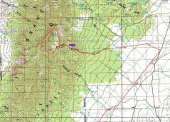
100k map. The first day, we visited
the canyons (dashed pink lines) on the west side of the peak. This map shows
our drive in from the SW; actually, it is easier to approach Scofield
Canyon from the NE.
|
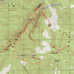
24k map, with the 2nd
day trip.
|
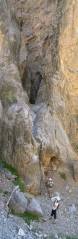
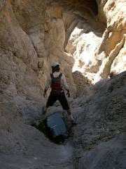
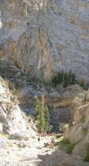
Nick and Bob, where we stopped in
the 1st canyon.
|
|
|
|
|
|
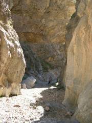
Heading out -- the route leads
through a few tunnels.
|
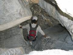
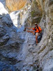
There are tortuous slick-rock
passages.
|
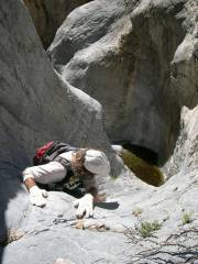
Bob (top) and HWS.
|
|
|
|
|
|
|
|
|
|
|
|
|
|
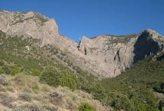
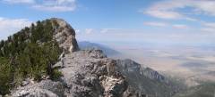
Looking E at the west side of Troy
Ridge, end of the 1st day.
|
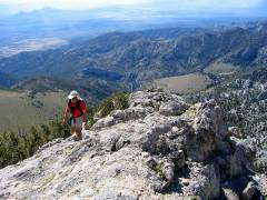
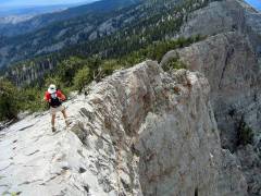
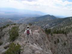
2nd day -- view east.
HWS heads up the ridge that appears in Pete Yamagata's photos.
|
View East, still heading up. Bob G
contemplates.
|
|
|
|
|
|
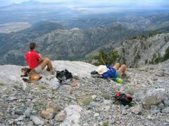
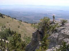
Lunch break on the White Pine
11248' peak. View SE. (Can you see anything unusual in this picture?)
|
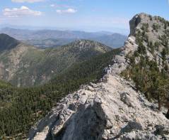
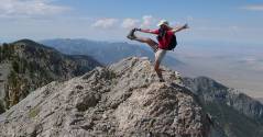
View SW as we head down the ridge.
|
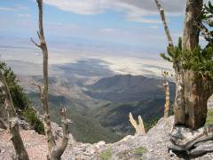
The W side has a sharp, long drop.
|
|
|
|
|
|
View back N.
|
Looking SSW.
|
View S.
|
|
|
|
|
|
View W.
|
|
|
|
|
|
|