|
Virgin Peak, Nevada April 3, 2003 The mountain is approached by leaving I-15 at the Riverside exit, crossing the Virgin River, then heading south along the west flank of the massif. Then one turns east through Whitney Pockets, and takes a very rough gravel road (4WD) north for 7 miles, in to the east side of the peak. We went searching for a lost camera. Since we had a GPS trace, we thought we knew the probable "drop route" to within +/-20 feet, over about 0.4 miles. Alas, the terrain looked at lot like Afghanistan (with thorn bushes), and every other piece of talus was about the same size, color and shape as the camera. |
|
|
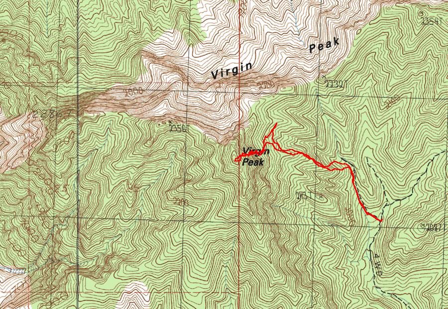
My GPS track of the trip. The sinuous nature of the track, on the steep stretch, was because I kept going back and forth, looking for the camera. |
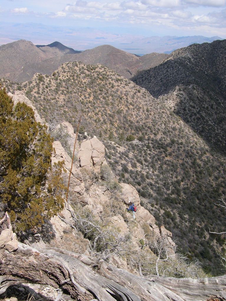
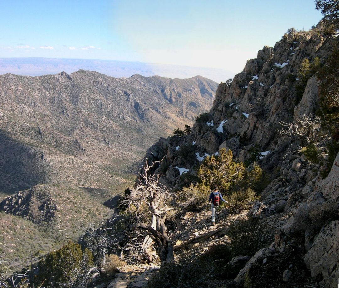
View NE -- here's Nick, looking for the camera. I think this picture helps explain why the task was difficult. |
|
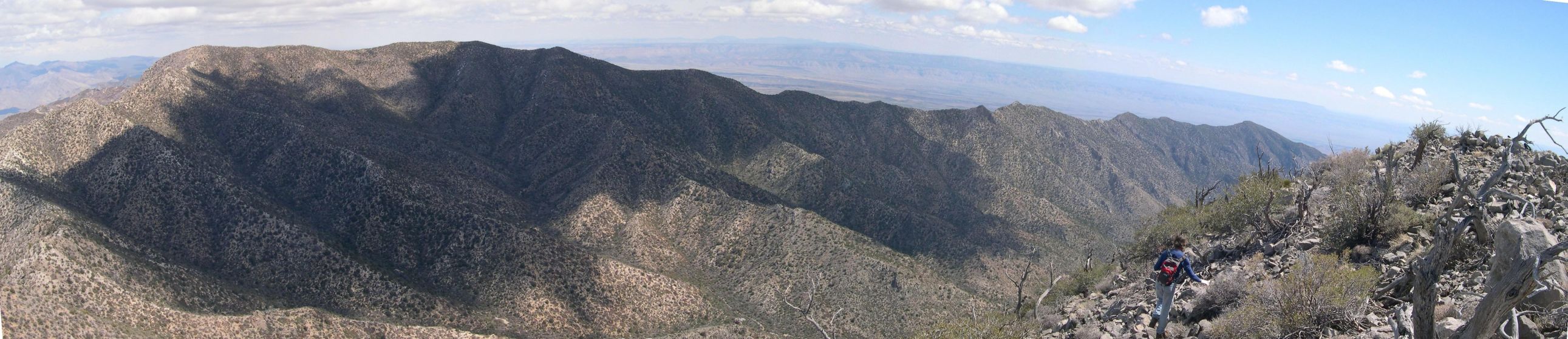
View from the top -- Panorama from SE (right) to NE. |
|
|
Panorama from NNE (right) to SW; from the top. Mesquite is visible along the river, on the right side of the photo. |
|
|
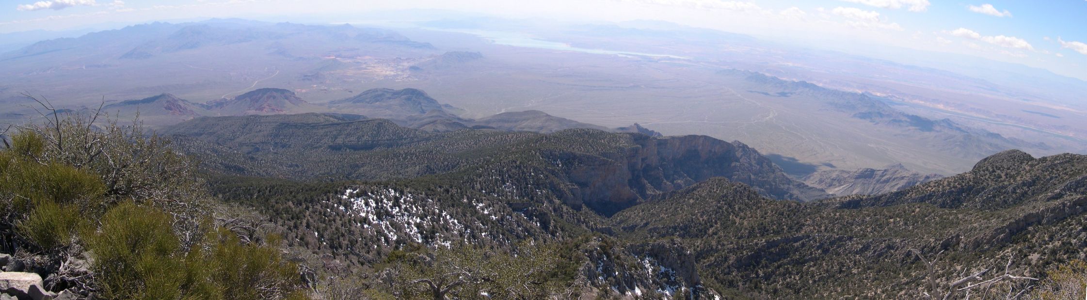
Panorama from WSW to SSE, from the top. Lake Mead is at center. |
|
|
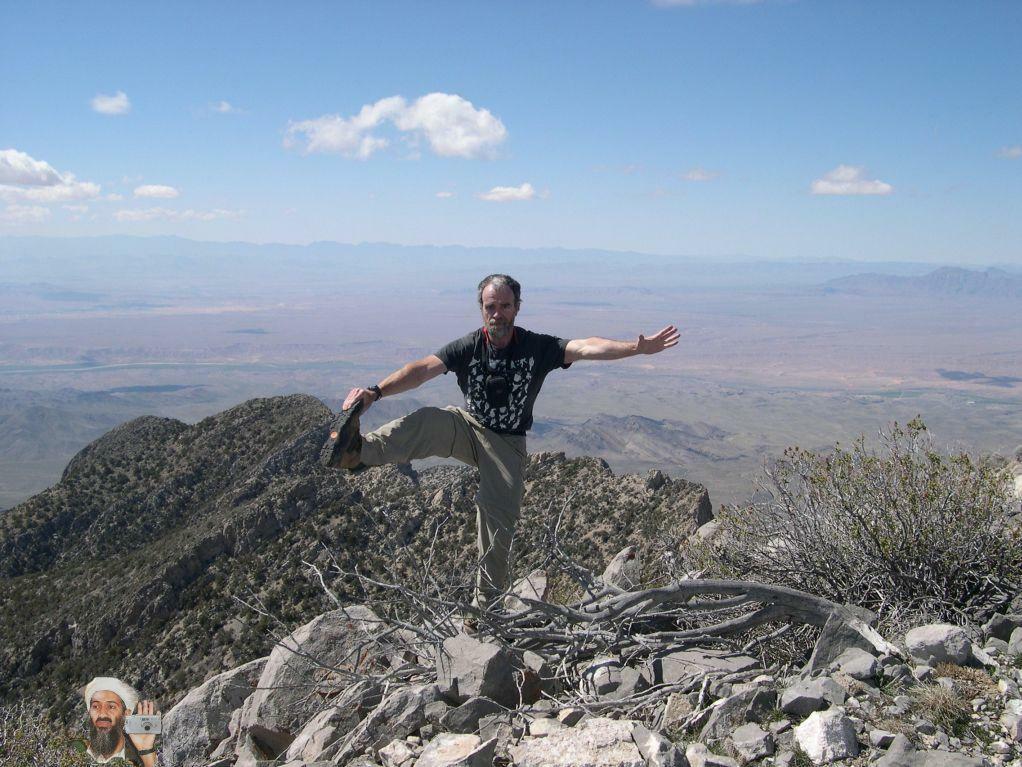
My standard cerebellum check on top, and a possible reason we didn't find the camera (on lower left -- someone else got there first). |
Heading back down, view SE as Nick checks a relatively level spot. |