Wabayuma Peak, Hualapai Mts AZ

Harlan W S & Jodie S
April 6, 2019

Thanks to Jodie for being so calm about driving her Jeep Wrangler so high; that saved up about 5 miles of walking round-trip.  She was also willing to be adventurous.

If one starts the walk from 4200' at the BLM boundary, there is no need to touch private land, and a modest 4x4/HCV (with careful driving and good recovery equipment) will do. If you don't want walk the flatter boring parts, there is a rough 4x4 road with a small stretch that crosses land owned by two holding companies; but there are no boundary signs anywhere in this stretch, and the land is littered with construction and mining trash. Earlier on, one passes through two small areas of the "Walnut Creek Ranch" which are currently owned by the Francis Creek Ranch LLC and 9N Holdings LLC. There are two unlocked gates, a few "No Hunting" signs, and a sign that says "no public right of way," but is unclear to which road the sign refers.  Most of the land is owned by BLM, and is apparently leased for grazing. The entire Walnut Creek "Ranch," which consists in vast part of leased BLM land, has entered into a Arizona "Reacreational Access Agreement" with AGFD (
https://azaccessmap.com/map.html click appropriate box on right bottom of map screen). I spoke with the folks at the BLM office in Kingman, and they agreed that if the gates were not locked and there was no prohibitive signage, it would be OK to cross the small deeded parcels to access USA land. The biggest warning was that there used to be survivalists up there, and they had killed someone 20-30 years back.

This is definitely not the normal route to Wabayuma, and this page may be the first documentation of the northern approach. The normal approach is by driving on the Hualapai Crest Road, either from the east Hualapais (near the ranger station), or from the west Boriana Mine area.  The Hualapai Crest road is long and in bad condition; when I tried it in late 2017, there were fairly major washouts and big boulders in the road. I may try the Boriana Mine approach, just for completeness; but I'm not fond of 20-mile days that involve running on rocky dirt roads.

2020 Note: The Boriana Mine Road has recently been bladed, a simpler approach.

00map
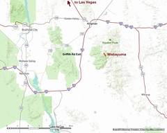
Location map. One takes
the Griffith Road exit
off i-40.
00map1b
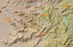
A bit closer location
map, with land use.
0map0
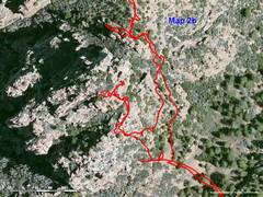
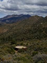
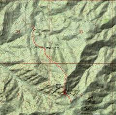
Now close-up,
the hike. See detail
maps below for a few
critical sections.
DSC02298
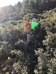
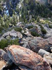
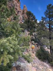
This stretch of 200'
was responisble for most
of our injuries. I had
mapped out a clearer
route from Google
Earth, but didn't check
as we stepped into the
manzanita
DSC02298jodie4 DSC02298z1mapa
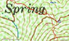
Here is the way to
avoid the terrible
manzanita. Go east
to open ground and
follow an animal
trail.
DSC02298zz1mapb
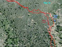
Same area, but
Google earth rendering.
DSC02300
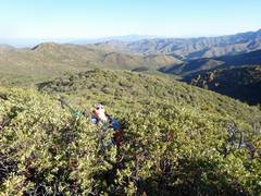
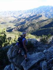
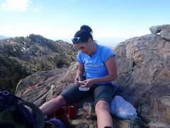
Jodie after escaping
the manzanita.
DSC02301
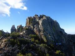
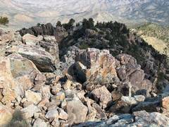
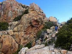
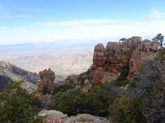
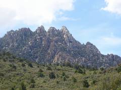
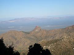
One of many sharp
peaks in the area
DSC02303 DSC02304
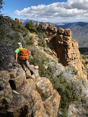
You can avoid
most cliffs by
staying east (L).
DSC02305
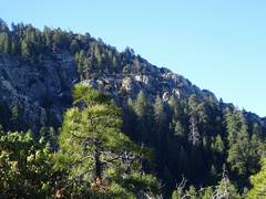
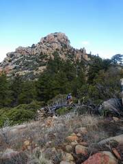
This tree is in a
chute that avoids
the cliffs
DSC02307
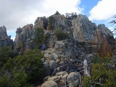
This is the summit
from the NE side.
Because of the colors
I had used to mark the
GPS routes, I thought
the summit was still to
the S, and went to
another peaklet
DSC02311
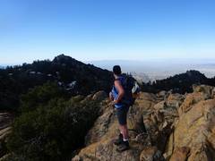
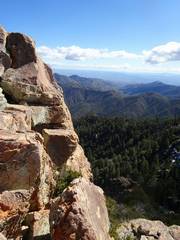
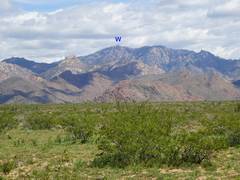
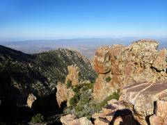
View W from near
Wabayuma summit
DSC02312
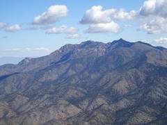
That's Wabayuma
to N
DSC02312xxmapa
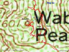
Here are some details
for the summit. I
went NE of top
to scout a descent
route, but decided
we should take the
devil we knew.
DSC02312yymapb
Same as last map,
but Google Earth
DSC02313
DSC02314
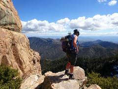
Now Jodie and I
start up true
Wabayuma.
DSC02314jodie12
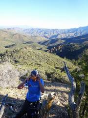
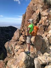
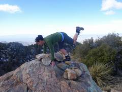
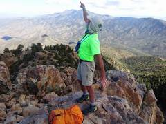
Jodie's photo of me
checking...
DSC02314jodie8
DSC02316
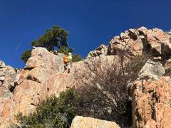
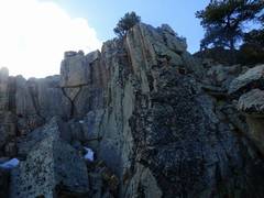
View from top of
only "class 4" stretch,
maybe 10-15'. (That
was the comment in
the only TR I found.
)
Big holds, no big
exposure. We climbed
down face-out.
DSC02318
After summit I
immediately
checked down
route to NE;
here I'm looking
back to summit.
DSC02319
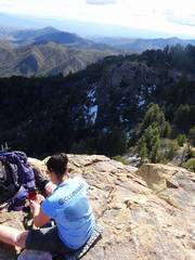
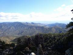
View ESE from
summit
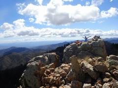
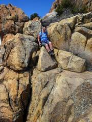
DSC02320
Jodie on summit
DSC02320jodie0 DSC02320jodie11
Jodie's view NE
from summit
DSC02320jodie9 DSC02321
Hayden (L) and
Hualapai (R) from
summit
DSC02324
DSC02325 DSC02329 DSC02330
DSC02332
Heading down, about
to drop down cl 4
DSC02333 DSC02334
DSC02335 DSC02335Jodie5
Jodies pic of me as I
head around E side
of peak on way back
DSC02335Jodie6
More around E
side of peak
DSC02340
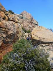
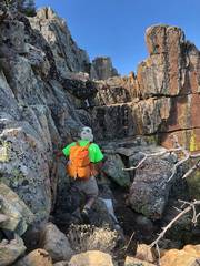
Jodie reaches NE side
of peak after scratchfest
DSC02341 DSC02342
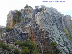
Possible class 4
way up NE side
DSC02342jodie13
Jodie's pic of me
exploring one
start to NE route
DSC02345
Jodie feels her oats
and runs down on
old road
DSC02348
DSC02349
random sharp
peaks W of
Wabayuma
DSC02351
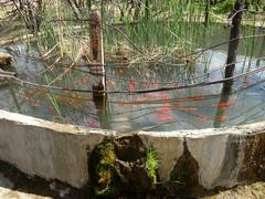
Koi in abandoned
cattle tank
DSC02354
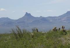
Thimble Mountain
to W
DSC02358
Wabayuma from
near Highway i40