White Mt, California (14246')
H.W. Stockman
Sunday July 18, 2004 |
The access to this mountain is via White Mountain
Road, off California Route 168. From Las Vegas, take i95 N to Route
266. Turn left (S) on Route 266, drive past the town of Lida, and into
CA. Turn left (S) on Route 168 at the town of Oasis, and travel W 24.6
miles, on 168, to the White Mt. Road turnoff on the right. A good, free
dry campsite is available at Grandview, ~5.6 miles N of the
intersection. From Grandview campground, travel ~19 miles N on White Mt
Rd., and park at the Barcroft gate, ~11635'. The hike is about 14 miles
roundtrip, and with the ups-and-downs, requires ~3300' elevation gain.
From CA, take Route 168 twelve miles E from Big Pine,
and take the White Mountain Road to the left (N ). White Mountain Road
is paved part way. The last 4 miles are a bit rough; one could probably
drive a 2WD passenger car with decent clearance, slowly, to the
Barcroft gate; we had a 4WD.
For a climb in July or August, the danger of lightning is the greatest concern. The hike is entirely above timberline.
Even on days when the weather reports for Bishop and Big Pine seem
good, it is best to start the hike early, because a perfectly clear sky
can degenerate to thunderheads by mid-day. Otherwise, I don't consider
this a difficult hike, if one is acclimated to altitude and in
reasonable condition. The path follows a 4WD road, and is strictly
class 1.
Matt got the idea for this hike; it was sort of a revival of the days when Matt, Pierre and I would plan big trips. We met Eric and Tika along the way.
Click
on any small image to see a larger picture. (Cliquez sur une petite
image pour voir la grande image correspondante.) Order is essentially
chronological. Even the large images are reduced in size to 20% the
number of pixels in the originals. Contact me if you want the
full-sized images. To save a large image under Windows, 1) click on the
corresponding small image; 2) when the large image appears (fully),
right-click on the image and choose "Save Picture As..." on the menu.
Be sure to note where you saved the image!
|
………….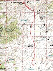
100k topo map, with GPS trace in red.* |
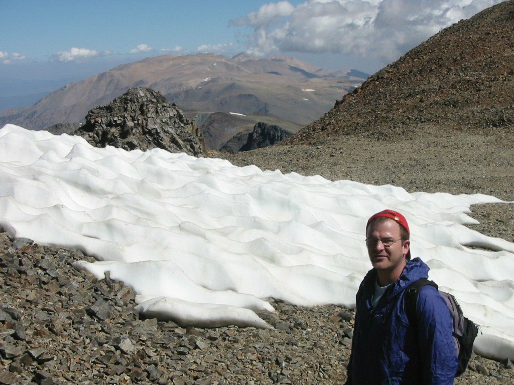
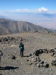
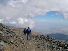
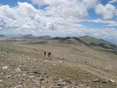
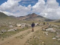
Starting out, about 6:12 AM at the Barcroft Gate (view NW). |
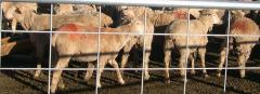
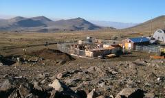
Sheep at Barcroft Station, 2 miles in from the gate. |
|
|
|
|
|
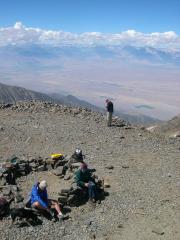
View back S over Barcroft Station, past sheep manure pile, to Eric and Tika. |
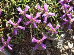
Prostrate Purple Penstemon. |
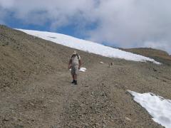
View N of White Mt Peak, near the observatory. Now we must lose several hundred feet of elevation en route. |
|
|
|
|
|
|
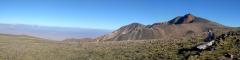
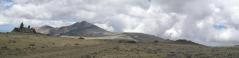
Panorama W to N. |
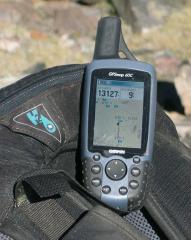
GPS for next picture… |
|
|
|
|
|
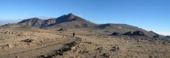
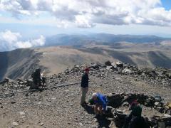
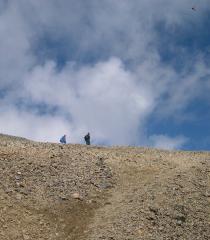
…View near highpoint of plateau. Next one loses ~150' to a col, then begins climbing ~1250' up the steeper peak. |
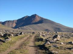
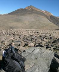
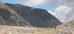
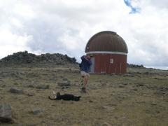
View of peak, after a bit of climb. Note the research station on the top of the peak. |
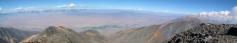
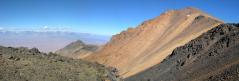
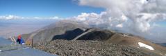
Panorama from top of mountain. W toward Sierras (L), to N toward Montgomery Peak (R). |
|
|
|
|
|
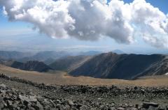
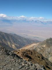
Looking E to Nevada, as clouds form. |
Eric and Tika. |
Eric and Tika. |
|
|
|
|
|
Tika digs a hole to lie down. |
West toward Sierras. |
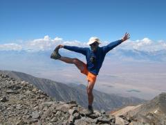
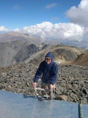
Cerebellum check for Harlan: 75% full on right side. |
|
|
|
|
|
Looking N toward Montgomery and Boundary Peaks. Matt climbs up ladder on top of Summit Station. |
View SW off top of station. |
View SSE off top of station. |
|
|
|
|
|
Pierre climbs up on station. |
|
Starting down, as more clouds start to form from air blowing W to E over mountaintop. View NE. |
|
|
|
|
|
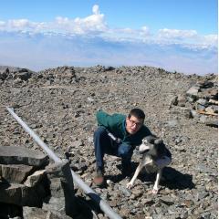
Robert Duvall and his dog head down. |
Matt and Eric. Note bird. |
Looking N at Matt, ~13150', after coming out of col. |
|
|
|
|
|
View SSW at Pierre, Eric and Matt. |
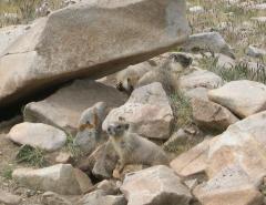
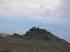
Three Marmoteers --Porthos, Athos and Aramis -- waiting for Marmoiselle from Armentiers. |
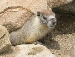
A marmot. |
|
|
|
|
|
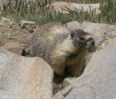
Another marmot. |
Pierre, Eric and Matt; view N. Note how the clouds have come in. |
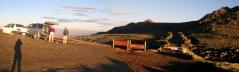
At the Barcroft Observatory, view N. By now we heard thunder and saw lightning. |
|
|
|
|
|
Pierre and Tika; observatory in back. |
View SW, just before reaching car. The Sierras are in back. |

Bonus from Pierre: Matt and view N. |
|
|
|
|
Want a GPS log, route or more info? Contact me at
hwstock at alum dot mit dot edu
*Brain-dead Microsoft Word refuses to center this map.