Wheeler Toiyabe LVMC Hike
pics by Harlan W.
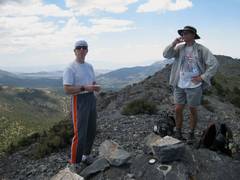
S. & Chris M. No, this isn’t that Wheeler. This is one of the most obscure summits in the |
|
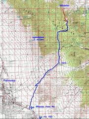
This approach near Pahrump requires a 20 mile drive on gravel roads. If you have a very capable 4WD, you can take the shorter road from the N. |
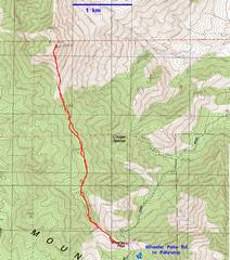
24k topo with GPS trace |
and is often very windy. However, there are many good shaded campsites 0.5 to 4 miles south. |
|
|
|
|
|
View to |
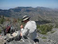
Near the first lump are angular quartzite blocks. |
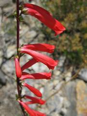
Palmer penstemon. |
|
|
|
|
|
|
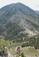
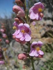
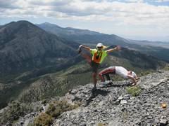
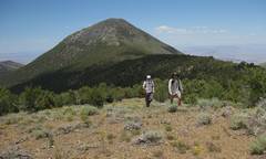
Bill travels past purple sage. Willow peak center background, with Mummy at L and
|
Chris calls Frank to tell him about the campsites. |
|
|
|
|
|
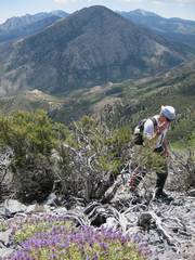
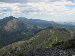
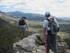
View back over the approach ridge (R) Willow (L), Pass in middle. |
|
|
|
|
|
|
|
Heading home on ridge; Wheeler to N in back. |
|
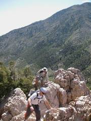
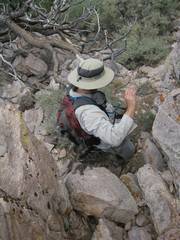
Chris gingerly climbs down quartzite. |
|
|
|
|
We had left open the possibility of
climbing both
Five days before, I had started taking a prostate drug. It was supposed to be obvious within 3 days if I could tolerate the drug, so I thought I was clear. I have a storied history of taking prostate drugs before epic adventures, always after doctor assurances that I will be fine, always with bad outcomes.
Unfortunately, I don’t fit the typical profile of men taking prostate drugs. For one thing, my blood pressure is low-moderate; for another I do stuff that is not within the range most doctors consider for “rigorous exercise”.
This drug lowers blood pressure, and the 17.1% incidence of “dizziness and vertigo” was 100% for me. I almost passed out several times on descent; I kept alert by flexing muscles and metaphorically pinching myself. And when I once more hit the flat and dropped my guard, I passed out for a fraction of a second and fell on my pack.
Fool me once, shame on you; fool me twice, shame on me. Fool me 4 times (my batting average with prostate medications), shame, shame, shame on me!
Another feature of this hike, which has become more common, was that people dropped out at the last moment. We ended up with just 3, which was actually probably good, as it was brutal in the sun, and had the added medical issues.
Driving
Directions from Mountain
Springs
First,
note that Mountain Springs is about 10 miles west (on state road 160) from the
intersection of sr 160 and sr
159. This intersection is where the “
From
fire station in Mountain Springs, (NOT the FS sign), travel west for 28.2 miles
(toward Pahrump) on sr 160,
to a right turn on the gravel Wheeler Pass Road. This road has a green sign on the right (N)
side of sr 160, and a yellow “right turn”
diamond-shaped sign on the same post.
Reset your odometer as you make this right turn.
(Just
before the Wheeler turn, there is a sign for
Go NNE
on the
At 10.5
miles, turn left on a slightly worse road; this intersection is completely
unsigned. You will travel up a wash,
past some impressive conglomerate rock formations, then past some crumbling,
fenced-in charcoal kilns (on left).
At ~16.3
miles, you will come to a signed intersection; the road at left goes to Wheeler
Well. Keep right, on the road for
In the
next 4 miles, the road gets worse; however, with careful driving, you should
never bottom out, if your car has at least modest clearance; I’ve been up
here twice with my Subaru Outback (7.3” clearance), and had no
problems. The last mile is heavily
switch-backed as the road climbs to the pass.
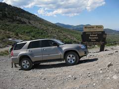
When you reach the pass at ~20.5 miles, park on the left by the sign.
You are at 7700’ elevation; both hikes start from this point. You can do one or both hikes, and can leave
extra water in/by the car for the 2nd hike.
Wheeler
(9168’), on the west side of the pass, is the more remote peak; the peak
is balded mainly by nature of the wind and dryness of
the climate here on the west end of the