Yucca Peak Project* (N of Las Vegas, NV)
H.W. Stockman
Saturday April 23, 2005 |
This 7103' peak is near the southern end of the Sheep
Range. A register was placed on top in 1996, by Gordon MacLeod and
friends of the Desert Peaks Section; they referred to the peak simply
as "VABM 7103". The survey lists the benchmark name as "Yucca",
probably because it is adjacent to the named Yucca Forest. Later,
someone wrote in the register that it was "Yucca Peak", choosing the
name on the benchmark PID entry as the name of the mountain.
Subsequently the basic hike was described by Jim Boone.
The basic hike (the red, NOT magenta track in the 24k
map) is fairly easy, with ~2200' accumulated elevation gain. However,
it would a miserably (perhaps fatally) hot trek in the summer. If you
go there, go in cool weather. The rock is very frictional, but since
few make this hike, there are many loose fragments on the cliffs that
cannot be trusted as hand- or foot-holds. There is no trail;
the many ridges look the same on the way down, and some end in cliffs,
so either bring a GPS or pay close attention on the way up. There are
places where you could either go up slippery talus, or go up the
frictional rock; the rock generally provides better footing. The
magenta route is challenging, with dryfalls, cliffs, and loose talus to
negotiate.
To get to the hike, take i95 NW from Vegas, then turn
right at the road to Corn Creek Station and the Desert Wildlife Center.
Past the Center, turn right and follow the directions for the Mormon
Wells Road (see green-yellow highlighted road on 100k map).
This hike was a pleasant surprise for me. We had cool
weather, and the slopes were covered with small flowers, principally
phacelias. The terrain would probably be much drabber in the fall, or
in a dry year. The slopes are fairly open, so there is little brush
abrasion on the standard route.
|
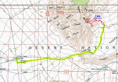
The 100k map showing the route
from Corn Creek Station
(N of i95).
|
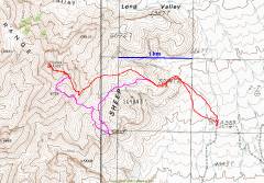
Our GPS trace on 24k map.
The magenta line shows
our side excursions on the
way down. We saw that
six 40' contour lines converged
above the mysterious CAVE
label (Latin for "beware");
what could this mean? We
had to go investigate. Imagine
our surprise to find a
200'+ dryfall.
|
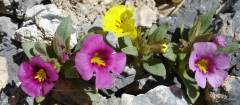
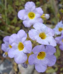
Bigelow and Parry Monkeyflowers. |
|
|
|
|
|
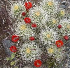
Claret cups. |
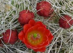
More Claret Cups. |
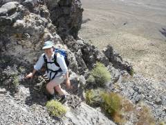
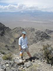
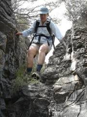
Alda on way up. |
|
|
|
|
|
View ~SW. The very west
edge of Vegas is at left.
|
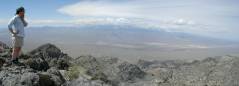
Panorama ~SW,
Mummy Mt in center.
|
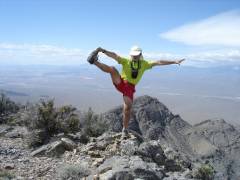
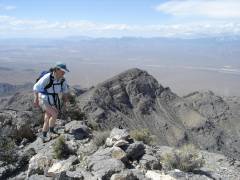
Look at me! |
|
|
|
|
|
|
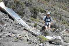
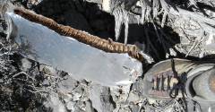
We detoured to look at
this odd wreckage -- probably
the remains of a dart aerial
tow-target.
|
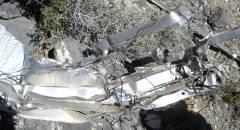
There is badly dry-rotted
wood in the structure,
and there are many thin
steel cables.
|
|
|
|
|
|
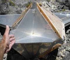
At one time the separate
vanes were apparently
connected at this pyramidal
aluminum-and-fiberglass hub.
|
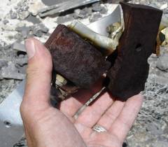
For all the attempts at light
weight, there are these
heavy steel chocks.
|
View of the honeycomb. |
|
|
|
|
|
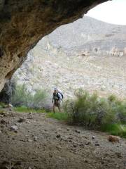
Alda on way down to investigate
the mysterious "CAVE"
(Latin for "beware") on 24k map.
|
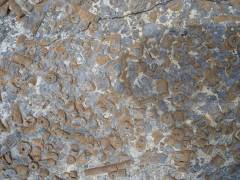
Crinoid fossils. |
A cave, by the "8" of 5284T
on the 24k map.
|
|
|
|
|
|
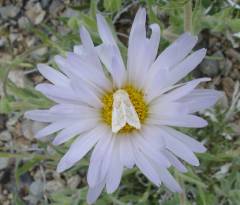
Mohave Aster with moth. |
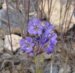
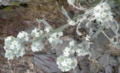
Fremont Phacelia. |
Many Fremont Phacelias. |
|
|
|
|
|
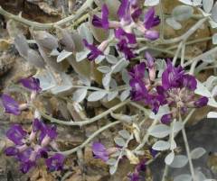
A legume, possibly Newberry
Milkvetch, possibly a locoweed.
|
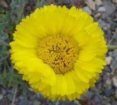
Desert Marigold. |
Another species of Phacelia,
possibly Lace-leaf.
|
|
|
|
|
|
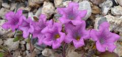
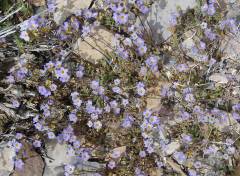
Purplemat or Desert Mat. |
Cryptanth, probably
Forget-Me-Nots.
|
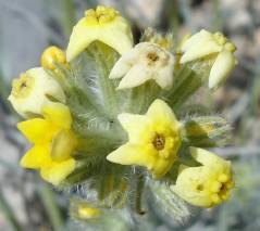
Yellow cryptanth. |
|
|
|
|
*We began to wonder, is this the same as the Yucca
Mountain planned for nuclear waste storage? This mountain doesn't seem
like a good place to store nuclear waste. For one thing, it is too
close to the new affordable housing developments that will soon ring
the Desert Wildlife Refuge and snake up the i95 valley to Mt Charleston
and beyond. This new growth is vital to the economy of Las Vegas and
our politicians, who depend upon the support of developers to carry out
civic duties. The new construction provides jobs, and a visit to any
construction site should convince you that the vast majority of
construction employees are long-standing citizens of Las Vegas, who are
likely to spend their incomes in town. More important, this mountain is
too close to the water sources in north Clark County and Lincoln
County; those sources must be kept pure, to provide water for the
plants, pools, golf courses, showers, dishwashers and flush toilets
that will service the new homes.