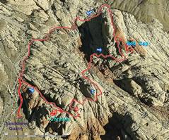
 Aerial photo; the topo gives this area a soft and fluffy look. Peak "?1" has a topo check elevation of 4708', but that was done by photogrammetry and "?2" appears as high. |
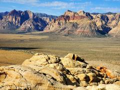
 Zoomed out map for context. |
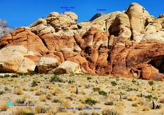 CCP as seen from the scenic loop road, just W of Calico 2 parking, and before Sandstone Quarry. |
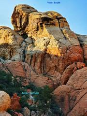 View S to CCP, from a crag on the other side of Sandy Corridor. |
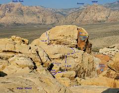 View W, from the route up "?1". The "5.2" section is short; to L is a bush that people have clambered over for cl 4 move that will eventually kill the bush. |
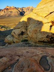
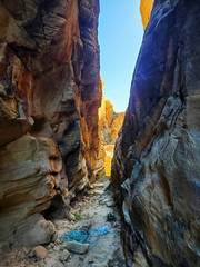
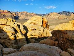
 OK, starting on the hike in Sandy Corridor, just before sun makes it over the rocks. CC is on L side of CCP. |
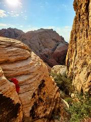
 After 1/4 mile ESE in Sandy Corrider, the trail turns R (SW) at this corner, and climbs... |
 ...to this next sharp R, up a cl 1 ramp, then to a ledge. |
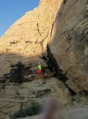
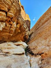
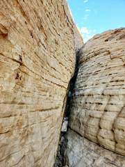
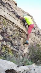 From the ledge. locate to crack 8' to R of the largest bush. This may be tough for short people. I used handholds on the chickenheads. This rating comes from Mark Thomas on Mountainproject. The bush is easier, but using it destroys the bush. |
 View back down over 5.2 crack. Descent is awkward, as one has to get a foot below chickenheads before they are weighted. If you follow the ledge R around the corner, there is a natural rap anchor. |
 At top of ledge in previous picture is next obstacle. It's just cl 3 on R side of boulder. |
 View back E at boulder.Walk W across the shallow ledge. |
 If you walk a bit farther W, you will see CC. For now turn L and S. |
 Next head to crack on SE side of CCP summit block. View W. |
 I go a bit L once I reach the 1st shelf. Coming down is awkward, make sure you head down to the correct place. Small pinch holds. Note pink dot. |
 I'm above the pink dot in previous picture, view E. |
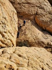
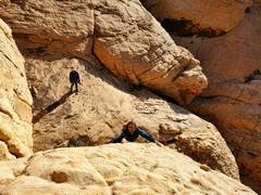 Same view. A fellow scrambler came to pink dot, couldn't find adequate handholds, and backed down. It is very hard to find a good belay stance. |
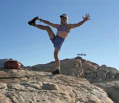 On top. Sports bra draw in for modesty. |
 View over N side of CCP, down CC. The bolt on R is for 5.12 "Fresh Air" route. |
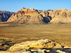 View W from CCP |
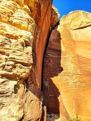
 The prominence of CCP is defined by this tight slot to E. On my first summit, I rapped into this slot, 30-40'. |
 Now I'm en route to "?1" from the ESE end of Sandy Corridor. I'll follow the L (N) side ramp up, and turn sharp L at the 2nd NW- trending slot |
 View SE back down slot. Note bush. cl 2. |
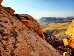
 Near top ?1. The ?2 peak is across a deep gully. Red Cap is behind ?2. |
 View back at CCP from near top ?1. |
 Dropping off NE side ?1 after a very circuitous route. I took the red shirt down (more on that later) |
 Head around SW side of ?2, then look N for this slot; climb by stemming. |
 |
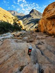 This extremely stinky bottle of MET-RX 51 protein shake was wedged into slot. I'll pick it up later when it dries. |
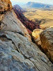
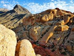 From top ?2; TurtleHead at L, Red Cap at R. |
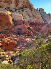 There is an "almost" walk off the N side of ?2, but some interesting slots will help you avoid brush and get down to the Calico Tanks trail |
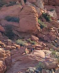 These people were watching me descend an interesting slot. |
 I took an off-books route up Red Cap; it's faster than normal SW route. |
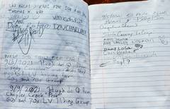 Red Cap register |
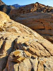
 In distance, Rainbow at L, Bridge Point and Bridge at R. In fore are peaks we just traversed. |
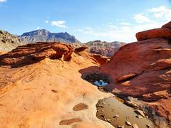
 Pool on way out |
![20210909_094729[1]](thumbnails/20210909_094729%5B1%5D.jpg) Some of the garbage I took back. The red shirt was bought at a bar in Nashville, and refers to a song by Blake Shelton. It smelled so strongly of cologne I had to put it in my ice axe loop. I wonder what happened to the owner. |
||