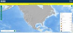
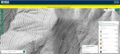
 01) Default map is hillside shading on the DEM (digital elevation model), which is not too intuitive. The real USGS map is here. |
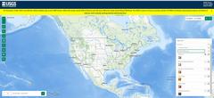 02) ...you will probably want to change to topo map. NOTE I have typed coordinates into upper right dialog box; hit "enter" after typing coordinates. |
 03) To get anything to show up, you may have to hit the minus (-) sign in upper left corner several times, then maybe + |
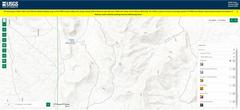
 04) I used the right-side menu to toggle back to the hillshade DEM view |
 05) I've zoomed in with +/- buttons on upper left, and chosen contours from the menu. |
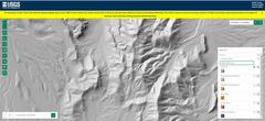
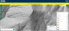 06) I have refined to 1m countours. |
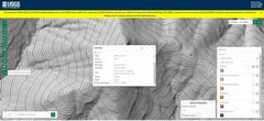 07) I use the information button and pick a point at the top of the peak. |
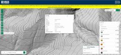 08) Now I pick a point in the prominence- defining saddle. This is a bit tricky, as you need the "highest low," right on the midline. |