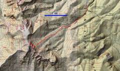
Start at the Deer Cr
Picnic Area parking
(NOT at the NLT
trailhead). Try to find
the ridge shown here;
there are remnants
of old fire roads and
a few cairns. Staying on
one ridge will make
life a lot easier.
|
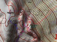
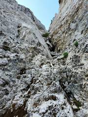
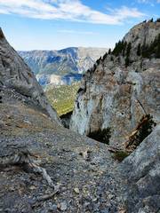
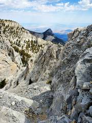
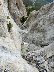
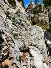
Where the ridge
hits the cliffs, go
NW to gully 2a,
which is quite narrow.
This is a rocky 3+
route. Click on this
image and See header
of full-size image
for instructions. Frequent
reference is made to
this map and the "dots"
therein.
|
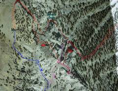
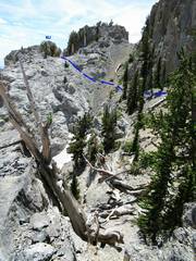
This google earth
image, with the same
tracks, shows the
gross inaccuracy of
the USGS topo map--
click to see notes in
header of full-sized
image.
|
Context
|
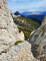
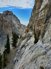
Heading S up 2a gully,
near red dot in
2nd map
|
There was a bit
of snow
|
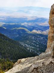
View N from
shelf on side
of gully
|
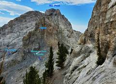
view NW from
orange dot in
2nd map, Mummy
Nose on left
|
View S across to
Charleston ridge,
at top of 2a gully
|
 |
 |
 |
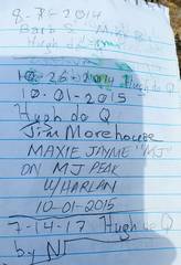 |
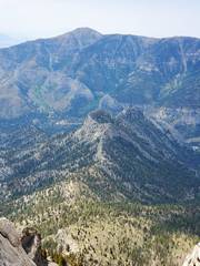
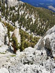
View S from MJ peak
with Cockscomb in
near foreground,
Cathedral Rock
behind, and Griffith
on skyline
|
View W across
gap between MJ
and Mummy
|
 |
 |
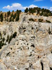
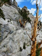
View SE from
magenta dot in
2nd map, ~class 4
route on cliffs. This
is the most direct
route from the summit
of Mummy Tummy,
but is not necessary.
|
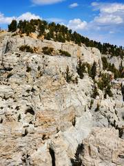
Same place,
some annotation
|
view NW near
green dot. Still
on most direct
route to Mummy
from MJ.
|
don't fall
|
now at blue dot,
view SSE over
traverse to traditional
Mummy route
|
 |
 |
 |
On Tummy,
Charleston
in back
|
Can't do a scale
till my back heals,
Charleston at
lower left
|
View NNW from
purple dot, place
to descend
|
View back NNW
from blue dot; Nick
showed me this route
in 2003
|
View N from white dot,
avoiding scree by
sticking to cliffs on
east side normal
descent gully.
|
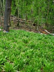
Down to Deer Cr.
Shooting starts are
lush, despite drought.
|
![20210619_122207[1]](thumbnails/20210619_122207%5B1%5D.jpg)
View NW where
use trail takes off
from gravel road.
One can avoid the 20'
of trespass by heading
left and uphill for
a short distance.
|
|