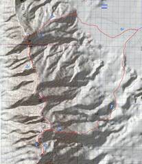
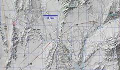
North Arrow (NV) Traverse:
Peaks 3282' (Arrow Canyon Peak) , 3598' (Cliff BM) and 3897' (Birthday Peak)

Pics by Harlan W S
Jan 18, 2023

These peaks are about 40-50 miles north of Las Vegas NV, via rte i-15, then rte 93, then rte 168.

There is no evidence anyone has been to these peaks since Purcell, more than 14 years ago. This traverse can be done from the east (as I did) or west (with 6 miles of desert walking in addition to the traverse, and the class 3 or 4 ramp on the S side of 3897)). Whatever the initial approach, I strongly recommend going S to N, rather than use my N to S approach. The steepest and longest cliffs are on the S sides of the peaks, and are more easily navigated when ascending.

The (unsigned) Dead Man Wash Road was in decent shape when I went, and can be handled by vehicle with 7" clearance and careful driving. However, the lower elevations are often filled with soft, slick mud, which should be avoided. The road leaves south from rte 168 at 36.79153, -114.85481 (WGS84).

The hypothetical west route would simply require parking on the side of rte 93; however, there was a time when NV state police would ticket anyone who was not parked well off the shoulder, and BLM police would ticket anyone parked too far off the shoulder.

0map0
My "hike."
1map0
Context
20230118_080515
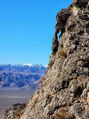
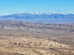
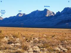
In the morning, the
view E from rte 93.
20230118_094021
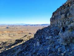
I've topped 3282; this
view is S.
20230118_095348
View W as I start
descent to saddle
with Cliff (3598).
20230118_100429
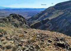
I've crossed the saddle,
and now look N back
to 3282. The descent
I chose was sketchy,
and it may be that
descending and following
dotted line is better.
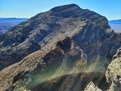
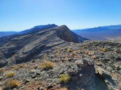
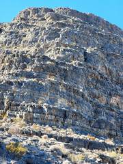
20230118_101551
View S to Cliff.
20230118_102942
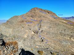
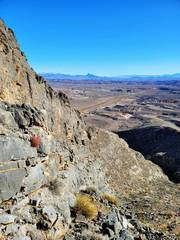
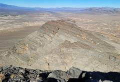
On top of Cliff,
view S; the peak 3845
(BEFORE 3897)
is visible at L.
20230118_103045
Starting descent of Cliff,
view SE. Shown is my
eventual descent
route at end of day.
20230118_103906
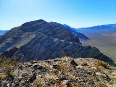
Another view ~S,
at 3845.
20230118_105020
Heading down S
side of Cliff, view
ENE to Moapa Pk.
20230118_110023
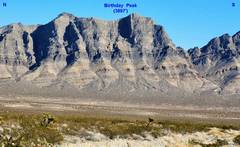
View N from S side
of saddle between
Cliff and Birthday.
The descent was
also sketchy.
20230118_111053
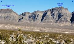
We will go to the
L (W) side of 3845
(minor peak on way),
and then cut W (R)
20230118_112816
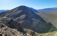
View S from 3845.
The intermediate
lump is 3897.
20230118_114519
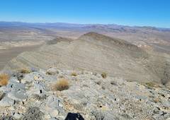
View N of 3845
and Cliff, from 3897
20230118_114533
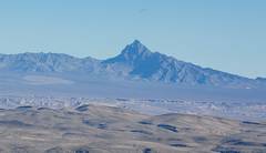
View ENE of
Moapa Peak,
from 3897
20230118_114539
View NE of
Mormon Peaks area
20230118_114558
View W of
Ram peaks on
N end of Sheep
Range.
20230118_115942
View W of
cliffs on NE side
of 3845.
20230118_121105
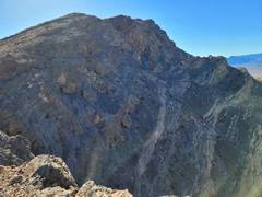
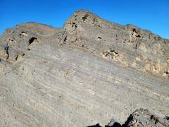
View N to Cliff
on descent from
3845.
20230118_124019
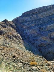
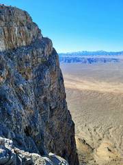
The descent of the E
ridge of 3845 was
slower than expected.
There were many cliff
bands to negotiate.
20230118_124522
View back W at
my descent route;
lots and lots of 5-15'
cliff bands.
20230118_140134
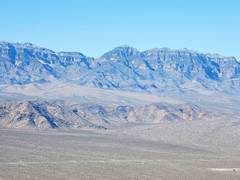
View E from rte 93...
20230118_140140
More view E from rte 93.
The canyon on the R (S)
side of 3897 allows
access to a very steep
ramp nearly 700'
vertical, with some
class 4.