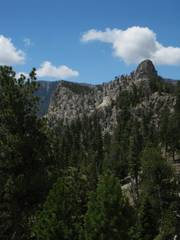
Cockscomb
Convoluted Hike
pics by Harlan W.S.
|
|
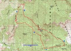
Kludged map from old GPS traces and my estimates. |
Back in June 2003, Nick and I went on a tiring route on Mummy, up a 4th class route, down the back side, then went up Cockscomb and down to When we got just N of the Cockscomb peak, I showed him the HikingLasVegas instructions, which back then urged one to drop 200’ and far to the east, to avoid a dangerous gully. “I’m not gonna do that,” Nick said; “I’ll just try climbing diagonally from here.” He did, and I followed, and it worked out just fine. |
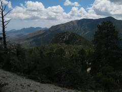
We traveled on S on the ridge… |
|
|
|
|
|
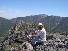
And I got this shot of Nick on the southern peak. I noted an easier way up, to the E, and took an international contingent that other way in August 2003. |
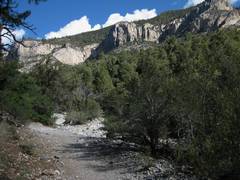
OK, back to 2010. I started off on the Fletcher Canyon Trail after 9:15, and it already seemed warm; though the air T was ~70F, the sun was relentless. I had forgotten my GPS, but knew the way pretty well. |
I later realized my off-the-cuff plans would have me dropping in, from the ridge, about here. Wasn’t gonna happen. |
|
|
|
|
|
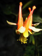
Scarlet columbine. |
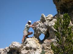
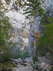
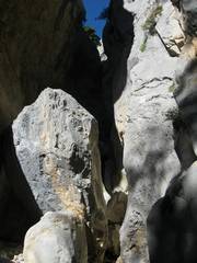
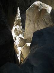
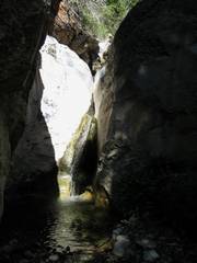
Fat Man’s Misery, from below. |
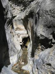
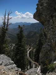
From above, looking down my favorite route. |
|
|
|
|
|
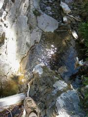
To my great surprise, Upper Fletcher was quite wet. I thought I’d enjoy stemming the slick rock, rather than seeking the high-water routes. |
Lots of water. |
OK, too much water. |
|
|
|
|
|
Finally where the canyon intersects the NLT; and ’ll be on trail briefly. Cockscomb in distance. |
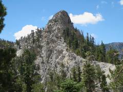
Off-trail again. I’ll go up the left side of the peak. |
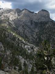
View E, where one drops down. In the next 30 minutes, I tried what looked like a neat class 4/5 variation, only to back down when the rock looked too cruddy. When I got back down, one of the rock ledges – where I had been standing—collapsed and showered me with debris. Humbled, and with welts on my
back, I went on to Nick and I used in 2003. |
|
|
|
|
|
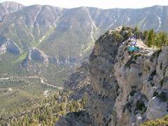
This was the only picture I took on the very top. Someone had carefully left this plastic sandwich container on top, even going so far as to weight it down with rocks, just a day or two before. Looks like Cockscomb has gotten a bit too popular*. |
I started down the Stanly B Springs route… |
…Then thought: “Hey, wouldn’t it be fun to traverse over that mysterious lump S of Fletcher Canyon? I can just drop into the Canyon N of that little (dark) peaklet!” This minor peak is marked 2631T (meters) on the topo map, and has barely 180’ prominence above the ridge. |
|
|
|
|
|
Actually, the ridge in between proved to be a PITA. |
View from the little lump |
Well, I started to look down as I approached the lump, and decided the direct descent N to So I turned S toward the down through Manzanita and mountain mahogany. I was lucky enough to find some deer paths, and had to walk the road for just a short distance. |
|
|
|
|


*I never intended to publicize these routes. Then a few years back, a fellow e-mailed me, saying that he had tried the northern approach shown on one of my GPS traces, and was afraid of the class 3 rock. I said that’s why I characterized it as a class 3 route, but I knew of a class 2 way; in fact it was on the same map-- the Stanley B Springs approach. He wanted more guidance, and had a GPS, so I sent him a GPS track for Stanley B Springs. He got lost. I sent him more waypoints, urging him to follow the track. (I’m always amazed that people will ask for GPS instructions, not follow them, get lost, and somehow imply the GPS was misleading.) The third time, he met with success… and he immediately published the route on Summitpost.org. No good deed goes unpunished.