|
|
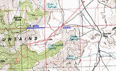
100k map, showing
the drive in from |
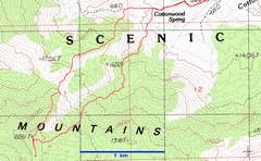
24k map showing my route up (westernmost) over the N ridge, and my route down through the DPS-recommended catclaw adventure. |
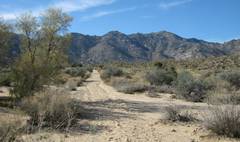
Near the start of the “trail”. You must walk on the rough road for about 2 miles. |
|
|
|
|
|
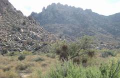
These granite slopes are typical of the landscape. Note the catclaw acacia with parasitic desert mistletoe. After you’ve hit a few catclaws, you begin rooting for the mistletoe. |
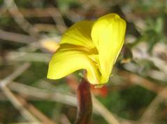
Lotus. |
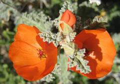
Desert (apricot) mallows. |
|
|
|
|
|
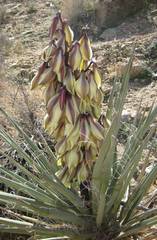
Banana yucca. |
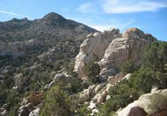
The bouldery terrain on the N ridge presents some navigation challenges. It is best to go around the boulders. |
|
|
|
|
|
|
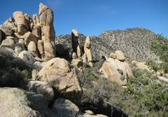
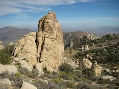
Some of the rugged boulders on the ascent via the N ridge. |
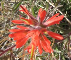
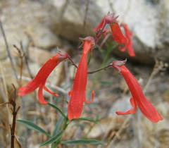
Paintbrush. |
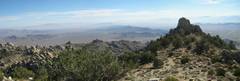
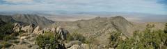
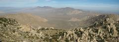
View ~ SE from summit. |
|
|
|
|
|
View N from the
main summit, over |
|
|
|
|
|
|
|
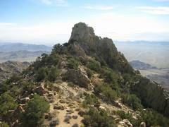
S of the main, lumpy summit, is this sharp pinnacle with an easy class 3 gully at R. |
Register on top of the pinnacle. I agree with Rick. |
|
|
|
|
|
|
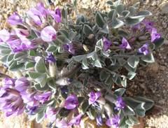
Vetch. |
|
This boulder is ~30’ high, and typifies the scenery near the summit. |
|
|
|
|
|
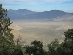
Providence Mts are to left; view on descent. |
Penstemons. |
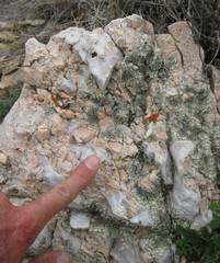
Coarse granite, quartz and K-spar. |
|
|
|
|
|
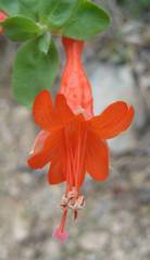
Fuschia. |
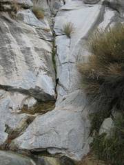
The lower part of the DPS route had a few trickles of water on smooth, steep rock slopes. |
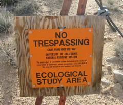
I didn’t see this sign till I came back, as I took the wash route in (this sign is on the rough road, 1 mile from the parking lot, and faces E). came back a different way, and saw this sign from the back |
|
|
|
|
Directions from
From Vegas, take i-15 S to the Nipton-Searchlight exit, and
take the exit E. In ~4.5 miles, turn S
on the
While I made good time on this hike (2 hours up, 2 hours down), the hike was harder than I expected. The initial road is in the sun, with soft gravel that doesn’t give good footing for fast travel. Of the two routes I took, I would prefer the ridge route, though some very big boulders may require that you do some careful route-picking. The ridge is more open, and it is fairly easy to avoid the many prickly plants. My descent route, near that suggested by the DPS, involves lots of brush in the gullies, and a bit of catclaw avoidance.
The pinnacle S of the main peak is a lot nicer, in the sense of seeming like a true summit. The main peak may be a better place to eat lunch.
I’m not sure what to make of the UC “No Trespassing” sign. The road is clearly the route intended in most guides. Perhaps the sign is mainly intended to warn ATVers, or 4wd types who have snuck past the first gate. It’s a bit hard to imagine how the rare person walking up the dirt road will cause ecosystem collapse.
Relative Beauty, and Why I Made this Trip
I prefer the
I had an awful week at work. On Friday morning, I awoke at 6AM, cognizant of the many vacation days I had banked in the last year; I had to go somewhere from which I could not see Vegas, and the reminders of broken dreams. I got up, dilly-dallied, then hit the road at 7:50 and headed down to the Granite Mts. I spent a few extra minutes in Primm (to gas up), outraced a coal train heading to Kelso, and reached the trailhead (well, there is no trail) about 10:10. Somehow I managed to fart around until 10:20, then hit the road, Jack. In the next 2 hours, I purged my mind of work. I stopped often to photograph and marvel at the flowers, surviving and blooming late in the season in this dry year; what a life lesson.