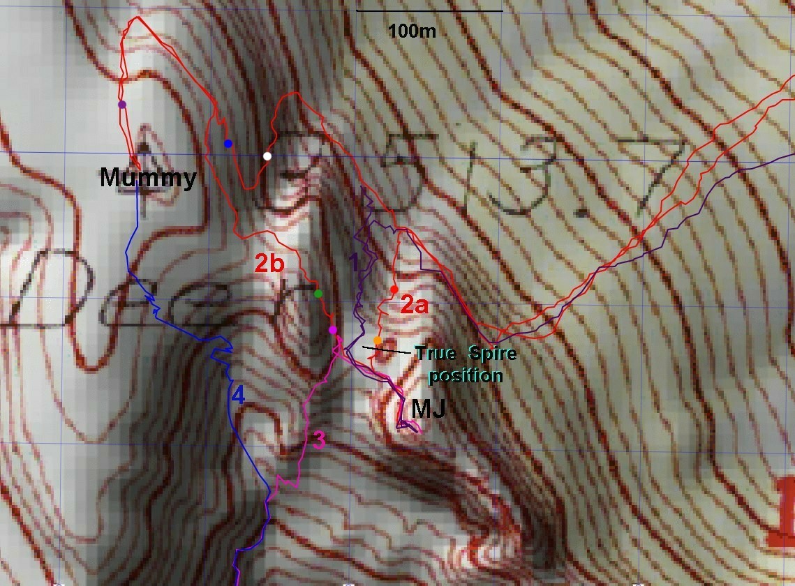
Hints for MJ and Mummy via Deer Cr. PicnicThe red route is my June 19/ 2021 trip, where I went up gully 2a to MJ, then took the 2b
traverse to join the normal route up Mummy Tummy. I then decended
by the blue and white dots, slight variations on the normal Mummy back
(north side) route. The dark purple 1
route is the easiest way to MJ; it goes up the next gully west, comes
out on the west side of the spire, and has a lot of loose scree.
Alternately, one ca start up blue 4 (Ed Forkos' South Gully route -- part of Branch Whitney's "Mummy the Hard Way"), and cut to magenta 3 to
reach the spire from the south and the NLT. This last route has a lot
of loose talus, and one 3+ dryfall, plus some very steep ramps, and is
a rather hard slog.
The next image (next page) is from Google Earth,
and shows how "off" the topo map is near cliffs.The slopes of the
gullies is wrong, the cliffs disappear, and the spire is in the wrong
place.
|