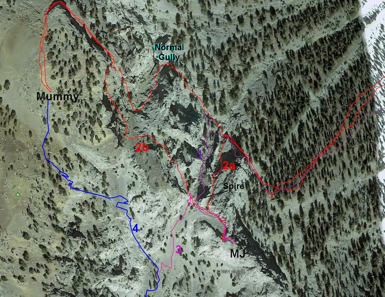
This
image (from Google Earth) shows the inaccuracy of the USGS topo map in
the previous image. The topo map puts the spire on the wrong side of
the 2a gully, does not show the steep dividing ridge between 2a and 1, and doesn't show the cliffs that cast deep shadows over the top left part of the red route. |
|