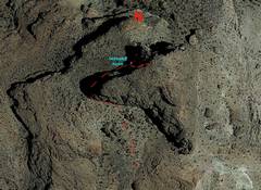
 Google maps aerial view. The USGS map omits the triangle-shaped, cliff-bounded summit block. |
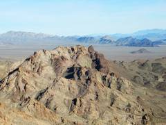
 Paula and I went down in Nov 2019, and kept joking about how it looked easier the closer we got. Red line shows final route. |
 Red line again shows route |
 |
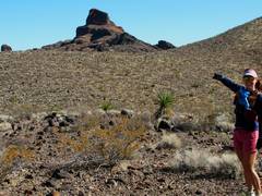
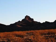
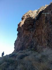
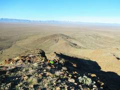
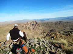
 Spirit Mt to S |
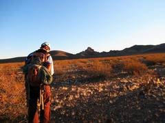 Jan. 18, 2020, we start out after dawn.* |
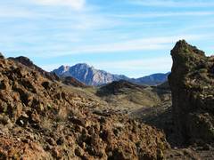
 Early morn lighting shows some of the cliffs. We are going up left side |
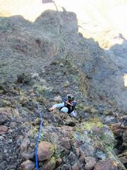
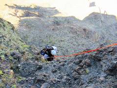
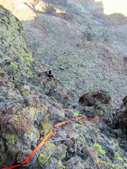 Tracy has just jumared up a horn I had lassoed the previous day. There is a 15-20' vertical wall just below him. The wall is largely devoid of cracks and doesn't take protection |
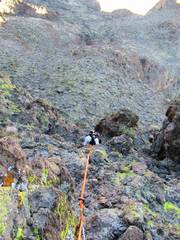
 Jumping back to 2019, Paula is at base of wall that Tracy had just jumared in previous. |
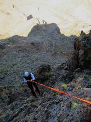
 I established a handline of 15mm webbing on a very steep slope. |
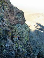
 Tracy breaks through the top cliff band |
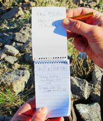
 1st ascentionist! |
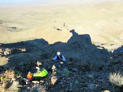
 View W; my pack is where we broke through the last cliff band |
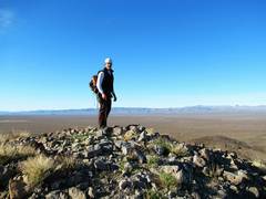
 Halo on Tracy's head, Spirit Mt. in back |
 |
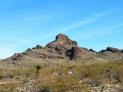
 The USGS says that peak (L mid-photo) is at least 100' higher |
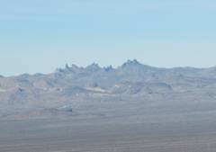 Castle Peaks CA |
 Pinto BM to N |
 |
 Tracy downclimbs top cliff band |
 Tracy starts single-strand rap. The fictive ledges are an optical illusion when observing from below. |
 |
 rap is about 40'. I later doubled the webbing so I could pull it, and went down on a single Munter. |
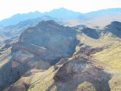
 View back at the peak. Again, we used L side. |
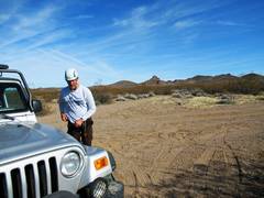 Back at jeeps. This road has some washouts and loose sand; Escape Buddies (sand ladders) might be a good idea. |
![IMG_1491[1]](thumbnails/IMG_1491%5B1%5D.jpg) What a few hours of cold, abrasive alkaline rock did to my finger tips. | I will likely remove the line I used to lasso the the horn, replacing it with a less-obvious device that can be reached by a long stick-clip. For a time window, a person with prussiks and 100' of cordage can do this without gear. If you rap off the current lasso on horn, be aware of pendulum danger. DO NOT TRY TO "BATMAN" UP THE ROPE; YOU WILL PULL IT OFF THE HORN AND DIE. |
The U.S. Board of Geographical Names assigned "Devil's Thumb" to the non-descript southern peak (5189) in 1990; that naming is very likely an error. The source of the decision is cited as NDOT base maps from the 1950s and 1960s; I have looked through all the historical NDOT maps available to me, and nowhere does this name appear. It seems Spirit Mt was confounded with "Dead Mt." The 1968 NDOT base map for southern Clark Co DOES NOT show a Devil's Thumb AT ALL, but labels what is now the 5189 peak "High Peak SE." This map also shows "Spirit Peak" and "Dead Mtn" (in larger type, apparently what is now called Newberry Mountains) as well as a "Flattop" just S of Spirit, and a "Rocky Peak" near what is now spot elevation 4917. In the early 90s, BGN asked locals about the names of nearby mountains, then gave the list to underlings to interpret. From review of other names they recommended, I surmise the reviewers would only assign peak names to a spot elevation printed on the corresponding USGS map, even if it were bizarrely inappropriate. The rugged mountain to the north, which looks thumb-like, has a severe USGS photogrammetry error (which cuts off the sharp cliffs that make up the summit block), and has no spot elevation. The conical lump 5189 had a spot elevation on the map. The most recent NDOT maps label 5189 as Devils Thumb, but those maps undoubtedly use the BGN database. What do you think?