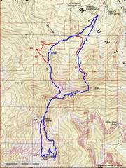
 The blue is my route in 2009, red is from June 25, 2022. I started using the Devil's Thumb Shortcut (DTS) in 2005. HP is just south of the DTS 1st crux. |
 This close-up near Lee Peak shows how my route evolved from sketchy loose class 2, to some class 3 and 4 on the cliffs near the peak. |
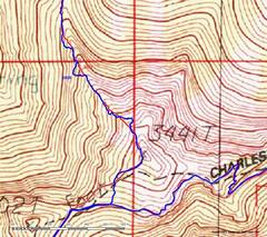
 And for context, a zoom- out map west of Las Vegas. |
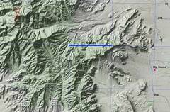
 Next an overview. HP is on the wall, just past crux of the original DTS. Left is view E from original DTS; right is view S from top of Devil's Thumb tower. |
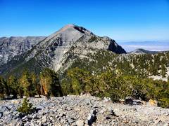
 HP as seen from SW. Rocketship Peak is in back. |
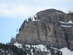 HP as seen from NW, from Amargosa Ridge (telephoto). DT is the Devil's Thumb tower. |
 Tom Hawley in center, 2017. Tom was a well-liked local newsman, and avid hiker. He passed away suddenly in 2021. |
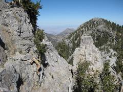
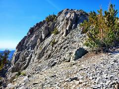
 OK, back to TR. I'm looking ENE from ~10900' on NW ridge of Lee Peak, June 25 2022. About here I climb up onto the cliffs |
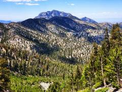
 Lee Peak ahead. |
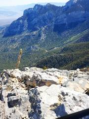 View ~NE from top of Lee. |
 View ~S to Charleston, from Lee. |
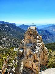
 Now magically, I'm on top of HP, looking N over the actual DT, to Rocketship Peak in back. |
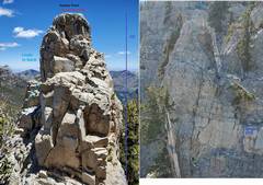
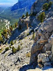
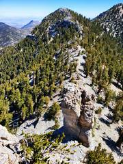
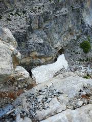
 View E of HP. I took the L side; the last 5' is a bit sketchy. I discommend this as a climb; LOOSE! |
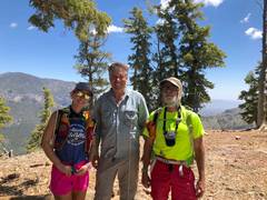
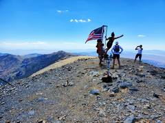 I continued up North Charleston ridge to find these happy trail-runners. |
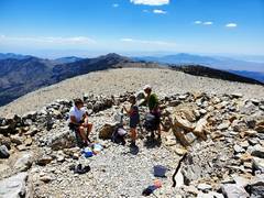 Dean M at L. We were both there for Tom Hawley's memorial potluck, which was supposed to be from 11 to noon... but the others left < 11! |
 McFarland, as viewed near 9300' on my descent route to the ski area. |
 There was still snow at 9000' in this deep gully. |
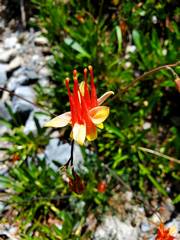 Scarlet columbine, a sign of wet soil. |
*I first went up the
NW ridge of Lee in 2009, and found sparse cairns on a class 2 version. But
given the steepness of the route, and the fragility of the dirt-pine needle
ground, this route apparently saw little use. For years, the only other footprints I saw
here were from deer. Then in 2013, a local hiking club put Lee Peak on their
list; I feared that if they ever discovered this scenic route direct to the top
of Lee, their large groups would quickly turn the fragile soil into a mud path.
So I purposely eliminated that part of the route from my trip reports. And for
the next 8 years, that was enough. It's the way of the world, and the new users seem more respectful.
The Devil’s Thumb Shortcut was known to locals at least
before 2003, when Branch Whitney wrote up instructions for traversing the North
Ridge of Charleston; his PDF guide has a picture of the break in the cliffs
just S of Devil’s Thumb. I put a summary on Summitpost in 2006,
but the route
was still little-used. Starting ~ 2014, fixed ropes would occasionally
appear
on the original route, and would just as soon disappear. There is an
easier
(but dangerously loose) bypass on the SE of the original route; there
has been
a fixed rope there for 3 years, and that is now the default route for
many who claim the Devil’s Thumb shortcut. In 2006-2007, a stump (that
used
to aid the 1st move) fell away, making the original route much
harder.
I started using the more northern descent route back to Ski
Lee parking in 2009, when a woman had a medical emergency on the NLT at 11200'. I had come
up Branch Whitney’s old Lee Canyon route, so my car was parked at Ski Lee
parking. I had to get back to my car quickly, so I chose the ridge just north
of the old Lee Canyon route. It was an extremely steep controlled fall,
punctuated with jumps over cliffs, and I got me (from the ridge at 10800') back to my car in 35 minutes. In
2013, I used that circuit several times to reach Charleston, before and after
the Carpenter Fire closures; I was about to abandon the down route, as I felt
the steep dirt and rock would become a mudslide if the route ever became popular. I
had just posted that down route on social
media, but decided after 2 days I should remove all mention, lest it
tempt
peakbaggers. Coincidentally, the fire closure shut down the normal
routes to
Griffith Peak, which was on "required peak" lists for local hiking
clubs. So the organizer
of one club decided to use Lee Peak as a replacement for Griffith, and
announced a “new route” to Lee that was very close to the one I had
posted. I
went back a week later, and it looked like a herd of elephants had
scrambled up
since my last trip, and sure enough, I was right behind trip for that
club. So the cat is out of the bag, here too, and I just go down a
slightly altered version.
Griffith Peak access is restored, so the hordes are no longer headed
for Lee
Peak from Lee Canyon.