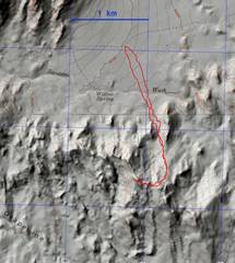
 The peak is accessed from the Xmas Tree Pass Rd, several miles east of the Spirit Mt parking. |
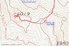 This a zoom of the USGS topo map. The USGS map gets the upper contours wrong, but my main idea is to show where the next photo was taken. |
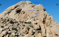 This photo of summit block shows the route. Dotted lines indicate route has gone behind an obstruction and is NOT actually visible in image. |
 view N through "tunnel." |
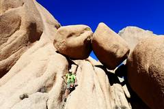
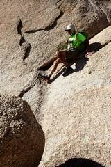 Kevin took this pic of me as I dropped from the S end of ramp across class 4. Going up, I started on boulder at L and jumped to grab a flake on the face, then put my L hand in L side of crack. |
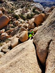
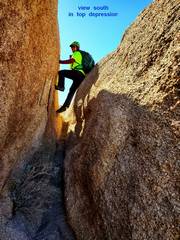
 Kevin's pic of me descending lower ramp. I sat in depression in back of me, to meat anchor a strap for Kevin. There are several good places on the ramp to meat anchor a strap. |
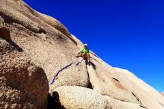
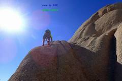
 My view of Kevin ascending ramp |
 Kevin a bit farther up ramp |
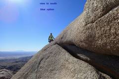 Now pick a route! This is Kevin's view S across lower, dark blue option. I have hunkered down and sidled across ledge, with my hands over lip at R, feet on sloped rock at L. |
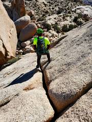
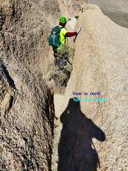 This a view N as Kevin descends through light blue option. It is helpful to have someone meat anchor a handline above and to L, so the descender can cross a somewhat exposed, 40 degree ramp to get to the S end of the crack. |
 This the green option. I'm just climbing free up this steep ridge, just W of the crack in the previous pic. This is very steep, and you should have sticky rubber soles, AND try to brush the loose granite off the rock as high as you can before you start. And perhaps just not do this. |
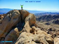
 Now we've crossed over into top depression, turned L, and climbed up the crack. At end of crack, step L and S, then step back N to walk to summit. Just past Kevin is a very short, very exposed section to R; I advise you not to slip there. |
 My view of Kevin to S, showing route. You won't see this view unless you travel N on a narrow ridge on the W side of top depression. |
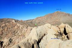 Kevin's view from summit, to where I took last pic. |
|