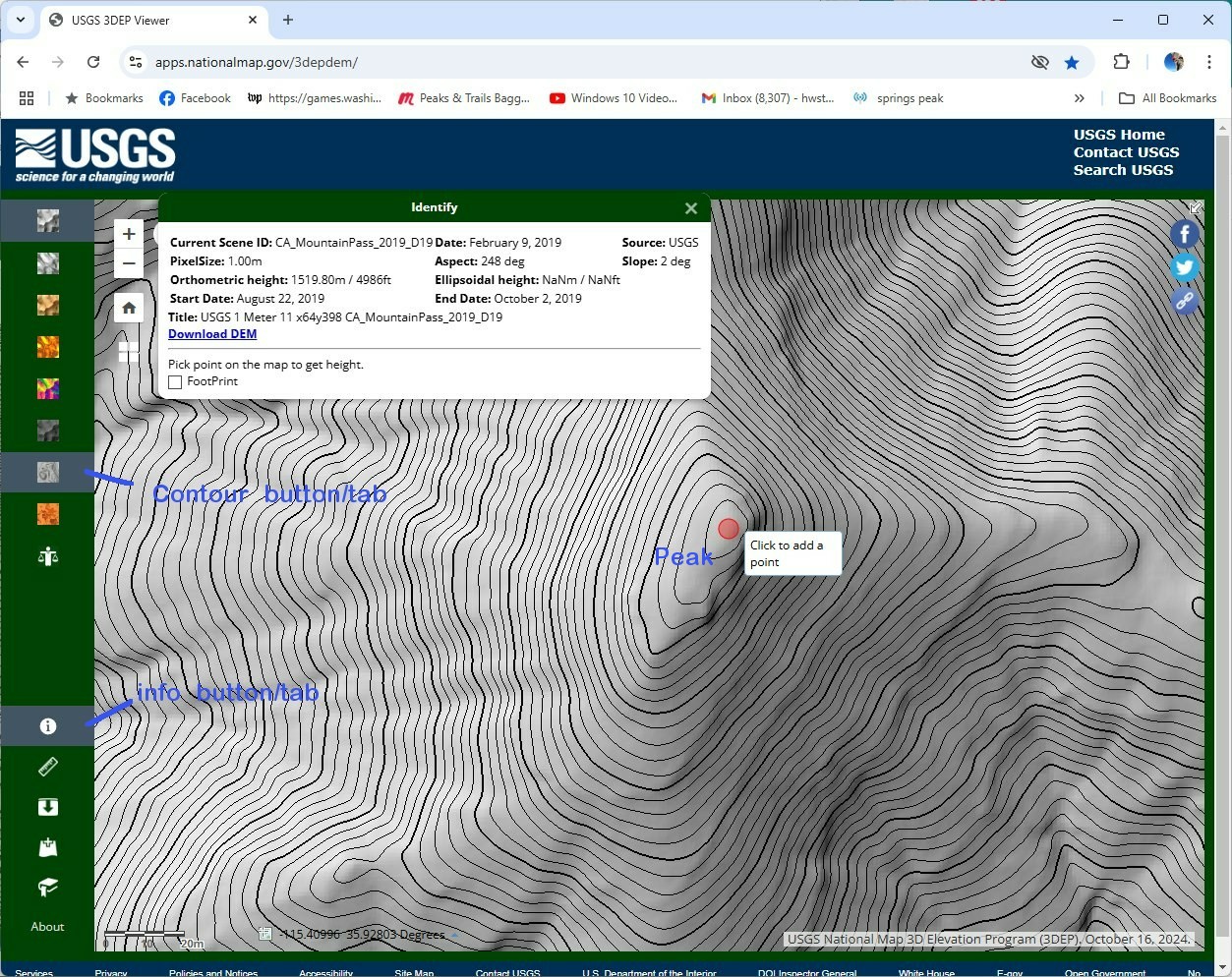
Using LIDAR from USGSH.W.Stockman
Dec 28, 2024
7) highlight the info tab. Put the pointer over the summit
ab click to see the LIDAR elevation for that point. You will have to hunt and
peck many times to get the highest point— the LIDAR data are for some points
only, and varies a lot.
|
